The Wuming Cliffs (無明) in Taroko National Park have such a bad reputation that many hikers opt to make two separate trips to summit all the nearby peaks, approaching from either side of the cliffs but never actually going through them. Before the open mountain policy was enacted in 2019, the Park actually forbade entry to this area altogether.
By far the most efficient way of summiting these peaks, however, is to suck it up and just follow the Central Mountain Range’s spine right through the difficult terrain, completing a loop and bagging four of Taiwan’s 100 Peaks — or baiyue (百岳) — in only three or four days. In March, another seasoned hiker joined me for a journey through the North Second Section, as this stretch of trail is known.
The night before our hike, we stayed at the Wang Xiaoming Hiking Services homestay along Highway 7, which caters specifically to hikers with cheap, bunk-bed accommodations and hot showers. Bookings can be made by phone (Chinese only) at 0968-050-329.
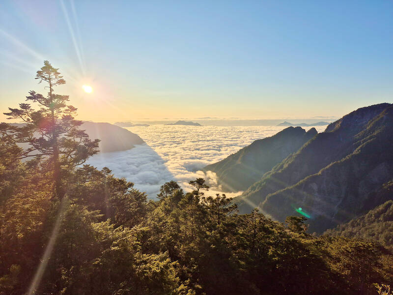
Photo by Tyler Cottenie
The next morning, a shuttle van (also booked through Xiaoming’s) took us on a memorable 45-minute ride up Forest Road 730 to the trailhead. For those planning to self-drive for this trip, don’t. This old logging road requires a very-high-clearance four-wheel-drive vehicle, or a healthy dose of reckless disregard for one’s property if attempting it by scooter.
TO THE END OF THE ROAD AND BEYOND
The shuttle took us up about 12km to a spot where an old landslide has washed out the road, but beyond this obstacle, the old logging road is in remarkably good shape. It’s a comfortable, shady walk up a gradual incline for another 13km. Along the way, we did the side trail on the right up to Shuan Mountain (閂山).
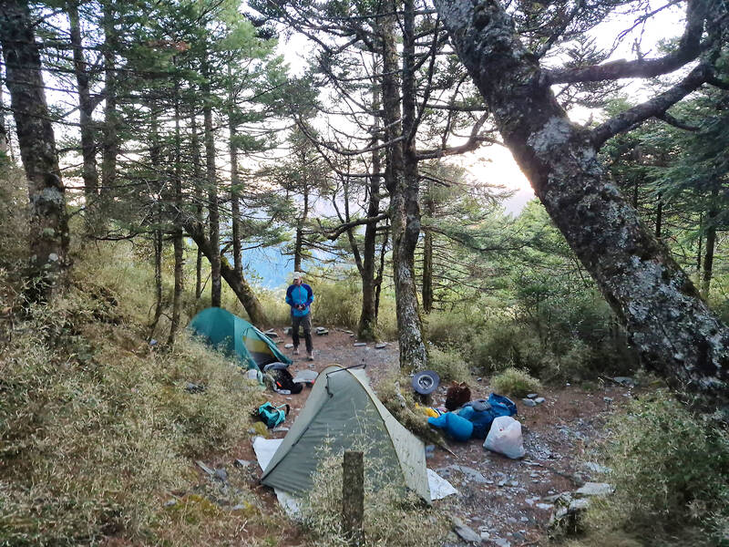
Photo by Tyler Cottenie
For those who aren’t interested in collecting as many of the baiyue as possible, it can be skipped; but as far as baiyue go, this one is one of the easiest. The entrance is well marked with ribbons, and the two-hour round trip alternates between forest and open bamboo meadows with sweeping vistas of the surrounding mountains.
Back on the forest road, we pushed on to the water source, a hose set up by other hikers that offers a trickle of clean water. Having used this source on three previous trips, I was surprised to find it bone dry. With no other good options for water ahead, I decided to trace the hose uphill to try to find the source. About 100 meters higher up, I finally came upon a bit of flowing water, and discovered that a hose connection had been dislodged by rockfall. Luckily, this was an easy fix and we were able to fill up and carry on.
About 15 minutes further up the road is the 25K workstation, left over from Taiwan’s logging days and still in decent shape, i.e., the roof and windows are still mostly intact. The interior is generally kept clean and dry by the various porters who provide meal service here (NT$1,300, contact A-Kai at 0920-719-724) and there is space for about 20 people to sleep. For those who prefer privacy or quiet, there is room to set up tents near the workstation and on the road back in the direction of the water source.
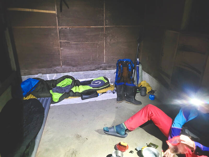
Photo by Tyler Cottenie
Beyond the workstation, hikers have the option of a higher trail along the ridge or a lower trail that stays on the forest road much longer before cutting straight up to the ridge. The former is more tiring, while the latter is overall easier, except for one extreme washout that requires a rope ascent up loose dirt at an 80-degree angle, so pick your poison. Eventually, both trails converge on the ridge and continue to the summit of Lingming Mountain (鈴鳴), another baiyue that boasts an incredible 360-degree view. This is the turnaround point for those not wanting to walk the Wuming Cliffs.
THE WUMING CLIFFS
After the peak, the trail turns east and drops down to a campsite in the next saddle. A water source is also available here in the steep gully to the north, but the round trip takes an hour and the flow is so low that it can be nearly impossible to collect without some creative use of sticks, leaves or drinking straws. However, there is no more clean flowing water available for the next day and a half, so it’s best to fill up here.
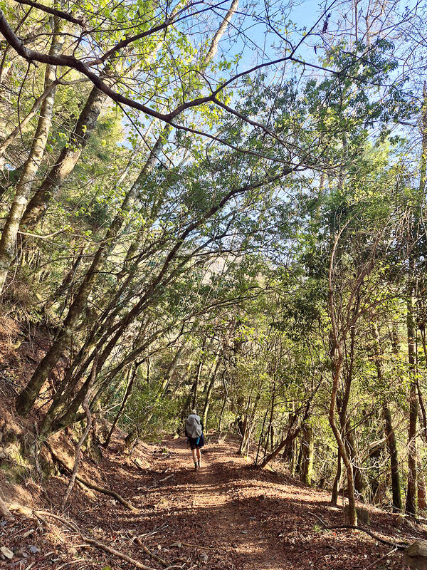
Photo by Tyler Cottenie
Beyond the saddle, the trail goes over a series of ups and downs through mostly forested terrain, punctuated by a few exposed sections where one side of the ridge is a vertical drop constantly being eroded away by Taiwan’s heavy rains and earthquakes. Whether it’s foggy or sunny, and especially when it’s somewhere in between, the hemlock and bamboo forest here is hauntingly beautiful.
The most challenging part ended up being not the cliffside trail sections — which, though unnerving, are not technical — but the places where a rope ascent up a vertical break in the ridge was necessary. With a heavy backpack on, it was difficult to keep one’s center of mass close enough to the wall not to be pulled right off by gravity, and it took all the upper body strength I could muster just to pull myself up.
After six hours of tiring, technical ascent, we finally summited Wuming Mountain, the highest point of the section at 3,449m, where another perfect panoramic view awaited us. Many hikers approach this peak from the other side as an out-and-back trip, avoiding the Wuming Cliffs altogether, so the trail beyond the peak was once again much more well-trafficked.
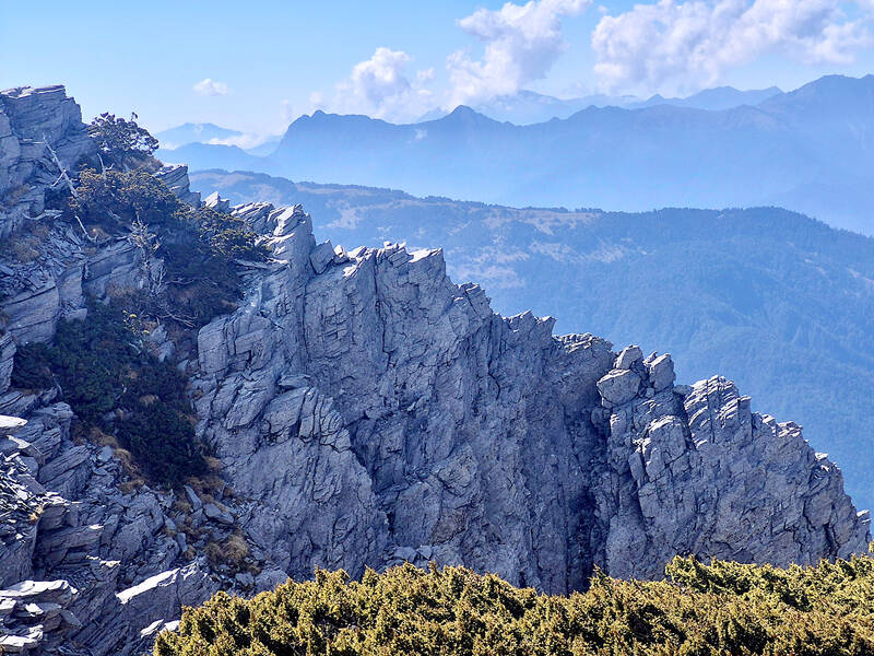
Photo by Tyler Cottenie
COMPLETING THE SECTION
We passed Wuming Pond and a couple of other stagnant brown ponds that can be used as water sources along the way to the next campsite but, thankfully, our clear water from below the saddle was still adequate. From the campsite, it was a straightforward 3.5-hour round-trip walk to the last baiyue of the trip, Ganshu Peak (甘藷峰), checking off the fourth and final baiyue of North Second Section.
Back at the campsite, we turned north and made the long descent to the river below. If arriving at mid-day, this river makes for a fantastic spot to clean off, have lunch and replenish your body’s water stores. If arriving in the evening, camping here is very comfortable as the low elevation makes the temperature a lot warmer and there is a never-ending supply of water nearby.
The final challenge of the trip is the steep ascent from the riverbed back up to Forest Road 730. There is a steep section of loose dirt that must be ascended with the help of ropes and, again, a lot of upper body strength. This is followed by switchbacks up the mountainside that seem to drag on forever until they finally reach the mercifully flat forest road.
From this point, it’s just over two hours back down the same road you walked in on to get to the trailhead. When you pass the abandoned motorcycle, give Xiaoming’s a call to ask for a shuttle and it should arrive at the trailhead just in time to pick you up and return you to the homestay for a free shower before you head home.
PLANNING
Starting early the first day as we did, it’s possible to do the trip in three days, staying at the east saddle campsite and the campsite before Ganshu Peak. A four-day itinerary would have you overnighting at the 25K workstation, Wuming Pond and the river at the bottom.
Bus 1751 (leaves Yilan at 7:30am) or Bus 1764 (leaves Luodong at 7am) can get you up to Xiaoming’s if you get off at the Huanxing stop. If driving your own car, you can park in Xiaoming’s parking lot.
A Taroko National Park permit is required and can be applied for in English at hike.taiwan.gov.tw.

Taiwan’s English education system is being pulled apart by three opposing forces. Bilingual Nation 2030 pulls students toward English and global communication. Artificial Intelligence (AI) readiness pulls them toward digital judgment, verification and AI-mediated work. But Taiwan’s old exam culture pulls them back toward memorization, grammar drills, timed reading and correct answers. If the education system keeps using old exams to define success, it risks producing graduates who are neither genuinely bilingual nor genuinely AI-ready, but trained for tasks machines can already perform. The first force is Bilingual Nation 2030. Launched in 2018, the policy aimed to “help Taiwan’s workforce connect

It seems every few days one bumps into one of those “real man” comments in which Taiwan is urged to “face reality” or similar, and “make a deal,” with the speaker implying that soon it will be too late. “Deal” advocates always present themselves as having a superior grip on reality, and the manly ability to make the “hard choice.” Their testosterone-laden language often echoes that of Taiwan sellout advocates. Note that such commentary always specifies a process (“make a deal, work with, make progress”), never the end state of what occupation by a violent authoritarian colonialist state will entail. In

There are shadowy cabals plotting to sell out Taiwan to be annexed by China, by invasion if necessary. Fortunately, they are buffoons. In 2019, former Bamboo Union gangster and founder of the China Unification Promotion Party (CUPP), Chang An-le (張安樂, colorfully known as “White Wolf”), led a protest at the Legislative Yuan against comments made by then-premier Su Tseng-chang (蘇貞昌) that in the event of an attack by China, he would never surrender, but would protect the nation by fighting to the end, even if he only had a broom. Chang had party members bring a wooden casket that they
June 1 to June 7 "If all Taiwanese were as afraid of dying as you, then what would happen?” Physician Shih Chiang-nan (施江南) reportedly said this to his wife Chen Chiao-tung (陳焦桐) after she urged him to stop intervening on behalf of Taiwanese soldiers stranded overseas after serving in the Japanese Army during World War II. Shih had clashed with high-ranking officials over the issue, engaged in several heated arguments with Taiwan governor-general Chen Yi (陳儀) and allegedly shouted at general Ko Yuan-fen (柯遠芬), chief of staff of the Taiwan Garrison Command, over