Jiasian (甲仙) in Kaohsiung is both a gateway and a crossroads. Provincial Highway 20, better known as the South Cross-Island Highway (南橫公路), goes through the center of this little town before climbing into the Central Mountain Range. Provincial Highway 29 approaches from the south, overlaps with Highway 20 for a few kilometers, then veers north into the Aboriginal district of Namasia (那瑪夏).
On any given weekend, hundreds of visitors stop in Jiasian to gorge on savory taro cake, taro-flavored ice cream and other local specialties.
I know the area well, but until earlier this week, I’d never walked the entire length of the Liouyi Mountain Trail (六義山步道). At certain points along this 4.25km-long track, it’s possible to look down at the streets of Jiasian. At others, hikers get a bird’s-eye view of Nanhua Reservoir (南化水庫) in neighboring Tainan.
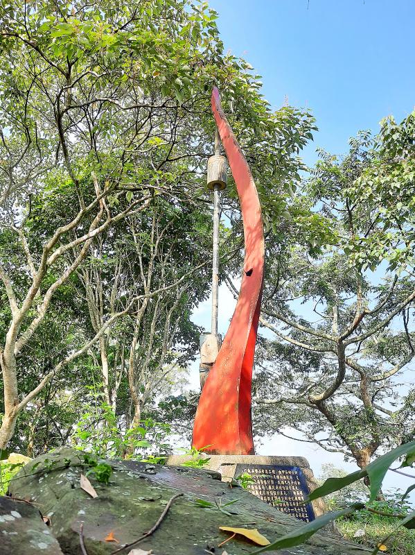
Photo: Steven Crook
Scootering inland on Highway 20, I crossed the Tainan-Kaohsiung border near the highway’s 52km-marker, then halted when I saw a small yellow sign mentioning the Liouyi Mountain Trail. Pointing to a narrow farmer’s road, it told me that the trail’s Zihxia (紫霞) entrance was just 300m away. The other three entrances are all closer to central Jiasian.
Not knowing how rough the road might get, I parked by the sign and began my hike there, about 300m above sea level. A few minutes later, at the formal entrance to the path, I found a small building that looked more like a forestry office than a hill farmer’s home. Over the past 30 years, sections of the east-facing slope here has been reforested with mahogany and other tree species. The trail’s distance markers run north to south, so the first one I saw read “4.25km.”
The initial section of trail was steep, gorgeous and dangerously slippery. The steps comprised large flat stones glazed with mossy slime. Holding on to the rope railing — itself green with lichen — I moved slowly up the hill, and made a mental note to be careful on the return leg.
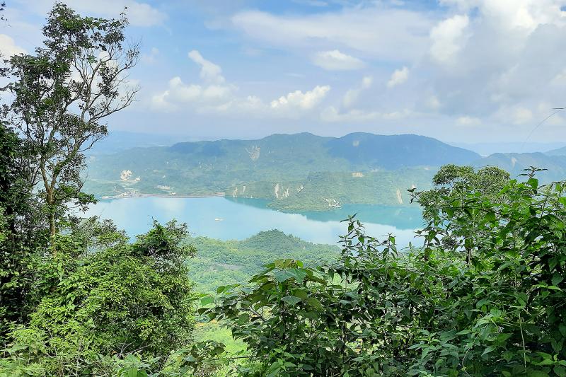
Photo: Steven Crook
From my scooter to the ridge took less than 15 minutes of hiking. I could now see the reservoir, and a marker told me I’d reached an elevation of 397m.
By then, I was realizing that mosquitoes can be a problem at this time of year. On the bright side, the bloodsuckers were just a tiny minority of the insects I encountered. Entomological gems included scores of butterflies, unusual-looking beetles and clouds of tiny grasshoppers which scattered whenever I disturbed the grass beside the trail.
Had it been a sunny day, I’d have certainly appreciated the shade cast by the tung trees, Taiwan Acacia, poison peach and other trees and shrubs.
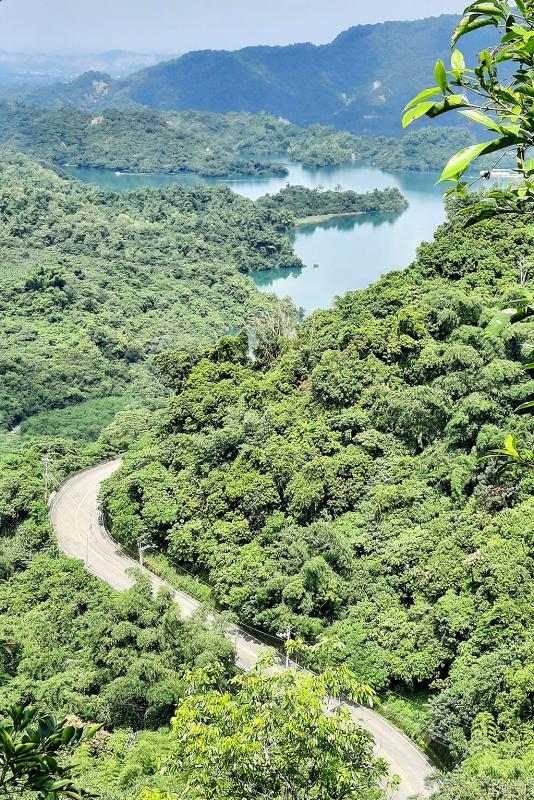
Photo: Steven Crook
For the next hour, the going was relentlessly upward. Trailside markers showed 466m above sea level, then 547m, then 678m. Just after the last of these, I got a clear view of Jiasian Bridge (甲仙大橋). It’s painted purple, in honor of the town’s famous taro crop.
According to an information board along the trail, Jiasian began to develop around 1736, thanks in large part to the camphor industry.
I took short rests at Guanba Gazebo (觀壩亭), which looks over Nanhua Reservoir, and Lansheng Gazebo (攬勝亭). It’s said that, on a good day, from the latter you get superb views of the Central Mountain Range. For me, the lack of long-distance vistas was a minor disappointment.
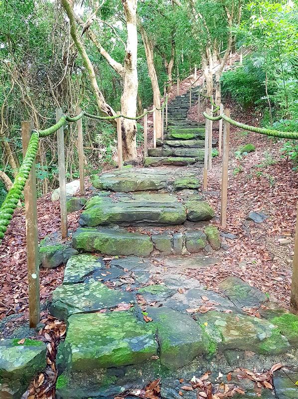
Photo: Steven Crook
Half a kilometer before I reached the twisting red column that stands at 784m above sea level — the highest point on the trail — I came across a bilingual sign that called it “Monument for Six Martyrs” (六義士紀念碑). Previously, I’d never given much thought to this landmark. But now I needed to know: Who were the six martyrs?
I did some research when I got home. Liouyi Mountain was originally called Jiasian Mountain (甲仙山). During the Japanese colonial era, the toponym Luming Mountain (鹿鳴山) was used.
After World War II, Luming Mountain morphed into Liouming Mountain (六命山). But in 1968, when then-governor of Taiwan Province Huang Chieh (黃杰) visited the area to check on the construction of the South Cross-Island Highway, he was told that six local men had died near here fighting the Japanese during the Tapani Incident of 1915. He decided that the name of the ridge should be adjusted to Liouyi Mountain “to comfort those heroic spirits.”
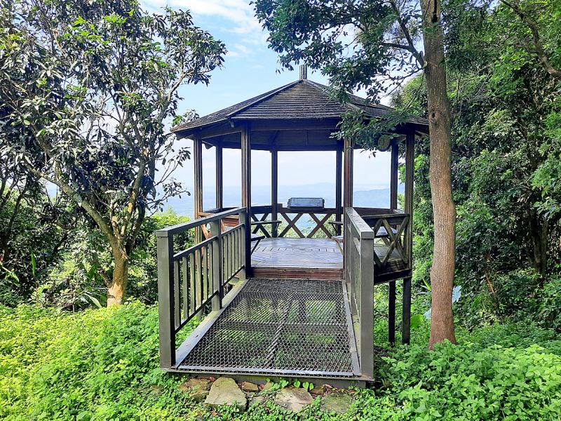
Photo: Steven Crook
The current monument to the six men, which was erected in 2003, looks as if it sustained some damage. Vandalism, a lightning strike or poor construction quality, I wondered as I examined it.
Moving north from the monument, I found the remaining 1.1km of path more challenging. Using my hands to steady myself, I climbed down across rocks, and enjoyed a few minutes of proper sunshine. I’ve not been able to confirm the precise altitude of the northern end of the ridge path, but I think it’s around 650m.
Some hikers walk from there down a concrete track to Jiasian Fossil Museum (甲仙化石館), and then into Jiasian itself. I retraced my steps to get back to my scooter, and did so gladly. The ridge at Liouyi Mountain is a good place to be if you want fresh air, exercise and hill-country views.
Steven Crook has been writing about travel, culture and business in Taiwan since 1996. He is the author of Taiwan: The Bradt Travel Guide and co-author of A Culinary History of Taipei: Beyond Pork and Ponlai.
Ajay Verma, a consultant gastroenterologist at Kettering general hospital in Northamptonshire, says our gut is a “complex machine.” “It is constantly providing us with the nutrition we need, initially to grow and develop, and then for us to survive, thrive and repair from injury and illness.” How can we keep it functioning well? Put simply: “Make sure what you put into it is balanced, and that you clear out its waste products adequately,” Verma says. “In a general gastroenterology clinic, the most common conditions we see are irritable bowel syndrome (IBS), gastroesophageal reflux disease, inflammatory bowel disease and constipation,” says Nisha
The arithmetic is straightforward and uncomfortable. By the end of 2025, Taiwan had committed itself to a 50-30-20 electricity mix — half natural gas, 30 per cent coal, 20 per cent renewables. The Ministry of Economic Affairs’s (MOEA) own monthly energy reports tell a different story. Natural gas reached 47.8 per cent of generation last year. Coal stood at 35.4 per cent, comfortably above its target ceiling. Renewables came in at 13.1 per cent, well short of the 20 per cent Taipei had pledged a decade earlier. Installed renewable capacity reached roughly half of the 12 gigawatts (GW) the government

Last week US President Donald Trump was asked by a reporter whether he would speak on the phone to the President of Taiwan. “l’ll speak to him. I speak to everybody. We have that situation very well in hand,” Trump said. This marked the second time in a couple of weeks he had said he would talk to the President of Taiwan. In 2016 he famously took a call from then-president Tsai Ing-wen (蔡英文), when he was president-elect. Despite warnings that the apocalypse was nigh because of a phone call, the world quickly forgot about the conversation between two democratically-elected presidents.
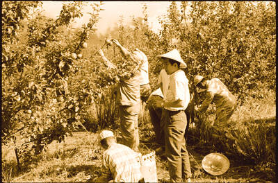
May 25 to May 31 Few believed that apples could be cultivated on a commercial scale in Taiwan’s high mountains. When horticulturalist Cheng Chao-hsiung (程兆熊) first proposed the idea in 1955, both American and Taiwanese colleagues dismissed it as implausible, arguing that temperate fruit could not be reliably grown on a subtropical island, especially on rugged terrain. However, it was this terrain in the Central Mountain Range where many Chinese Civil War veterans were resettled in the late 1950s. With limited job prospects and no family in Taiwan, they were placed on cooperative farms aimed toward self-sufficiency. Some say the conditions