First, the bad news. Erren River (二仁溪), which divides Tainan from Kaohsiung, is seriously polluted.
An academic paper published in 2018 concluded that, of 14 major waterways in Taiwan, Erren River contained the highest levels of cadmium, chromium, copper and mercury. The study, which averaged data gathered between 2002 and 2016, also found that the concentrations of arsenic and zinc in the river were among the highest in the country, while manganese levels exceeded the limit set by Taiwan’s Environmental Protection Administration.
Now for some good news. Erren River isn’t nearly so noisome as it once was. If it isn’t out of the hospital, at least it’s no longer in intensive care.
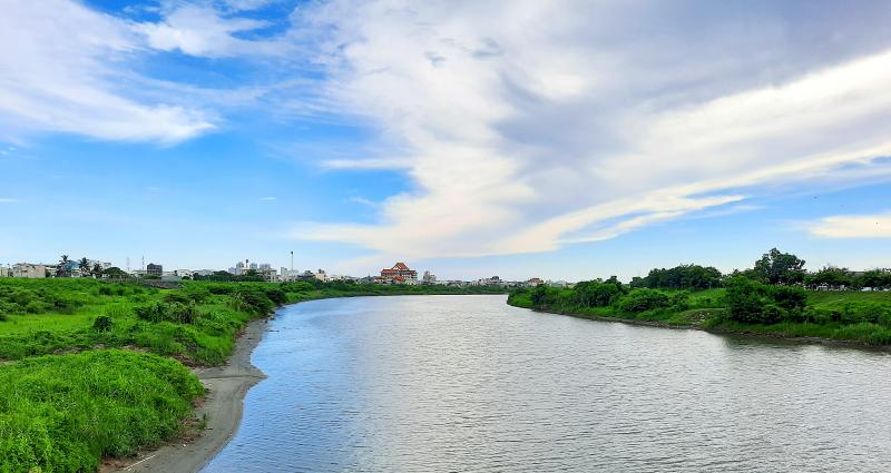
Photo: Steven Crook
According to an article posted on the Water Resources Agency’s River Restoration Network Web site, by the 1960s the bed of Erren River was covered with waste metals, and it emanated a constant stench. Much of the contamination was the result of smelting factories dumping solid and liquid waste. Untreated sewage from pig farms made matters worse.
A key year in the river’s environmental history is 1986, when the “green oyster incident” (綠牡蠣事件) galvanized public opinion. After oysters being raised in the shallows of Kaohsiung’s Cieding District (茄萣) began dying en masse, scientists found they contained dangerously high copper concentrations.
Within six years, cleanup efforts — which included dredging to remove contaminated sediment — had reduced copper levels in oysters to less than a tenth of those recorded in 1986. Even so, in the words of one group of scientists, Cieding “still produced oysters with the highest copper and zinc concentrations among the areas investigated.”
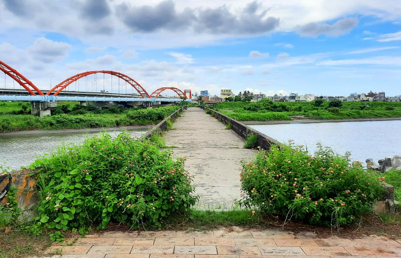
Photo: Steven Crook
I’ve crossed Erren River countless times, but only recently did I begin to explore its environs, and delve a bit into its history.
The river’s source is 460m above sea level at a spot called Shanjhu Lake (山豬湖), on the watershed between Kaohsiung’s Neimen District (內門) and Tainan’s Nanhua District (南化). Shanjhu means “Mountain Boar,” yet satellite photos show no lakes. I’ve no idea if mountain boars roam the area.
The river’s length is 63.2km. Before July 1823 it was slightly longer, as it emptied into the Taiwan Strait a few kilometers to the south of its current estuary. That month, southwestern Taiwan was deluged by rain. Huge amounts of mud washed down Erren River and Zengwen River (曾文溪), realigning both waterways.
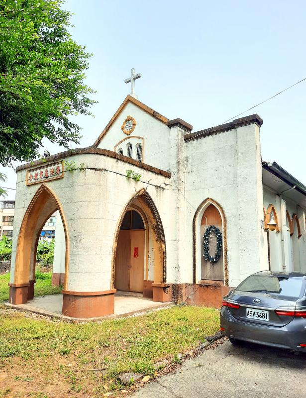
Photo: Steven Crook
On my first research trip, I crossed from Tainan’s Rende District (仁德) into Kaohsiung’s Hunei District (湖內) via Renhu Bridge (仁湖橋), then turned inland and cycled along the top of the levee.
When I found a way to get down to the water’s edge, I approached it with some trepidation. There hadn’t been any real rain in the preceding fortnight, and the water was flowing slowly. Even so, I could linger within a meter of the water without finding the smell offensive.
I rode east as far as the railroad. If you’re into watching trains, it’s a good spot — but I was shocked by the foliage that seemed to cover every square meter of the river’s surface.
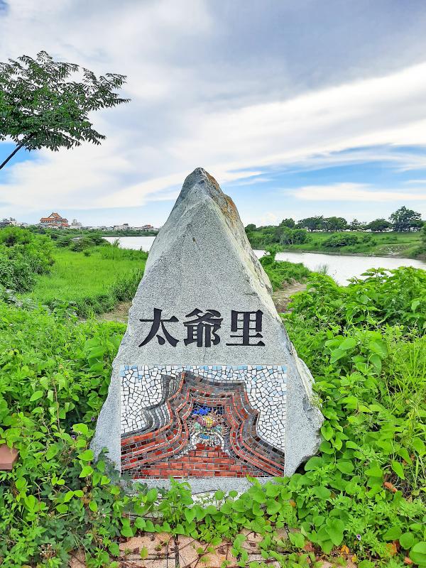
Photo: Steven Crook
Between the weir just downstream of where I was standing and upstream as far as I could see, the river flowed beneath a carpet of greenery. I’ve not been able to confirm if this greenery is evidence of eutrophication, which is usually caused by excessive use of fertilizers on farmland. When the chemicals wash into creeks and streams, they elevate the level of nutrients (usually nitrogen and phosphorus), causing certain algae and aquatic plants to rapidly multiply.
Heading toward the sea, I stumbled across two minor attractions.
The first was a disused but elegant Presbyterian Church on Renai Street (仁愛街) in Hunei. This 1953 building was replaced by a grander structure because it was too small for the congregation. The current Hai-po Presbyterian Church (長老教會海埔教會) is at 115 Heping Road (和平路).
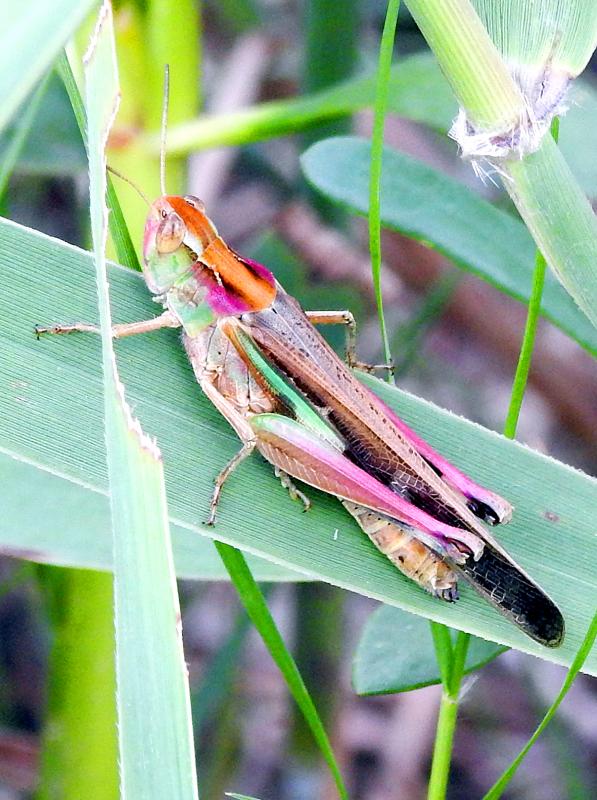
Photo: Steven Crook
Searching for a shortcut behind Cieding’s Wanfu Temple (萬福宮), I found a weather-worn stele preserved behind perspex in a purpose-built pavilion.
An information board beside it provides some history in Chinese. The Two Counties Border Stele (臺鳳二縣定界碑), which dates from 1763, was designed to resolve a dispute between the governments of Taiwan County (臺灣縣, roughly equivalent to modern Tainan) and Fengshan County (鳳山縣, which covered today’s Kaohsiung and Pingtung). Neither wanted to be responsible for dredging nearby docks, so the imperial authorities stepped in and clarified the precise boundary.
By the time I returned to the Tainan side on Provincial Highway 17, I was running out of daylight. Weeks passed before I was able to return to the area to tick two more boxes, one historical, the other ecological.
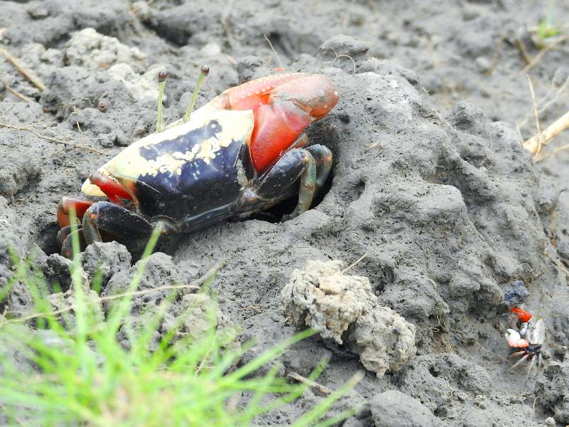
Photo: Steven Crook
Just west of the bridge that takes Provincial Highway 1 over Erren River, there’s a far older crossing point. The original highway bridge, not even two cars in width, was constructed in 1921. Repairs done since then have left it with an uneven appearance. Nowadays, only pedestrians and cyclists are permitted to use it.
The significance of this spot is made clear by a small monument halfway near the northern end of the bridge. It was here, on Oct. 20, 1895, that Reverend Thomas Barclay, a Tainan-based Scottish missionary, led a delegation to meet with the commander of the Japanese military force approaching Tainan. Barclay’s intervention ensured Tainan’s peaceful surrender at a moment when it seemed the city might go up in flames.
Baishalun Wetland (白砂崙濕地) lies between Erren River and its southern levee, just inland of Provincial Highway 17A (17甲). Illegal dumping of printed circuit boards left the mudflats here severely contaminated, but following clean-up work completed in 2006, the local ecosystem has made an impressive recovery.
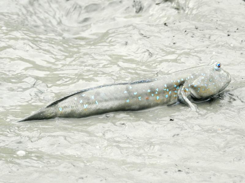
Photo: Steven Crook
The managed wetland has since been expanded from 0.5 hectares to 4 hectares. Thanks to volunteers who recycled bamboo from old oyster scaffolds into a pair of footbridges, it’s possible to explore most of the wetland without getting your shoes too muddy. At the same time, you can get unusually close to the creatures that dwell in the silt.
Two mangrove species thrive in the wetland, and there are thousands of fiddler crabs. For the better part of an hour, I was mesmerized by the antics of scores of mudskippers. Some looked to be a good bit longer and twice as thick as my index finger. Between sessions of motionless basking, they engaged in frantic twitching and flapping.
Away from the mud, I saw and photographed a remarkably colorful insect. I’d never before seen a grasshopper decorated with patches of green, black, orange and purple. At the time, I assumed it must be an uncommon species, but I haven’t been able to identify it. Even though it looked healthy, I still wonder: Is it possible this spectacle was a result of poisonous pollution?
Steven Crook has been writing about travel, culture and business in Taiwan since 1996. He is the author of Taiwan: The Bradt Travel Guide and co-author of A Culinary History of Taipei: Beyond Pork and Ponlai.

Taiwan’s English education system is being pulled apart by three opposing forces. Bilingual Nation 2030 pulls students toward English and global communication. Artificial Intelligence (AI) readiness pulls them toward digital judgment, verification and AI-mediated work. But Taiwan’s old exam culture pulls them back toward memorization, grammar drills, timed reading and correct answers. If the education system keeps using old exams to define success, it risks producing graduates who are neither genuinely bilingual nor genuinely AI-ready, but trained for tasks machines can already perform. The first force is Bilingual Nation 2030. Launched in 2018, the policy aimed to “help Taiwan’s workforce connect

It seems every few days one bumps into one of those “real man” comments in which Taiwan is urged to “face reality” or similar, and “make a deal,” with the speaker implying that soon it will be too late. “Deal” advocates always present themselves as having a superior grip on reality, and the manly ability to make the “hard choice.” Their testosterone-laden language often echoes that of Taiwan sellout advocates. Note that such commentary always specifies a process (“make a deal, work with, make progress”), never the end state of what occupation by a violent authoritarian colonialist state will entail. In

There are shadowy cabals plotting to sell out Taiwan to be annexed by China, by invasion if necessary. Fortunately, they are buffoons. In 2019, former Bamboo Union gangster and founder of the China Unification Promotion Party (CUPP), Chang An-le (張安樂, colorfully known as “White Wolf”), led a protest at the Legislative Yuan against comments made by then-premier Su Tseng-chang (蘇貞昌) that in the event of an attack by China, he would never surrender, but would protect the nation by fighting to the end, even if he only had a broom. Chang had party members bring a wooden casket that they
June 1 to June 7 "If all Taiwanese were as afraid of dying as you, then what would happen?” Physician Shih Chiang-nan (施江南) reportedly said this to his wife Chen Chiao-tung (陳焦桐) after she urged him to stop intervening on behalf of Taiwanese soldiers stranded overseas after serving in the Japanese Army during World War II. Shih had clashed with high-ranking officials over the issue, engaged in several heated arguments with Taiwan governor-general Chen Yi (陳儀) and allegedly shouted at general Ko Yuan-fen (柯遠芬), chief of staff of the Taiwan Garrison Command, over