Australian Prime Minister Anthony Albanese yesterday hailed a “positive” meeting with Chinese Premier Li Keqiang (李克強) — the first in-person encounter between leaders of the two countries since 2019.
Albanese, whose Labor government is keen to scrape the ice off of Canberra’s frosty relationship with Beijing, spoke to Li at a gala dinner on Saturday night at the ASEAN summit in Phnom Penh.
“I had a great conversation with Premier Li. It was very positive and constructive,” Albanese told reporters yesterday.

Photo: Reuters
Ties with Beijing had in recent years hit an all-time low under Australia’s previous conservative government.
China whacked Australia with trade sanctions costing billions of dollars in merchandise and service exports after Canberra called for an independent inquiry into the origins of the COVID-19 pandemic.
Former Australian prime minister Scott Morrison was the last Australian leader to speak with Li and Chinese President Xi Jinping (習近平) in 2019.
Saturday was the first time Li and Albanese met in person, and they discussed the 50-year anniversary of the two countries’ diplomatic ties.
“I think it’s a good thing that it happened. I’ve said repeatedly about the relationship with China — that we should cooperate where we can and that dialogue was always a good thing,” Albanese said.
Asked if he thought China was looking to recalibrate its relationship with other countries, he said: “We should cooperate with China where we can and that’s what we’re doing.”
The discussion came amid speculation about a possible meeting between Albanese and Xi at a G20 summit in Indonesia today.
Albanese on Wednesday said that a meeting with Xi would be a positive development after years of tense relations.
Albanese also held a “constructive” 40-minute meeting with US President Joe Biden yesterday. Topics ranging from climate change and regional security to Russia’s invasion of Ukraine and the AUKUS partnership featured in the talks, he said.
Albanese said that he had invited Biden to address parliament when Australia hosts a meeting next year of leaders of the Quadrilateral Security Dialogue regional grouping.

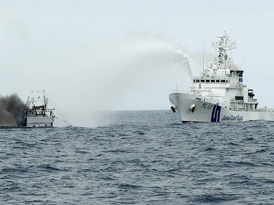
CREDIT-GRABBER: China said its coast guard rescued the crew of a fishing vessel that caught fire, who were actually rescued by a nearby Taiwanese boat and the CGA Maritime search and rescue operations do not have borders, and China should not use a shipwreck to infringe upon Taiwanese sovereignty, the Coast Guard Administration (CGA) said yesterday. The coast guard made the statement in response to the China Coast Guard (CCG) saying it saved a Taiwanese fishing boat. The Chuan Yu No. 6 (全漁6號), a fishing vessel registered in Keelung, on Thursday caught fire and sank in waters northeast of Diaoyutai Islands (釣魚台). The vessel left Keelung’s Badouzih Fishing Harbor (八斗子漁港) at 3:35pm on Sunday last week, with seven people on board — a 62-year-old Taiwanese captain surnamed Chang (張) and six

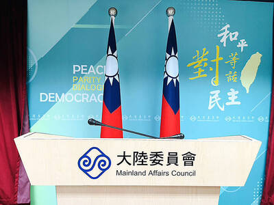
RISKY BUSINESS: The ‘incentives’ include initiatives that get suspended for no reason, creating uncertainty and resulting in considerable losses for Taiwanese, the MAC said China’s “incentives” failed to sway sentiment in Taiwan, as willingness to work in China hit a record low of 1.6 percent, a Ministry of Labor survey showed. The Directorate-General of Budget, Accounting and Statistics (DGBAS) also reported that the number of Taiwanese workers in China has nearly halved from a peak of 430,000 in 2012 to an estimated 231,000 in 2024. That marked a new low in the proportion of Taiwanese going abroad to work. The ministry’s annual survey on “Labor Life and Employment Status” includes questions respondents’ willingness to seek employment overseas. Willingness to work in China has steadily declined from

The Legislative Yuan’s Finance Committee yesterday approved proposed amendments to the Amusement Tax Act (娛樂稅法) that would abolish taxes on films, cultural activities and competitive sporting events, retaining the fee only for dance halls and golf courses. The proposed changes would set the maximum tax rate for dance halls and golf courses at 50 and 20 percent respectively, with local governments authorized to suspend the levies. Article 2 of the act says that “amusement tax shall be levied on tickets sold or fees charged by amusement places, facilities or activities” in six categories: “Cinema; professional singing, story-telling, dancing, circus, magic show, acrobatics

INFLATION UP? The IMF said CPI would increase to 1.5 percent this year, while the DGBAS projected it would rise to 1.68 percent, with GDP per capita of US$44,181 The IMF projected Taiwan’s real GDP would grow 5.2 percent this year, up from its 2.1 percent outlook in January, despite fears of global economic disruptions sparked by the US-Iran conflict. Taiwan’s consumer price index (CPI) is projected to increase to 1.5 percent, while unemployment would be 3.4 percent, roughly in line with estimates for Asia as a whole, the international body wrote in its Global Economic Outlook Report published in the US on Monday. The figures are comparatively better than the IMF outlook for the rest of the world, which pegged real GDP growth at 3.1 percent, down from 3.3 percent