For the authorities that brought the Mountains to Sea National Greenway (山海圳國家綠道) into existence, the route is as much about culture as it is about hiking.
Han culture dominates the coastal and agricultural flatlands of Tainan and Chiayi counties, but as the Greenway climbs along its Tribal Trail (原鄉之路) section, hikers pass through communities inhabited by members of the Tsou Indigenous community.
Leaving Chiayi County’s Dapu Village (大埔), walkers follow Provincial Highway 3 to Dapu Bridge where a sign bearing the Tsou greeting “a veo veo yu” marks the point at which the Greenway turns off to follow Qingshan Industrial Road (青山產業道路) — and the point at which the balance of cultures tips towards primarily Indigenous.
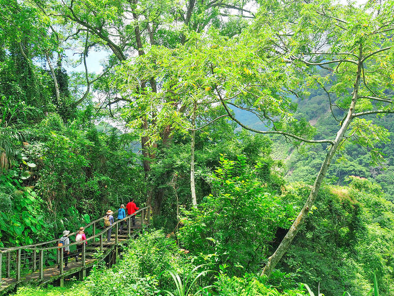
Photo: Ami Barnes
CAYAMAVANA’S PAVILIONS
A zigzagging climb brings hikers to Cayamavana (Chashan, 茶山). The village is unique among Taiwan’s indigenous settlements both for its ethnic diversity — Tsou individuals comprise the largest group here, but there are also Bunun and a scattering of Han villagers — and also for its extensive collection of pavilions.
Pavilions — more specifically thatched-roofed hufus — are scattered all around the village and are a big part of daily life.
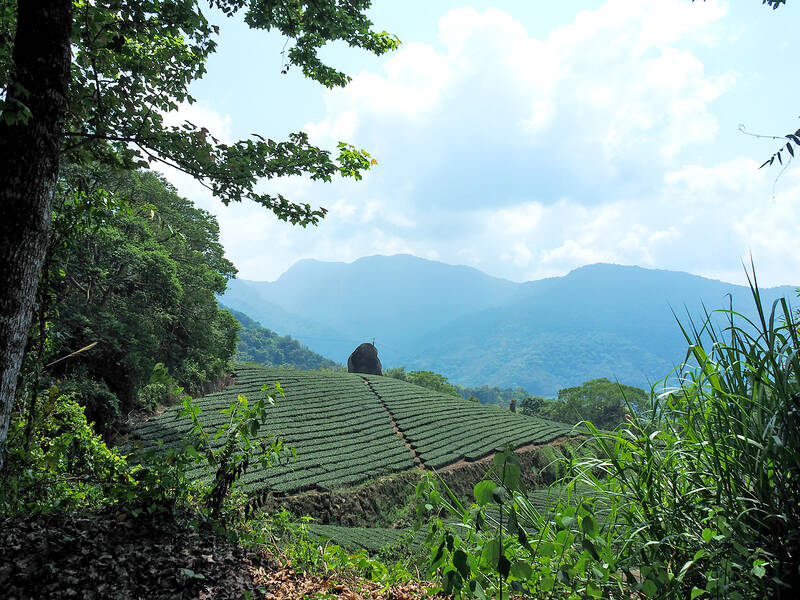
Photo: Ami Barnes
They are where the community gathers, chats and shares food — relics of a time when the community’s dead were buried below their living quarters, necessitating that noisy socializing activities be conducted away from the home.
Cayamavana is a good place to spend the night. Stopping here makes the Dapu-to-Cayamavana day short and the following day long, but Cayamavana has more places to stay than the next village — among them, Chashan Kaiyuan Farmstead (茶山開元農場) is a welcoming option — prices start at NT$1,200, bookable by calling (09) 3277-3883.
From Cayamavana, the Greenway follows Chiayi District Road 129 for about 17 kilometers, passing through Niahosa Village (Xinmei, 新美) about halfway along this leg.
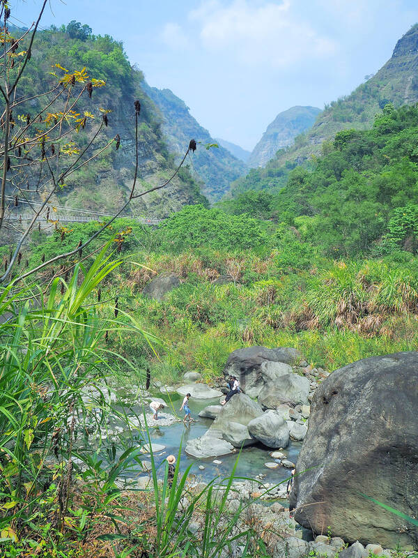
Photo: Ami Barnes
The village is relatively young, with most families having resettled there in the wake of World War II, although nearby archaeological excavations have revealed pottery, hunting paraphernalia and graves dating back around 3,800 years.
Niahosa feels a tad livelier than neighboring Cayamavana. It has a well-stocked convenience store, a coffee shop and some small eateries. There’s also an elementary school (at the latest count, populated entirely by Indigenous youths) and a couple of churches.
ECOLOGICAL PARK
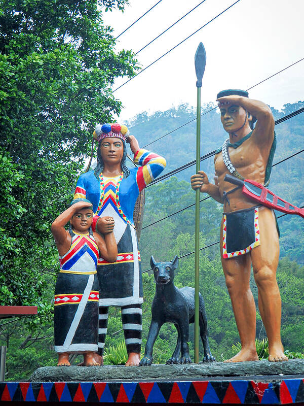
Photo: Ami Barnes
At Danayigu Nature Ecological Park (達娜伊谷自然生態公園), the Greenway finally parts ways with the road.
The route passes straight through the park and out the other side, meaning walkers must pay the entry fee (NT$150, discounted for Mountains to Sea Greenway trail passport holders).
Run by the Tsou peoples of Saviki (Shanmei Village, 山美) — it’s an example of collaborative efforts affecting real change.
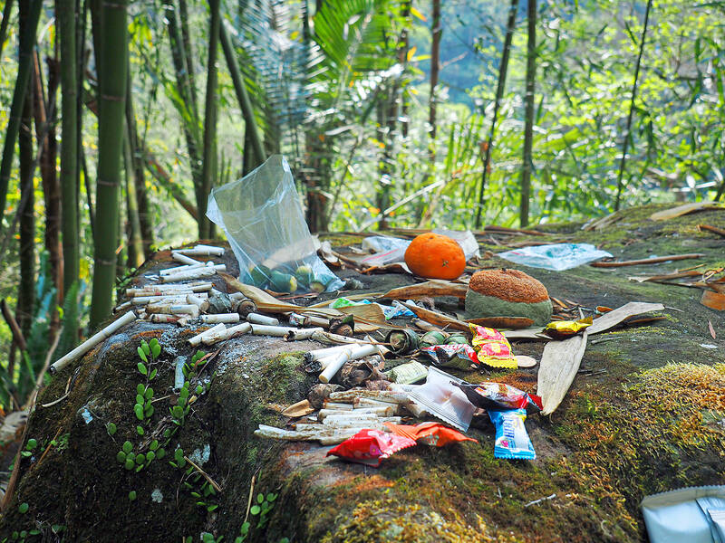
Photo: Ami Barnes
The Tsou traditionally practiced a combination of agriculture and hunting, with each family assigned an area of land comprising a stretch of riverbank and forest hunting grounds.
Ancestral lands sustained families for generations, but this system was thrown into disarray when post-World War II incomers brought destructive fishing practices such as electrofishing, stunning fish with electric currents.
It only took a couple of decades for the fish population to be all but eradicated, prompting villagers to take the drastic step of pooling their clans’ hunting grounds in order to preserve them.
The two waterways that run through the park — Zengwen River (曾文河) and Danayigu Creek (達娜伊谷溪) — were classified as shoveljaw carp conservation areas, and land to either side of the water became a hunting-prohibited nature reserve.
Fish fry from the creek’s headwaters were reintroduced to kickstart population recovery, and villagers organized patrols to ensure the new rules were followed. Within a short span, these efforts bore fruit — or rather, fish — and the cooperatively run park opened to visitors.
Passing through, hikers can visit the fish-viewing trail, learn about Tsou ways of life and refuel at stalls selling barbecued meats and local produce.
The Greenway leaves the park via an owl-adorned bridge before a lung-busting climb up Limei Refuge Trail (里美避難步道).
REMOTE NIAE’UCNA COMMUNITY
Before the Japanese colonial period, this was the primary route between Saviki and Niae’ucna (Lijia, 里佳). The Japanese constructed a new trail and this one fell into disuse until Typhoon Morakot wiped out sections of Niae’ucna’s only access road — prompting the old trail’s rebirth as an evacuation and supply route, then later a leisure trail.
Near the top, walkers can choose the slightly longer Giant Stone Slab Trail (巨石板步道) or crack on with the walk along Wuqiha Creek Industrial Road (烏奇哈溪產業道路) in search of rest in Niae’ucna — the through-hike’s most remote community.
Niae’ucna has a single homestay, Jiana Baiyi Workshop (嘉娜百藝工坊) and no official restaurant, but the homestay partners with villagers to offer hearty Indigenous-style feasts (advance booking required). Rooms are NT$2,400 per night, bookable by phoning (05) 251-1383.
Leaving the village, hikers pass Niae’ucna’s tribute stone stacked high with offerings for the locale’s guardian spirit, which appears to have a penchant for cigarettes and betel nuts.
The road is bounded by fields of tea and ginger and shaded by Formosa sweet gum trees, which — according to tribal lore — the Tsou are descended from.
Tapangu (Dabang, 達邦) and Tefya (Tefuye, 特富野) are the Greenway’s final two villages. Occupying parcels of flat land among an otherwise mountainous landscape, legend holds that the two villages sprang up in the footprints of Hamo — the Tsou creator god.
Tapangu is small and the sights densely packed. The Tsou Cultural Exhibition Hall (free to enter) sits between the school and its mountain-view running track.
West of the track, Tsou Fengguan Tribal Restaurant (鄒風館部落餐廳) serves up excellent Tsou cuisine, while at the eastern edge, a Japanese-era police dormitory serves as a reminder of the repression endured by Taiwan’s Indigenous communities.
Tapangu’s kuba — a ceremonial meeting place — is tucked between houses to the north of the running track, with thatched roofs capped with a living Dendrobium orchid and are where the community gathers for festivals. Tapangu and Tefya are the last of Taiwan’s communities with kubas.
A suspension bridge spans the river valley separating Tapangu from Tefya, and the trail on the far side ascends through creaking bamboo forests and towering camphor giants.
FARM-TO-TABLE COFFEE
Coffee growing has taken off in the region over the past decade, and as the trail approaches Tefya, it skirts several small coffee plantations and a handful of wayside cafes where the coffee must have one of the shortest farm-to-table journeys ever recorded — the plants are within literal striking distance of the tables.
The Tribal Trail continues a little further before segueing into the Greenway’s final portion — the Sacred Mountain Trail (聖山之路) — but since Tapangu and Tefya make an excellent point to break up the journey, it makes sense to pause the writing here too.

If a leisurely afternoon of high-end dining and watching the scenery roll by from the comfort of a plush armchair sounds like a good time to you, consider a trip on the Sea Breeze (海風號). This culinary, cultural and scenic experience is the perfect setting for a date, a celebratory outing with a small group of friends or a relaxing solo ride. The price tag is steep, especially if you consider the short distance the train actually covers over the 3.5-hour journey. But what you’re paying for on the Sea Breeze isn’t transportation; it’s the comfort, the service, the exclusivity, the
Audiences in Leicester, Cardiff, London and Sheffield will this month gather to watch a series of black-and-white Taiwanese-language films made more than 70 years ago. On the surface, these screenings commemorate the seventieth anniversary of taiyupian (台語片) — Taiwanese-language cinema. Yet the significance of these events extends far beyond nostalgia or film history. They represent a remarkable chapter in Taiwan’s ongoing effort to recover, preserve and reinterpret a cultural heritage that was once thought to have largely disappeared. The centerpiece of the program is the Ho Chi-ming (何基明) directed Xue Pinggui and Wang Baochuan (薛平貴與王寶釧), a film produced in 1955 and
In December of 2008 Lee E-tin (李乙廷), a Miaoli county legislative hopeful, was convicted of vote-buying. Rather than buy votes retail, voter by voter, in the usual manner, Lee had done it wholesale, in a commendably efficient manner: he had visited local temples and made donations to gain their support. Because he did not normally make donations to temples, the court ruled he was attempting to improperly influence voter behavior. The case indicates how important temples are in influencing political life. Both judge and politician appeared to see them in the same way. Beijing sees them that way as well. Democratic Progressive

One of the wildest things about the reception of Chinese Nationalist Party (KMT) Chair Cheng Li-wun (鄭麗文) in the international media is the way her words are presented without being contextualized, let alone challenged. The Financial Times, for example, interviewing her during her visit to New York, said that she blamed the halt to exchanges between Taiwan and the People’s Republic of China (PRC) for raising tensions. “There has been no dialogue, so you can see that the situation is almost on the brink of war,” the Financial Times quoted her as saying, without any hint that the PRC, not