The year was 1991. A Toyota Land Cruiser set out on a 67km journey up the Junda Forest Road (郡大林道) toward an old loggers’ camp, at which point the hikers inside would get out and begin their ascent of Jade Mountain (玉山). Little did they know, they would be the last group of hikers to ever enjoy this shortcut into the mountains. An approaching typhoon soon wiped out the road behind them, trapping the vehicle on the mountain and forever changing the approach to Jade Mountain.
THE CONTEMPORARY ROUTE
Nowadays, the approach to Jade Mountain from the north side takes an extra day and starts down in the hot spring village of Dongpu (東埔) in Nantou County. The walk starts out on the Batongguan Traversing Trail (八通關越道路) within the boundaries of Yushan National Park. After a full day’s walk up this trail, hikers are in a good position to reach the summit of Jade Mountain on the second day. Alternatively they can continue eastward to complete the Traversing Trail or connect with other trails. However, the abandoned Land Cruiser makes for a great hiking destination in itself.
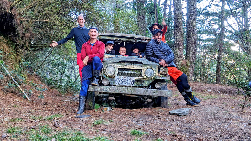
Photo courtesy of Richard Hazeldine of Asia Hikelopedia
To reach this abandoned shuttle bus, hikers only need to make their way up as far as the remains of the Dueiguan Police Station (對觀駐在所). The Batongguan Traversing Trail was built by the Japanese to exert control over the indigenous in the mountains, so there was a police station every few kilometers along the trail from Nantou to Hualien. Dueiguan, of which only the concrete foundation remains, was one such post.
Just before the 10K mark on the trail, there is a water source trickling across the trail, and a small waterfall blasting down next to (and onto) a metal pedestrian bridge. Be sure to fill up with water at one of these for an overnight trip, as there is no other water source along the way. Another half a kilometer ahead is Dueiguan, where the route to the Land Cruiser turns off the main trail.
TAIWAN’S LONGEST LOGGING ROAD
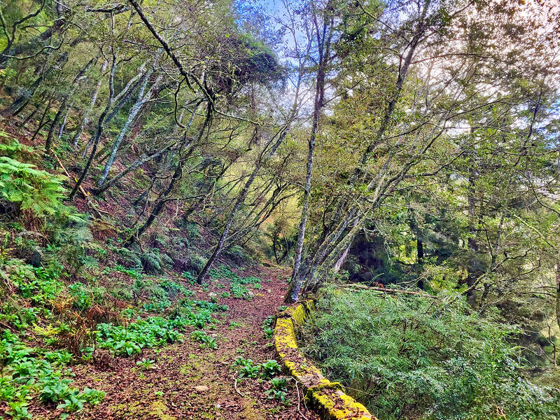
Photo: Tyler Cottenie
The Batongguan Traversing Trail and Junda Forest Road run parallel to each other on opposite sides of the mountain. At Dueiguan Police Station, look to the left for ribbons and a narrow trail leading up the steep slope. This will take you up to the ridge and down to the forest road on the other side. It’s a strenuous two-hour climb to the top and a quick half-hour down the other side. This is not an officially maintained trail, and the back side of the ridge is not even in the national park, so proceed with caution.
After the old Japanese trail — comfortably wide, but riddled with landslide damage — and then the even narrower bush trail over the ridge only recently tramped down by hikers, it’s a bit of a surprise to suddenly arrive at the broad, level forest road. This road holds the record as the longest logging road ever built in Taiwan (not including branch roads). With the help of American foreign aid, the government initially built a 40km stretch of road here. This was later extended to 69km and finally to the record-breaking 83km.
The route to the shuttle bus from here is much easier and safer. Head to the right (uphill) to reach the old loggers’ camp at Guangao (觀高), where hikers, in the 1980s, would start their ascent of Jade Mountain. Head to the left (downhill) to reach the abandoned shuttle bus.
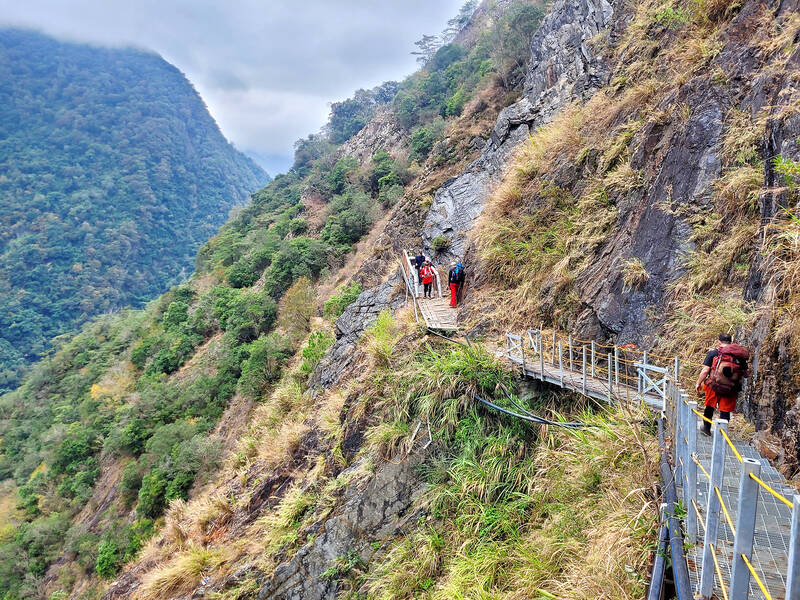
Photo: Tyler Cottenie
In the past, continuing in this direction would take you all the way down the mountain. However, a major landslide forever cut off this part of the road. Nowadays, cars can only drive up as far as the Junda Mountain trailhead at 32K, or the 33K mark, where hikers can proceed on foot through several landslides to 45.3K and turn off to start the South Third Section hike (南三段). The landslide at 47K was the one that sounded the death bell for the Land Cruiser in 1991.
IN AND AROUND THE SHUTTLE BUS
The walk down to the shuttle bus is the most relaxing part of the whole hike, thanks to the well-preserved forest road, which is several meters wide, nearly flat, and still not heavily overgrown. The soft bed of pine needles and moss, paired with views of the Central Mountains amid comfortable mid-altitude temperatures make this an enjoyable walk at any time of the year. Old power poles line the road, more evidence of its logging history. The power line has fallen across the road in places, so be aware of this hazard.
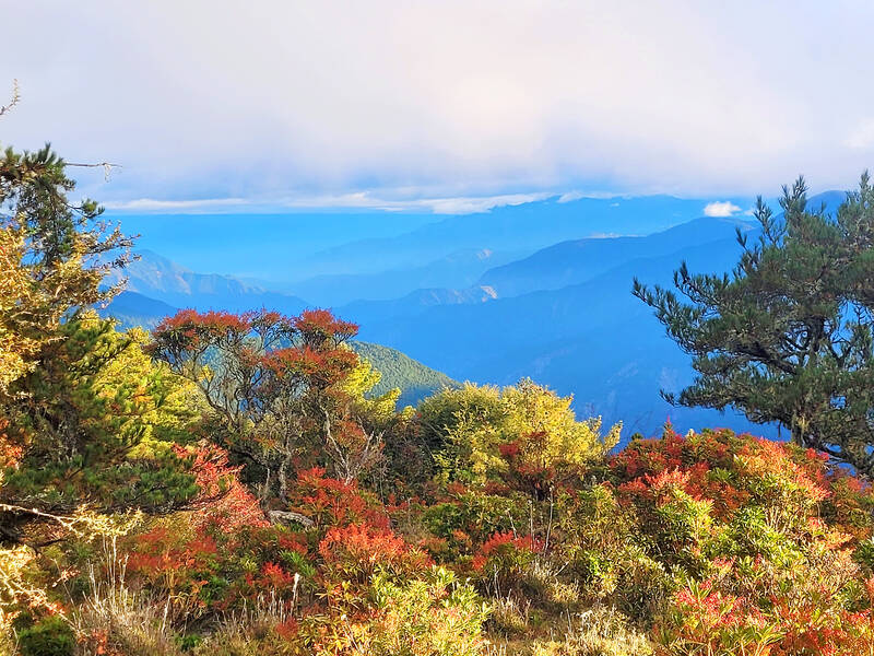
Photo: Tyler Cottenie
After an easy half-hour walk, you will see a 40 series Land Cruiser come into view around a curve near the 59K mark. Sporting five doors, a custom forest-green with white stripe exterior and rear bench seating that would have allowed it to carry at least 10 passengers, the shuttle bus now sits peacefully on the side of the road, almost as if the driver had stopped for a smoke break and just forgotten to come back. The body and most of the windows are intact, even after decades in the elements.
Clues to its time and place of origin are visible on the exterior. The name of the company that ran the shuttle service, Shueili Sin Shan Yuan Rest Stop (水里欣山園休息站), is painted on the side of the vehicle. Sin Shan Yuan still exists today in Shueili as a restaurant and banquet center, though they no longer provide shuttle services to hikers. The phone number on the side of the Land Cruiser even matches the current number for Sin Shan Yuan, except for the initial “2” that was only added to Chunghwa Telecom numbers in Nantou in 2001. The license plates feature seven digits under the heading “Taichung Office” (台中所), corresponding to sixth-generation plates issued between 1984 and 1995 when the issuing Motor Vehicles Office was printed on the plates.
Getting here from the trailhead in Dongpu takes seven to eight hours, so you’ll probably want to make camp here. The wide and flat road makes for a perfect campsite, and the remoteness means your only other companions are likely to be barking deer and weasels. The return trip to Dongpu the following day is much more leisurely, as there is very little uphill climb. You may even have time to explore more of the forest road in either direction first.
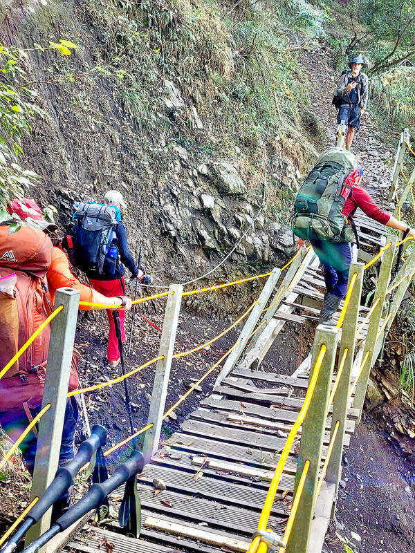
Photo: Tyler Cottenie
For those with an extra day available, it’s also possible to climb back up to the ridge from here to the summit of Dueiguan Mountain (對觀山), and then continue several hours more up to the campsite just short of the summit of Junda Mountain, one of the 100 Peaks. Reach the summit the next day and follow the traditional hiking route back down to the drivable portion of the Junda Forest Road at 32K, or take the much more advanced route down a steep slope back to your starting point at Dongpu.

Photo: Tyler Cottenie

Cheng Ching-hsiang (鄭青祥) turned a small triangle of concrete jammed between two old shops into a cool little bar called 9dimension. In front of the shop, a steampunk-like structure was welded by himself to serve as a booth where he prepares cocktails. “Yancheng used to be just old people,” he says, “but now young people are coming and creating the New Yancheng.” Around the corner, Yu Hsiu-jao (饒毓琇), opened Tiny Cafe. True to its name, it is the size of a cupboard and serves cold-brewed coffee. “Small shops are so special and have personality,” she says, “people come to Yancheng to find such treasures.” She

Late last month Philippines Foreign Affairs Secretary Theresa Lazaro told the Philippine Senate that the nation has sufficient funds to evacuate the nearly 170,000 Filipino residents in Taiwan, 84 percent of whom are migrant workers, in the event of war. Agencies have been exploring evacuation scenarios since early this year, she said. She also observed that since the Philippines has only limited ships, the government is consulting security agencies for alternatives. Filipinos are a distant third in overall migrant worker population. Indonesia has over 248,000 workers, followed by roughly 240,000 Vietnamese. It should be noted that there are another 170,000

Hannah Liao (廖宸萱) recalls the harassment she experienced on dating apps, an experience that left her frightened and disgusted. “I’ve tried some voice-based dating apps,” the 30-year-old says. “Right away, some guys would say things like, ‘Wanna talk dirty?’ or ‘Wanna suck my d**k?’” she says. Liao’s story is not unique. Ministry of Health and Welfare statistics show a more than 50 percent rise in sexual assault cases related to online encounters over the past five years. In 2023 alone, women comprised 7,698 of the 9,413 reported victims. Faced with a dating landscape that can feel more predatory than promising, many in

“This is one of those rare bits of TikTok fitness advice with a lot of truth behind it,” says Bethan Crouse, performance nutritionist at Loughborough University. “Sometimes it’s taken a bit too literally, though! You see people chugging protein drinks as they’re scanning out of their gym.” Crouse recommends the athletes she works with consume 20-30g of protein within 30-60 minutes of finishing a resistance training session. “The act of exercising our muscles increases the breakdown of muscle proteins,” she says. “In order to restore, or hopefully improve them — and get gains such as increased muscle mass or strength —