The cool, clean river water quickly evaporates as I warm myself in the tropical sun, still strong at midday even in November. Below me is a bend in the river, and a deep emerald pool has formed here alongside the concrete platform I am sitting on, which once served as a check dam, but today serves as the perfect place to launch myself into the water. On shore, children splash in the water as parents sit nearby under awnings. Above me, a hawk traces out lazy circles against the bright blue sky. In the distance, a train emerges from a tunnel onto a bridge upstream, giving passengers on board a brief glance at our paradisaical campsite before disappearing into the next tunnel.
The river is a part of Pingtung County’s Fangshan River (枋山溪) system, whose economic importance is well established but whose recreational value is not so well known. It is here that the railway leaves the west coast and makes its way to Taitung County through tunnel after tunnel, passing by our remote campsite along the way. As the train does not stop for passengers anywhere in the valley, entering by road is the better option to take advantage of the recreational opportunities here.
SOUTH-LINK RAILWAY LINE
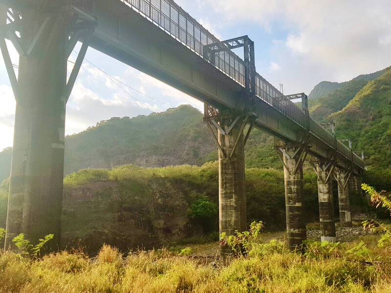
Photo: Tyler Cottenie
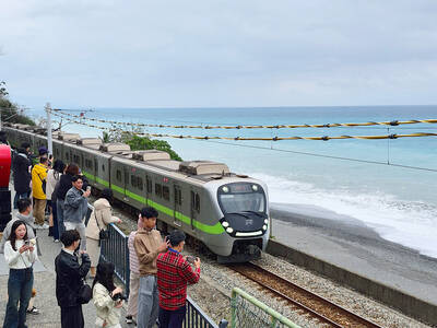
The nearest passenger train station is Fangshan, near the mouth of the river on the west coast. It has the dual distinction of being the railway’s southernmost station, and the station with the fewest number of commuter trains making stops there, only two in each direction per day. That being said, it is worth a visit when the weather is nice. The station is up on a hill, and the large parking lot in front provides an excellent view of the village and coastline below. In fact, the “blue train” — a retro tourist train not part of TRA’s regular schedule — also makes an 18-minute stop here, just so passengers can get out and take photos during the late-afternoon golden hour.
This area is not only of strategic importance for the railway, but also for communications. Higher up on the hill is an important telecommunications center with several conspicuous satellite dishes. Three of Taiwan’s submarine communication cables also land in Fangshan and connect to the rest of the island via this center.
Speaking of important signals, the railway has two more stations further up the valley, known as signal stations, where passengers are not allowed to get on or off. The first is Fangye Signal Station, which is manned. The station grounds are attractive, with potted plants and a great view of the surrounding mountains. It is possible to visit this station by road, and the TRA staff are usually happy to talk to visitors as the place is otherwise very quiet.
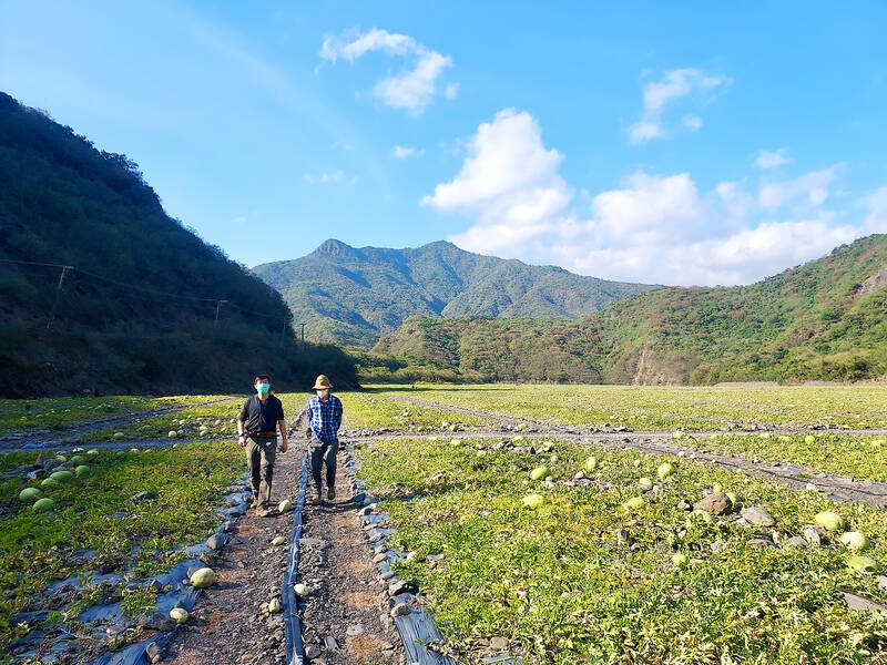
Photo: Tyler Cottenie
Deeper in the mountains lies an unmanned station that is little more than a set of locked, plain-looking buildings housing machinery. For the average tourist, getting here may not be worth the effort, but for railway enthusiasts, the long drive down the dirt road to Central Signal Station is a must. The longest stretch between any two TRA passenger stations is 30.2km, from Fangshan in the west to Dawu in the east, and this station lies right in the middle, on the west end of the 8km tunnel bored right through the Central Mountain Range.
THE GREAT OUTDOORS
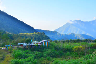
The road that ends at Central Signal Station, Pingtung County Road 147-1, begins way back near Fangshan Station and Provincial Route 1. This is the way in for those who really want to explore the valley. It initially passes through a few fruit farms and then follows the river closely for the rest of its course, hugging cliffs at times, and descending right onto the riverbed at others. With a careful driver, any car can make it down this road. It seems almost purpose-built for motorcycle riding, though, and this is the most enjoyable way to make your way up the valley. Mountain biking is also an excellent option.
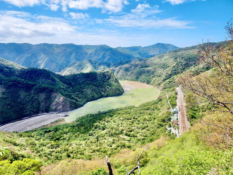
Photo: Tyler Cottenie
Similar to the Lanyang River (蘭陽溪) in Yilan County, the Fangshan River valley is full of watermelon fields at certain times of the year. Come in December and some green will already be showing. In late February or early March it’s harvest time and the whole valley floor will have transformed from a grey expanse of river gravel into a textured carpet of green from one bank to the other. The best place to get a bird’s-eye view of this phenomenon is on a hiking trail further up the valley.
About 10 kilometers in, a chain blocks the way. This is a Forestry Bureau checkpoint, and usually passing through here is as simple as showing your ID and giving a phone number. However, the road may not always be open, as there are occasional logging projects in the valley that require the use of this road. Immediately after entering the restricted area, a U-turn to the left takes you up to Fangye Signal Station. Continuing straight instead takes you right to the trailhead for Bacengbamo Mountain (八層巴墨山), marked only by a couple of ribbons.
This trail is quite steep, ascending over 800 meters in just under 3km. If an 800 meter ascent seems too daunting, the good news is that climbing about 30 minutes is all that’s necessary to reach an area with a stunning view of the valley below. From here, you get a bird’s-eye view of the watermelon fields filling the valley, and trains emerging from the tunnels next to Fangye Signal Station. Hikers should also keep an eye out for macaques, barking deer, wild boar, pangolins and, of course, snakes.
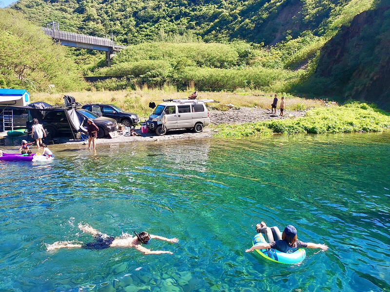
Photo: Tyler Cottenie
If you’re feeling too hot after the hike, why not cool off with a dip in a cool river? Further up the road, at the end of a bridge, there is a T-junction. The dirt road on the right continues up the Fangshan River as far as the Central Signal Station. The left fork follows the Sidoujiao River (西都驕溪) to a couple of excellent swimming holes. How close to the river you can get on this road depends on the vehicle you are driving, but no matter where you decide to stop and park, it’s not a long walk to the first swimming hole.
A slab of concrete from a collapsed check dam lies next to the river here and the deep pool beside it can only be described as pristine. Bring a snorkel and mask to check out the multitude of fish and shrimp in the water, or bring an inflatable mattress and float your cares away on the calm river water. On the weekend, you are likely to see a few families here camping. The shore here is broad and flat, making it a great spot to socialize for a day or two, but bring a chair and a good sleeping pad as the ground is rocky.
In the summer, the river is sometimes too high to make use of this space, but in the winter, for those looking for a wild camping experience in Taiwan’s warm, sunny south, this place is hard to beat: an interesting ride in, clean air, clean water and not a single “No Swimming” sign in sight.
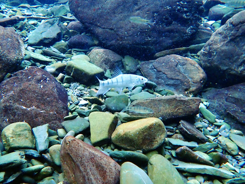
Photo: Tyler Cottenie
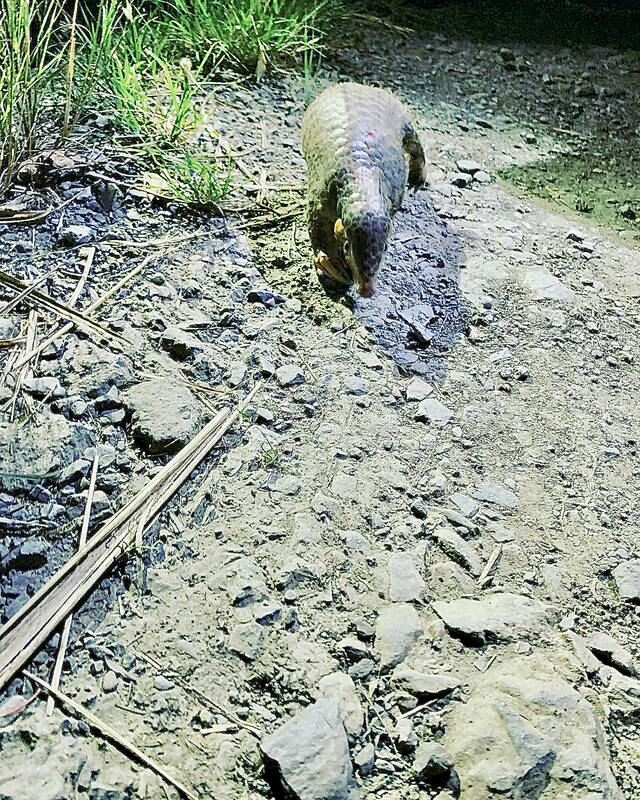
Photo courtesy of Huang Bo-nian
If one asks Taiwanese why house prices are so high or why the nation is so built up or why certain policies cannot be carried out, one common answer is that “Taiwan is too small.” This is actually true, though not in the way people think. The National Property Administration (NPA), responsible for tracking and managing the government’s real estate assets, maintains statistics on how much land the government owns. As of the end of last year, land for official use constituted 293,655 hectares, for public use 1,732,513 hectares, for non-public use 216,972 hectares and for state enterprises 34 hectares, yielding
The small platform at Duoliang Train Station in Taitung County’s Taimali Township (太麻里) served villagers from 1992 to 2006, but was eventually shut down due to lack of use. Just 10 years later, the abandoned train station had become widely known as the most beautiful station in Taiwan, and visitors were so frequent that the village had to start restricting traffic. Nowadays, Duoliang Village (多良) is known as a bit of a tourist trap, with a mandatory, albeit modest, admission fee of NT$10 giving access to a crowded lane of vendors with a mediocre view of the ocean and the trains
Traditionally, indigenous people in Taiwan’s mountains practice swidden cultivation, or “slash and burn” agriculture, a practice common in human history. According to a 2016 research article in the International Journal of Environmental Sustainability, among the Atayal people, this began with a search for suitable forested slopeland. The trees are burnt for fertilizer and the land cleared of stones. The stones and wood are then piled up to make fences, while both dead and standing trees are retained on the plot. The fences are used to grow climbing crops like squash and beans. The plot itself supports farming for three years.

For many people, Bilingual Nation 2030 begins and ends in the classroom. Since the policy was launched in 2018, the debate has centered on students, teachers and the pressure placed on schools. Yet the policy was never solely about English education. The government’s official plan also calls for bilingualization in Taiwan’s government services, laws and regulations, and living environment. The goal is to make Taiwan more inclusive and accessible to international enterprises and talent and better prepared for global economic and trade conditions. After eight years, that grand vision is due for a pulse check. RULES THAT CAN BE READ For Harper Chen (陳虹宇), an adviser