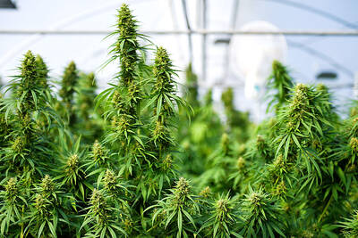
Expect a lot of rain in the next two months, the Central Weather Bureau warned yesterday as the nation's annual plum rain season approaches.
The natural weather cycle means the nation can expect heavy rainfall from mid-May through to mid-June, said Daniel Wu (吳德榮), director of the Weather Forecast Center at the bureau.
This period of time is referred to as meiyu jijie (梅雨季節), meaning "plum rain season," as it coincides with the plum season.
Rainy season
The plum rain season is the main annual rainy season in the country, as, on average, 25 percent of annual rainfall in the north comes within these two months, and "in south Taiwan, over 30 percent of [annual] rainfall comes during the plum rain season," Wu said.
"So far, we haven't seen anything that would cause dramatic change to this year's plum rain season, both rainfall and temperature forecasts fall within the average range," he said.
Within the two months, the amount of rainfall throughout the nation is expected to be between 560mm and 570mm, except in Hualien where the amount of rainfall is expected to be approximately 414mm, according to the forecast.
Temperature
Average temperatures in May will be in the low to mid-20s throughout the nation, except in the south where the average is expected to be from 26.9oC to 27.5oC.
In June, the average temperature will rise throughout the country to between 27oC to 28oC on average.
Although the plum rain season is a natural phenomenon, unexpected natural disasters could occur, Wu warned.
"Natural disasters caused by exceptionally heavy rain, thunder storms, strong winds, isolated occurrences of hail and tornadoes are possible," Wu said.

UPGRADE: The Kang Ding-class frigate is replacing its Chaparall missiles with Tien Chien II and Hua Yang VLS, which would provide it with long-range, 360° air defense Taiwan plans to produce 1,200 to 1,376 Hai Chien II missiles (海劍二, Sea Sword II) — also known as TC-2N — to serve as the standard air defense system of the navy’s surface combatant fleet, a source said yesterday. Last week, the Hai Chien II, the naval version of the Tien Kung II missile (天劍二, Sky Sword II), completed a live-fire test in waters off the National Chungshan Institute of Science and Technology’s Jiupeng facility (九鵬) in Pingtung County’s Manjhou Township (滿州). The MIM72 Chaparral and other dated air defense missiles that currently arm Taiwanese ships have inadequate range to combat Chinese
REASONS FOR TRAVEL: An assistant professor said that proposed amendments to penalize drivers if they used drugs overseas would not deter people from traveling People who operate a motor vehicle under the influence of marijuana would have their driver’s license revoked, even if they used the substance while overseas, the Ministry of Transportation and Communications said yesterday, citing proposed amendments to the Road Traffic Management and Penalty Act (道路交通管理處罰條例). The amendments would also authorize the government to revoke the licenses of people determined to have used Category 1 or Category 2 narcotics, even if they were not operating a vehicle while under the influence of drugs, as well as ban them from taking the license test for three years, the ministry said. People aged 18 or
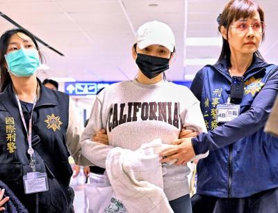
Johanne Liou (劉喬安), a Taiwanese woman who shot to unwanted fame during the Sunflower movement protests in 2014, returned to Taiwan last night after being deported from the US. She is to stand trial in Taiwan for charges involving embezzlement, fraud and drug crimes. The Criminal Investigation Bureau (CIB) said it took her into custody at Taiwan Taoyuan International Airport and would first question her before transferring her to the New Taipei District Prosecutors’ Office. She was arrested upon disembarking a flight from San Francisco that landed shortly before 7pm. Liou absconded to the US in 2019 after jumping bail
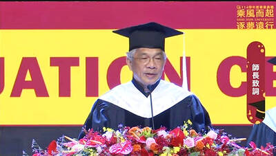
Shih Hsin University President Chen Ching-he (陳清河) yesterday issued a public apology for comments made in his commencement speech last week, stating that he has asked the school to suspend his duties and halt his wages for two months as a show of contrition. At the commencement ceremony on May 30, Chen said, “If you don’t manage your time well, or your own emotions, or your health, then I am telling every one of you — put a quick end to ‘you,’ because the world has no need for ‘you.’” The comments have sparked significant controversy online, and Chen through an open