The scenic Southern Cross-Island Highway (
Since the highway zigzags through a wide area of the Yushan National Park (
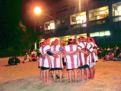
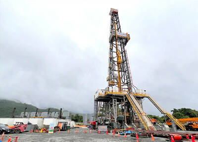
PHOTO: DEREK LEE, TAIPEI TIMES
Highway No. 20 was completed in 1973 but was opened to the public in 1993, because of the dangers inherent in its treacherous terrain and the frequent landslides.
The highway rises from a few hundred meters above sea-level at Tainan to 2,731m at Yakou (土
More importantly, this spectacular route, stretching 209km from Tainan to Taitung, passes by the southwest entrance of the Yushan National Park, at the route's 109.5km mark and extends to the 147km mark, at the west end of Yakou Tunnel. The terrain of the park rises from Lakulaku Stream Valley (
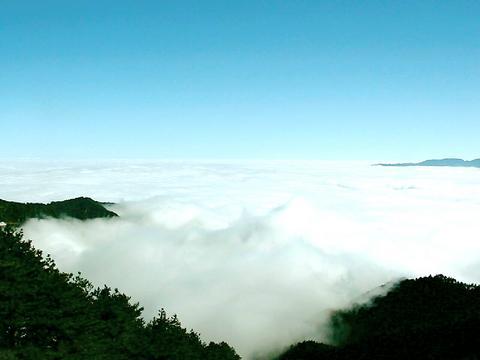
Such a topographically varied territory with a mild temperature gives birth to dramatic natural scenery: steep river valleys, breathtaking gorges and giant Taiwan red cypress or Morrison spruce forests.
The area's temperature is generally cool, though there is great variation between day and night and between seasons. Temperatures go as high as 30?C in the summer and drop below-zero in the winter. Best of all, snow is rarely seen on the route, mainly due to a lack of moisture in the air.
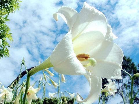
From January to March, as soon as spring touches the ground, the area is decorated with numerous flowers such as Taiwan cherries, azaleas and plum blossoms. The Taiwan lily, Formosan raspberry and glandular rosa (
Since different animals live in different floral zones, the rich variety of vegetation in Yushan National Park breeds a wide range of fauna, such as Formosan macaque, wild boar, black bear and numerous bird species, both endemic and migratory.
Across these vast mountains and green valleys, a ferociously brave tribe, whose members proclaim themselves "the sons of Yushan," has resided for many centuries.
The present-day Bunun tribe (
The Bunun are an internationally renowned group of people who are blessed with an amazing talent of choral singing. Every year, between the months of April and July, the Bunun tribesmen hold two traditional festivals.

PHOTO COURTESY OF CHEN JUNG-LUNG
At the height of each ceremony, a team of eight or more adult men (no women are allowed) form a small, close circle and sing praise songs such as Pasi But But (Praying for a Rich Millet Harvest, 祈禱小米豐收歌) or Manandi, (Chief Ritual Song, 首祭之歌) to worship their gods in eight vocal parts (a choir normally sings four vocal parts in the West).
According to Wu Rung-shun (
The Bunun tribe's natural singing talent has been passed on to descendents such as Biung (
Due to an absence of snow and severe weather, the area is often crowded in winterwith people who visit to climb nearby mountains, hike trails or ride cross-country bikes.
The "three-stars (mountains) of the Southern Crossing" (
Hikers who have planned well may make their trip to and from the mountains in a day if they start their journey from Yakou. A nearby lodge (土
On the road: Provincial Highway No. 20
1. Yujing (
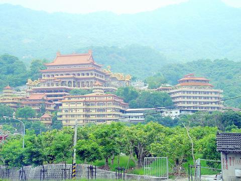
2. Yushan Baoguang Sacred Temple (
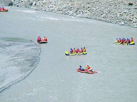
3. Baolai (寶來). Excited about riding rapids? White water rafting is available in this tiny mountain village, a 21km drive from Jiasian, from May to October. It's generally a 13km, eight to 10-person raft ride, on the Launong Stream (荖濃溪) and takes about two hours to complete. The cost is around NT$700 to NT$800 per person, above the age of 12. After all this excitement and long-distance driving, you might be ready to take a dip and relax in one of the village's hot springs. This amazing village is home to many hot spring hotels. Fun Chen Sawuna Resort Hotel (芳晨溫泉渡假村), located at the street end of Boalai village, is an ideal place to spend a night.
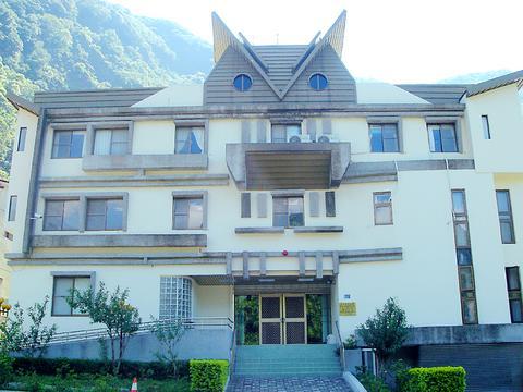
4. Meishan Youth Activity Center (梅山青年活動中心) is another 30km eastward from Baolai and is a modern building constructed by the Chinese Youth Corps, just like Yakou Lodge. It is a quiet, exclusive lodge for those who choose to be close to nature. Both the Meishan Visitor Center and Bunun Culture Exhibition Center are nearby. The Meishan Police Squad office next to them by the roadside looks like an owl, an auspicious animal in the Bunun tribe's customs. It has won a lot of praise from visitors for showing the Bunun people's sense of humor.
5. Jhongjhihguan (
6. Tianchih is an important landmark on the highway and is named after the lake in the high mountains. The lake, a few kilometers away from Jhongjhihguan, is 2,200m above sea level.
7. Kuaiku (
8. Daguanshan Tunnel (
For Sinying (
From the Tainan area, take National Highway No. 8 to Sinhua (新化) and connect to Provincial Highway No. 20 at Tsochen (左鎮).
From the Kaohsiung area, take National Highway No. 10 to Cishan (

If a leisurely afternoon of high-end dining and watching the scenery roll by from the comfort of a plush armchair sounds like a good time to you, consider a trip on the Sea Breeze (海風號). This culinary, cultural and scenic experience is the perfect setting for a date, a celebratory outing with a small group of friends or a relaxing solo ride. The price tag is steep, especially if you consider the short distance the train actually covers over the 3.5-hour journey. But what you’re paying for on the Sea Breeze isn’t transportation; it’s the comfort, the service, the exclusivity, the

June 15 to June 21 According to legend, a giant from Orchid Island (Lanyu, 蘭嶼) named Si Mangangavang once built a large tatala canoe capable of carrying 16 people. He set sail southward to the Batanes in the Philippines, where he traded with the local Ivatan people. One of the goods they coveted was cowhide, which the Tao people of Orchid Island used to make armor. Through continued trade, the Tao and Ivatan forged close ties, and Si Mangangavang became good friends with a Batanes giant named Si Vakag. This story, collected in a 1998 book by ethnologist Yu Guang-hong (余光弘)
Taiwan’s renewable shortfall is a problem of execution, not resources. Japan’s long-cycle, joined-up energy planning is the model worth studying — but what Taiwan can borrow is the institutional machinery, not the politics. When Nvidia CEO Jensen Huang (黃仁勳) used his visit to Taipei last month to warn that the country needs far more electricity, he was naming a constraint its own planners already know well: Taiwan Power Co (Taipower, 台電) expects demand from the semiconductor and artificial intelligence (AI) sector alone to exceed 5 gigawatts (GW) by 2030. The harder question is not whether to build more capacity but which

One of the wildest things about the reception of Chinese Nationalist Party (KMT) Chair Cheng Li-wun (鄭麗文) in the international media is the way her words are presented without being contextualized, let alone challenged. The Financial Times, for example, interviewing her during her visit to New York, said that she blamed the halt to exchanges between Taiwan and the People’s Republic of China (PRC) for raising tensions. “There has been no dialogue, so you can see that the situation is almost on the brink of war,” the Financial Times quoted her as saying, without any hint that the PRC, not