Every now and then, even hardcore hikers like to sleep in, leave the heavy gear at home and just enjoy a relaxed half-day stroll in the mountains: no cold, no steep uphills, no pressure to walk a certain distance in a day. In the winter, the mild climate and lower elevations of the forests in Taiwan’s far south offer a number of easy escapes like this.
A prime example is the river above Mudan Reservoir (牡丹水庫): with shallow water, gentle current, abundant wildlife and a complete lack of tourists, this walk is accessible to nearly everyone but still feels quite remote. On a sunny November day, the author and two friends set out after a leisurely breakfast for our half-day exploration of the Rureng River (汝仍溪), the main tributary to Taiwan’s southernmost reservoir.
After turning left at Checheng (車程) onto County Route 199, passing through the hot spring town of Sihchongsi (四重溪), and arriving at Shihmen Village (石門村), we took the next left after the junior high school to access the concrete road running along the west side of the reservoir. Be careful when driving here, as the road isn’t very wide and large dump trucks and other construction vehicles appear frequently when reservoir maintenance is underway. That being said, take time to appreciate the views of the reservoir on your right side.
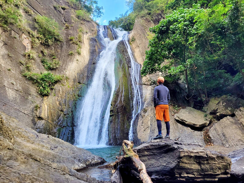
Photo: Tyler Cottenie
After crossing the northern tip of the reservoir on a bridge, the road ended about one kilometer ahead at a large clearing with two covered shrines. We parked the car here and set out on foot around noon. Scooters could have gone another 200 meters, but the parking was better in the large clearing.
STARTING UPRIVER
Our agenda for the day was to simply walk upstream for a couple of hours to see what it looked like, and then walk back to the car. We had also heard there was a waterfall along one of the branch streams that we would try to locate. Entering with low expectations, we were pleasantly surprised by what we encountered that afternoon.
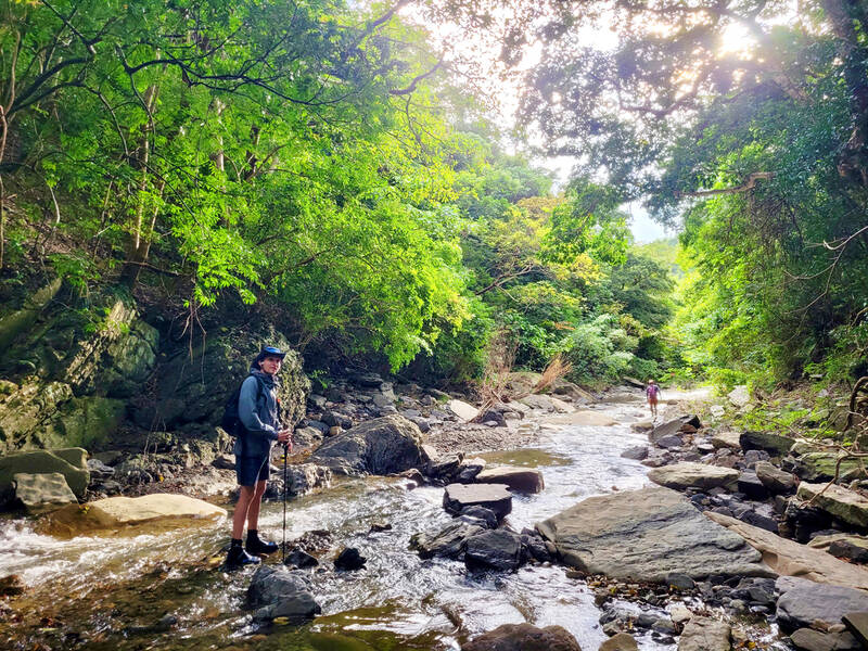
Photo: Tyler Cottenie
Just around the corner was the final (most upstream) check dam for the reservoir, recently reinforced. A small waterfall poured off the bottom level, above which were some inviting, clear pools. The rough road we were walking on went directly to the riverbed above the dam, however, so we continued walking upstream.
The riverbed here is wide and flat, and the water only calf-deep. If you visit, wear river tracing shoes or sandals with good grip, as walking in the water is unavoidable. It’s also always a good idea to wear a helmet when walking along rivers in case you slip on wet rocks. You should never have to walk in water deeper than your knees, so if you wear shorts, a change of clothes shouldn’t be necessary.
After a 180-degree bend in the river to the left, and another to the right, the river makes a 90-degree turn to the left (north). After this turn, on the right-hand side, we noticed what looked like a trail leading up to a flat area above the river. We hiked up and, to our surprise, came across a banana plantation that seemed like it was still occasionally visited and maintained.
Photo: Tyler Cottenie
Following an obvious path, we then came across a tidy concrete platform with three buildings on it: one storage shed, one bathroom, and one house, or at least that’s what our best guess was. Firewood was stacked neatly against one building, and water was flowing out of a pipe onto the ground next to the bathroom. Clearly, this was a regularly used retreat for a local hunter or farmer.
A MAJESTIC SIDE STREAM
Beyond the house, we made our own way through the forest and back down to the river on the other side. The river soon turned 180 degrees again, from south to north. At the next bend in the river, we came upon a deep turquoise pool just below a set of rapids. As with the other deep pools along this river, it could be easily circumvented by taking the high ground along the shore on one side or the other.
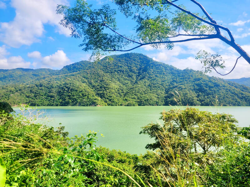
Photo: Tyler Cottenie
However, having walked for an hour already under the warm sun, the water was simply too enticing. Off went the packs, on went the swimsuits (the only change of clothes I do recommend bringing for this hike), and in went the three of us. The source of the Rureng River is only around 700 meters high, so even in the dead of winter the water is not very cold. Floating in cool blue water, under a warm blue sky, surrounded by pristine mountain wilderness on all sides, we all agreed we had made the right choice in choosing this relaxing Sunday walk.
After drying off, we still had time to continue exploring, so we proceeded upstream in search of the waterfall we had heard about. Less than 10 minutes later, we turned left up an obvious side stream that appeared to show a waterfall in satellite imagery. With very little water or vegetation in this streambed, the walking was easy, and in about 15 minutes, we turned a corner and a gorgeous waterfall appeared before our eyes.
Below the main waterfall was a lower tier about 8 feet high that was impossible to ascend, but after scouting in the forest on the left side, we did find a very precarious route up and over the ledge to the base of the waterfall’s main tier. This is the only part of the hike that is not beginner-friendly and is not advised for those without a lot of experience scrambling in loose soil. The view from the lower level is already quite good and still worth the walk in.
WRAPPING UP
Our time had run out for the day, so we turned around and headed back toward the reservoir. Four and a half hours after setting out, we were back at the car. The drive out was a picture-perfect end to the day, with the mountain behind the reservoir lit up in golden hues that only appear in the day’s final hour of sunlight. There was surely more to explore further upstream, but that could wait. For a casual half-day hike, it couldn’t get any better than this.
If you go, it’s best to drive your own car as we did, or ride a scooter. Public transit would be challenging, though not impossible, as Bus 302 from Checheng to Shihmen only runs three times a day, and the concrete road around the reservoir adds 6 km of walking each way. Always check the weather forecast and avoid the river altogether if rain is forecast, as sudden rises in water can be lethal.
The “reng” in “Rureng” looks quite a lot like a character pronounced as “nai” (仍 vs 乃), so the river is occasionally known as “Runai River.” This confusion extends to the highest peak in its catchment area, known as both “Nyureng” and “Nyunai” Mountain. To make matters more confusing, the first syllables in the river name and mountain name are also visually similar (汝 vs 女). When applying for the mountain entry permit for this hike at https://nv2.npa.gov.tw/NM107-604ClientE (English), choose Runai River as your destination if you apply in English or Rureng River (汝乃溪) if you apply in Chinese.

Ajay Verma, a consultant gastroenterologist at Kettering general hospital in Northamptonshire, says our gut is a “complex machine.” “It is constantly providing us with the nutrition we need, initially to grow and develop, and then for us to survive, thrive and repair from injury and illness.” How can we keep it functioning well? Put simply: “Make sure what you put into it is balanced, and that you clear out its waste products adequately,” Verma says. “In a general gastroenterology clinic, the most common conditions we see are irritable bowel syndrome (IBS), gastroesophageal reflux disease, inflammatory bowel disease and constipation,” says Nisha
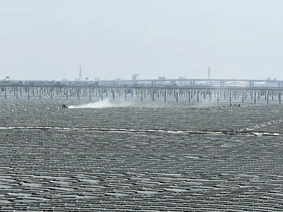
The arithmetic is straightforward and uncomfortable. By the end of 2025, Taiwan had committed itself to a 50-30-20 electricity mix — half natural gas, 30 per cent coal, 20 per cent renewables. The Ministry of Economic Affairs’s (MOEA) own monthly energy reports tell a different story. Natural gas reached 47.8 per cent of generation last year. Coal stood at 35.4 per cent, comfortably above its target ceiling. Renewables came in at 13.1 per cent, well short of the 20 per cent Taipei had pledged a decade earlier. Installed renewable capacity reached roughly half of the 12 gigawatts (GW) the government

Last week US President Donald Trump was asked by a reporter whether he would speak on the phone to the President of Taiwan. “l’ll speak to him. I speak to everybody. We have that situation very well in hand,” Trump said. This marked the second time in a couple of weeks he had said he would talk to the President of Taiwan. In 2016 he famously took a call from then-president Tsai Ing-wen (蔡英文), when he was president-elect. Despite warnings that the apocalypse was nigh because of a phone call, the world quickly forgot about the conversation between two democratically-elected presidents.
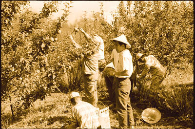
May 25 to May 31 Few believed that apples could be cultivated on a commercial scale in Taiwan’s high mountains. When horticulturalist Cheng Chao-hsiung (程兆熊) first proposed the idea in 1955, both American and Taiwanese colleagues dismissed it as implausible, arguing that temperate fruit could not be reliably grown on a subtropical island, especially on rugged terrain. However, it was this terrain in the Central Mountain Range where many Chinese Civil War veterans were resettled in the late 1950s. With limited job prospects and no family in Taiwan, they were placed on cooperative farms aimed toward self-sufficiency. Some say the conditions