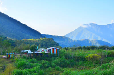
On those rare days in Kaohsiung when the air is crisp and clear, the eastern horizon is dominated by a green wall that towers high above the Pingtung plains. This is the ridge running from Wutou Mountain (霧頭山), up to Beidawu Mountain (北大武山) at 3,092 meters. Many make the trek up to Beidawu, but very few walk the top of this wall over to Wutou, and for good reason: it is an unmarked, overgrown death trap with no reliable water and steep slopes full of rotten wood and crumbly rock.
Last week, news emerged that a French couple called for rescue in Pingtung County after getting lost while attempting to walk this very ridge. By some miracle, these tourists had somehow been able to find enough information about it to deem it worthy of hiking, and by an even greater miracle were eventually found and rescued by helicopter.
Three years ago, I completed this hike with two Taiwanese friends and to this day it remains the most difficult one I have ever done. I cannot help but discourage anyone from attempting this route. Though there were some truly breathtaking views along the way, it was overall a harrowing and demoralizing experience I don’t need to repeat.
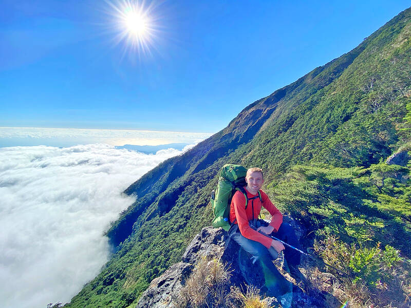
Photo courtesy of Wei-chun Chiu
A TOUGH START
On New Year’s Day, 2021, I set out with two friends, Jeffrey and Wei-chun, on the Beidawu Mountain Trail. The first day was relatively straightforward, as we made our way up the well-maintained trail alongside a crowd of other hikers. Even on this day, however, our task was harder than theirs. As the Wandao Traverse (彎刀縱走) is a dry trail, we had to carry an extra three days’ worth of water on our backs.
We passed the peak of Beidawu early the next morning and began our journey into the unknown. The Wandao Traverse translates to “Machete Traverse,” apparently due to the shape it traces out on a map, though I now wonder if it’s not because the entire route could use a lot of hacking with a machete. We were immediately pushing through three-meter high bamboo to get to a small rocky outcrop ahead, Three-Tower Peak (三塔峰).
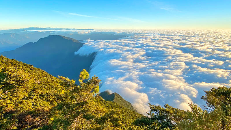
Photo courtesy of Wei-chun Chiu
Upon reaching the peak, we were treated to a perfect sea of clouds on the Taitung side pouring right over the ridge and vanishing in the drier Pingtung air — a phenomenon known as a “cloud waterfall.” A beautiful sight indeed, but at 9:30am this was already the high point of the day. I took no more pictures for the entire rest of the day as we were too busy trying not to get lost or die.
TRYING NOT TO GET LOST OR DIE
The mountain becomes very steep on the north and east sides here. We had a GPX track to work with, but even so, we struggled to find a way down. Wei-chun went ahead, exploring the slope in front of us that got steeper and steeper until he was actually climbing down from tree to tree. He got stuck at one point, and we had to go down and pull his backpack up first in order for him to be able to get back up. We diverted course slightly and managed to crawl down the slope to where it leveled out below.
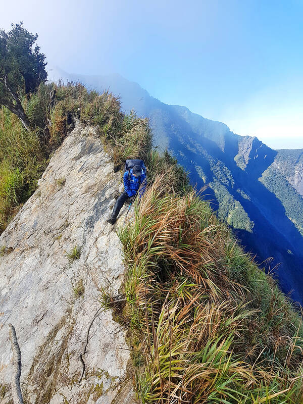
Photo: Tyler Cottenie
Later in the afternoon, the cloud waterfall phenomenon returned, but being inside it was not nearly as beautiful as seeing it from above. A cold wind howled and the foggy mist soaked us. Progress was so much slower than anticipated that we had still not reached our camp when darkness set in. We encountered a giant boulder on the ridge with an impassable steep drop on the left and right, while going across the slanted rock itself was unsafe as we might slide right off into the abyss. After finding a way around this obstacle in the dark, we were still cold, wet and frustrated but only 200 meters from camp.
That 200 meters ended up taking another hour. One final hill stood in the way and as we pushed blindly through the bamboo, we kept running into cliffs. When we finally found a way over, the campsite we were expecting did not exist. Jeffrey hacked down some grass with his machete until there was enough space for Wei-chun’s two-person tent (which sleeps one person comfortably) and the three of us all squeezed in for the night. As we lay in this cramped space dreading the trail and the weather outside, I’m sure I wasn’t the only one wondering just what had possessed us to attempt this trail in the first place.
The weather was favorable the following morning but the trail certainly was not. The day consisted of slowly moving forward along the ridge — which tapered to a knife edge of rock at some points — trying to follow a trail that simply did not exist. When the way forward was impassable, we had to climb down to the left or right on precarious holds looking for a workable detour. Thick, tall grass pushed backed against us and blocked our view of the precarious footholds. The protective glasses I was wearing kept fogging up but I didn’t dare take them off as I was continually whipped and scratched in the face.
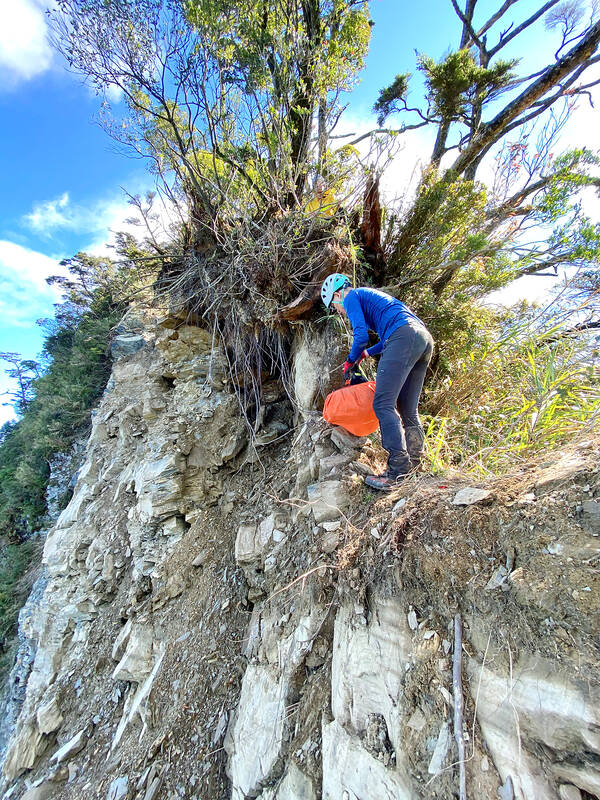
Photo courtesy of Wei-chun Chiu
SHOULD WE CALL A HELICOPTER?
The campsite that evening was large and comfortable, and a quick easy hike the next morning brought us to the peak of Wutou Mountain, what should have been the climax of the trip. I was now back on familiar territory, as I had been here from the other side a few years earlier, and the entire descent back to the trailhead from here had been an easy eight-hour walk. I reassured Wei-chun and Jeffrey that there was nothing to worry about anymore.
I led the way down feeling quite confident, until the trail suddenly disappeared in front of me. At some point in the intervening years, the original trail had fallen a thousand meters into the valley below, and all that was left in front of me was a 10-meter-high crumbling wall. To the right was a sheer cliff, and to the left was forest so steep it would not be passable. Jeffrey set up a rope and we managed to haul the backpacks down the wall and climb down separately. Crisis averted.
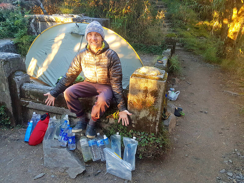
Photo: Tyler Cottenie
Not two minutes later, I found the ridge ahead broken by another new landslide. This one had no platform onto which we could climb down with a rope. We explored the forested side, trying to detour down, across, and back up, but it was simply too steep to traverse. After an hour of searching for a way forward, we were getting desperate. With our water supply now running dangerously low, no way forward in sight, no feasible way down to water and the safety of the Beidawu trail nearly three days behind us, I asked the other two if we might not have to call in for a helicopter soon. The silence I got back was answer enough.
This is when teamwork came into play. I went to take one more careful look at the broken ridge ahead and discovered a small platform off to one side. I still saw no way forward as the ridge was obstructed by a slanted boulder. Jeffrey then set up his rope and Wei-chun — more daring than either me or Jeffrey — held onto this as he ran across the sloped rock, using his momentum to keep from sliding downward. With a rope in place, Jeffrey and I were then able to cross. We celebrated on the other side with an adrenaline-fueled cheer before collapsing to the forest floor in stunned silence to reflect on our life choices.
We managed to complete the remainder of the still-treacherous descent without incident, finally reaching the trailhead at Wutai Township’s Ali Village in the dark, 12 hours after starting down from Wutou Mountain. As we examined our battered and destroyed gear — and bodies — while waiting for our ride, we discussed our adventure and all agreed that we would not be coming back here any time soon.
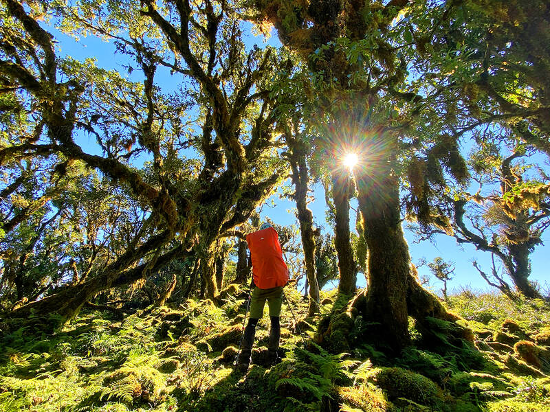
Photo courtesy of Wei-chun Chiu
Photo: Tyler Cottenie
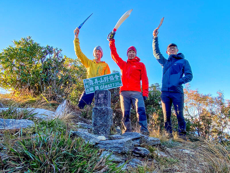
Photo courtesy of Wei-chun Chiu
If one asks Taiwanese why house prices are so high or why the nation is so built up or why certain policies cannot be carried out, one common answer is that “Taiwan is too small.” This is actually true, though not in the way people think. The National Property Administration (NPA), responsible for tracking and managing the government’s real estate assets, maintains statistics on how much land the government owns. As of the end of last year, land for official use constituted 293,655 hectares, for public use 1,732,513 hectares, for non-public use 216,972 hectares and for state enterprises 34 hectares, yielding
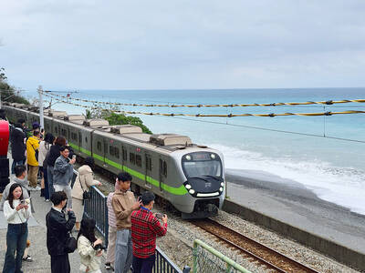
The small platform at Duoliang Train Station in Taitung County’s Taimali Township (太麻里) served villagers from 1992 to 2006, but was eventually shut down due to lack of use. Just 10 years later, the abandoned train station had become widely known as the most beautiful station in Taiwan, and visitors were so frequent that the village had to start restricting traffic. Nowadays, Duoliang Village (多良) is known as a bit of a tourist trap, with a mandatory, albeit modest, admission fee of NT$10 giving access to a crowded lane of vendors with a mediocre view of the ocean and the trains

For many people, Bilingual Nation 2030 begins and ends in the classroom. Since the policy was launched in 2018, the debate has centered on students, teachers and the pressure placed on schools. Yet the policy was never solely about English education. The government’s official plan also calls for bilingualization in Taiwan’s government services, laws and regulations, and living environment. The goal is to make Taiwan more inclusive and accessible to international enterprises and talent and better prepared for global economic and trade conditions. After eight years, that grand vision is due for a pulse check. RULES THAT CAN BE READ For Harper Chen (陳虹宇), an adviser
Traditionally, indigenous people in Taiwan’s mountains practice swidden cultivation, or “slash and burn” agriculture, a practice common in human history. According to a 2016 research article in the International Journal of Environmental Sustainability, among the Atayal people, this began with a search for suitable forested slopeland. The trees are burnt for fertilizer and the land cleared of stones. The stones and wood are then piled up to make fences, while both dead and standing trees are retained on the plot. The fences are used to grow climbing crops like squash and beans. The plot itself supports farming for three years.