


The outer rain bands of Typhoon Bavi would begin affecting Taiwan today, with its storm circle reaching land this evening and its level-10 wind radius covering all of northern Taiwan by noon tomorrow, an official said yesterday.
The Central Weather Administration (CWA) issued a sea warning for the storm at 2:30pm yesterday, advising of heightened danger in eastern areas and in the Bashi Channel south of Taiwan.
Typhoon Bavi is expected to bring strong winds, extremely heavy rainfall and rough seas to Taiwan today and tomorrow, with the heaviest rain forecast for mountainous areas and sustained winds of up to 12 on the Beaufort scale in northern Taiwan and outlying islands, an official said.
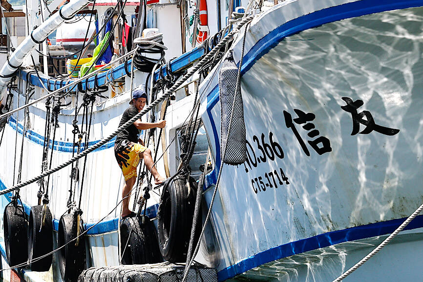
Photo: Ritchie B. Tongo, EPA
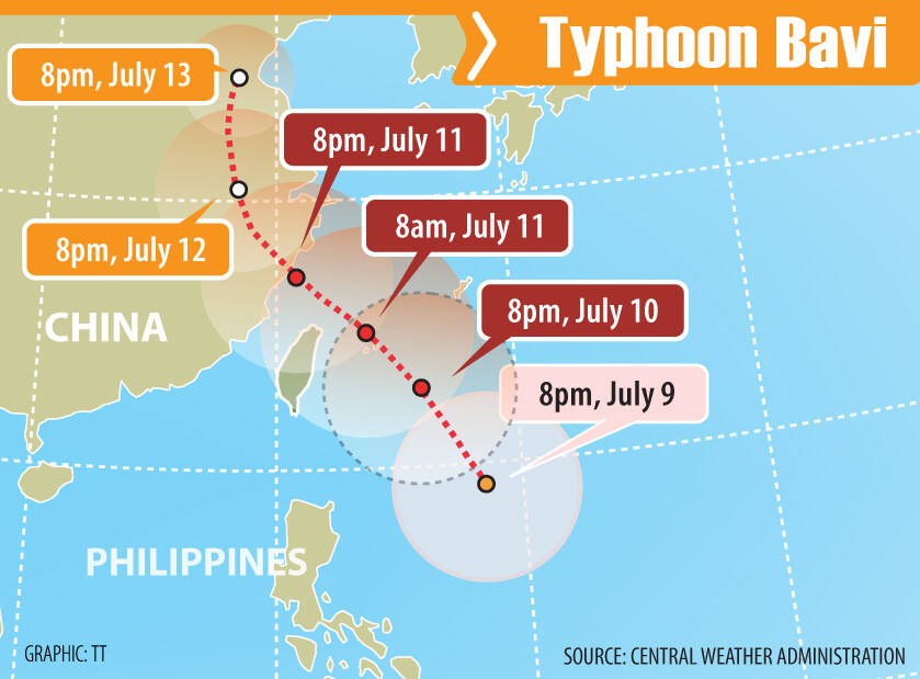
As of 2pm yesterday, Bavi was about 920km east-southeast of Taiwan with a radius of about 380km. It was moving north-northeast at 20kph, packing maximum sustained winds of 184kph, CWA data showed.
The storm’s outer bands would begin affecting Taiwan today, CWA head Lu Kuo-chen (呂國臣) told a Cabinet news conference.
Rainfall is expected to intensify today and peak tomorrow, with short-duration rain in mountainous areas reaching 600mm to 900mm, while low-lying areas could also face prolonged heavy rain capable of triggering flooding and landslides, Lu said.
He also warned of waves exceeding 6m along parts of Taiwan’s northern, western and eastern coasts tomorrow, with even higher waves possible near the typhoon’s center.
Northern Taiwan, the northeast and outlying islands could face sustained winds exceeding 12 on the Beaufort scale, with stronger gusts possible in exposed areas, he said.
Powerful winds are forecast for tomorrow, when the typhoon is expected to be closest to Taiwan, with gusts of 14 on the Beaufort scale possible in coastal parts of northern areas, Lu said.
The typhoon is expected to weaken tomorrow night, although its effects are likely to be most strongly felt in Lienchiang County (Matsu) tomorrow and on Sunday, he said.
Premier Cho Jung-tai (卓榮泰) told a Cabinet meeting that he had told government agencies and local authorities to be on high alert today and tomorrow, when the typhoon is likely to have the greatest impact on Taiwan.
The government has convened disaster preparedness meetings with all 22 local governments and postponed the university Advanced Subjects Test originally scheduled for Saturday and Sunday to Monday and Tuesday next week to ensure the safety of students and staff, Cho said.
The Ministry of National Defense has 28,922 troops on standby, while 24 helicopters, 3,355 military rescue vehicles and vessels, and 2,664 water pumps have been pre-positioned nationwide, National Fire Agency Deputy Director-General Feng Chun-yi (馮俊益) said.
Officials are closely monitoring a barrier lake in Hualien County’s Wanli River (萬里溪) basin, where heavy rainfall could trigger an overflow, Cho said.
Local authorities have been instructed to review evacuation plans, shelters and warning systems, he added.
Work and class are canceled today for Taipei, New Taipei City, Keelung, Taoyuan, Hsinchu county and city, as well as Miaoli, Hualien, Lienchiang and Yilan counties, a government notice showed.
Taichung and Nantou County suspended classes and work from 6pm today and all of tomorrow, it said.
Work and classes would proceed as normal for Yunlin, Changhua, Pingtung, Taitung and Kinmen counties, the notice said.
Additional reporting by Jake Chung
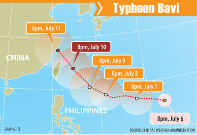
Typhoon Bavi’s center is looking more likely to pass north of Taiwan than to make landfall in the northern part of the country, the Central Weather Administration (CWA) said yesterday, adding that the storm is still too far away to forecast its exact track. As of 2pm yesterday, the center of Typhoon Bavi was about 2,560km east-southeast of Taiwan, moving west-northwest at 27kph, according to the agency. The storm, which has a radius of 350km, had sustained winds of 216kph near its center, with gusts of up to 270kph, CWA data showed. Bavi is expected to pass closest to Taiwan on Friday or

BAVI: Taipei, New Taipei City, Taoyuan and others announced work and class closures today, with the storm expected to affect Taiwan through tomorrow The outer rain bands of Typhoon Bavi would begin affecting Taiwan today, with its storm circle reaching land this evening and its level-10 wind radius covering all of northern Taiwan by noon tomorrow, an official said yesterday. The Central Weather Administration (CWA) issued a sea warning for the storm at 2:30pm yesterday, advising of heightened danger in eastern areas and in the Bashi Channel south of Taiwan. Typhoon Bavi is expected to bring strong winds, extremely heavy rainfall and rough seas to Taiwan today and tomorrow, with the heaviest rain forecast for mountainous areas and sustained winds of up to 12 on
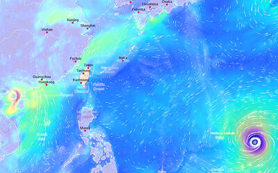
Typhoon Bavi is forecast to start having a major effect on the weather in Taiwan on Thursday and its outer bands could bring rain and lower temperatures across the country, the Central Weather Administration (CWA) said yesterday. The storm is still far from Taiwan, and its path is not certain, the CWA said, adding that it did not rule out issuing a sea or land warning. As of 2pm yesterday, the typhoon was about 3,360km east-southeast of Oluanpi (鵝鑾鼻), Taiwan’s southernmost tip, and was moving west to west-northwest at 13kph. It was packing maximum sustained winds of up to 191kph near its center,

A 33-year-old Chinese man was arrested yesterday at Taichung International Airport after he allegedly assaulted a Japanese media personality following his speech on cross-strait relations in a hotel in Taichung’s Situn District (西屯). After giving a speech in Taichung yesterday morning, Akio Yaita, was attacked by a man wearing black inside a hotel lobby, who police identified as a Chinese man surnamed Liao (廖). Yaita, formerly the Sankei Shimbun Taipei bureau chief, was invited as a keynote speaker at a conference hosted by the Spring Rain Culture and Education Foundation, where he spoke on cross-strait relations and Indo-Pacific security, according


 RSS
RSS