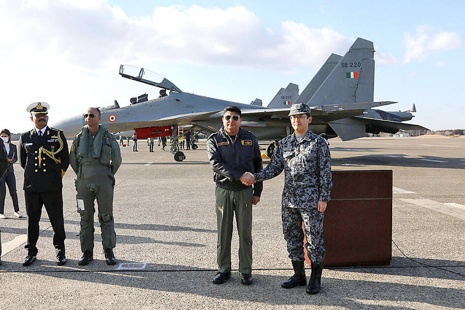
Japan and India held their first joint air drills in an area outside Tokyo as both nations step up their military exercises with other countries amid worries about China’s assertiveness.
About four F-2 and four F-15 jets were expected to take part in the drills that started yesterday and would run until Thursday next week at an airbase in Ibaraki Prefecture, northeast of Tokyo, the Japanese Ministry of Defense said.
While the two have trained together before in other nations, it is the first one-on-one training of its sort, the ministry said.

Photo: AFP
The exercise started as Japanese Prime Minister Fumio Kishida completed a trip this month to Italy, the UK, Canada and the US to bolster his nation’s alliances to help deter China.
Japan is also a member of the Quadrilateral Security Dialogue that includes India, Australia and the US, and is seen as a check on Beijing’s assertiveness in the Indo-Pacific region.
The joint drills with India grew out of a security meeting in New Delhi in November 2019, but had been put on hold due to the COVID-19 pandemic, Kyodo News reported.
Kyodo said that India’s is the fifth military Japan has hosted in this type of bilateral exercise after those of the US, Australia, the UK and Germany, citing the ministry.
India is fielding Russian-made Su-30MKI fighters and US-made C-17 Globemaster heavy lift transport aircraft in the maiden exercise, air force spokesman Wing Commander Ashish Moghe said.
The two sides would carry out complex air combat drills and exchange best practices, he said.
Tensions between India and China have been simmering along the border between the two nations since a June 2020 clash — the worst in more than 40 years.

DEFENDING DEMOCRACY: Taiwan shares the same values as those that fought in WWII, and nations must unite to halt the expansion of a new authoritarian bloc, Lai said The government yesterday held a commemoration ceremony for Victory in Europe (V-E) Day, joining the rest of the world for the first time to mark the anniversary of the end of World War II in Europe. Taiwan honoring V-E Day signifies “our growing connections with the international community,” President William Lai (賴清德) said at a reception in Taipei on the 80th anniversary of V-E Day. One of the major lessons of World War II is that “authoritarianism and aggression lead only to slaughter, tragedy and greater inequality,” Lai said. Even more importantly, the war also taught people that “those who cherish peace cannot

STEADFAST FRIEND: The bills encourage increased Taiwan-US engagement and address China’s distortion of UN Resolution 2758 to isolate Taiwan internationally The Presidential Office yesterday thanked the US House of Representatives for unanimously passing two Taiwan-related bills highlighting its solid support for Taiwan’s democracy and global participation, and for deepening bilateral relations. One of the bills, the Taiwan Assurance Implementation Act, requires the US Department of State to periodically review its guidelines for engagement with Taiwan, and report to the US Congress on the guidelines and plans to lift self-imposed limitations on US-Taiwan engagement. The other bill is the Taiwan International Solidarity Act, which clarifies that UN Resolution 2758 does not address the issue of the representation of Taiwan or its people in

Taiwanese Olympic badminton men’s doubles gold medalist Wang Chi-lin (王齊麟) and his new partner, Chiu Hsiang-chieh (邱相榤), clinched the men’s doubles title at the Yonex Taipei Open yesterday, becoming the second Taiwanese team to win a title in the tournament. Ranked 19th in the world, the Taiwanese duo defeated Kang Min-hyuk and Ki Dong-ju of South Korea 21-18, 21-15 in a pulsating 43-minute final to clinch their first doubles title after teaming up last year. Wang, the men’s doubles gold medalist at the 2020 and 2024 Olympics, partnered with Chiu in August last year after the retirement of his teammate Lee Yang

The Philippines yesterday criticized a “high-risk” maneuver by a Chinese vessel near the disputed Scarborough Shoal (Huangyan Island, 黃岩島) in a rare incident involving warships from the two navies. The Scarborough Shoal — a triangular chain of reefs and rocks in the contested South China Sea — has been a flash point between the countries since China seized it from the Philippines in 2012. Taiwan also claims the shoal. Monday’s encounter took place approximately 11.8 nautical miles (22km) southeast” of the Scarborough Shoal, the Philippine military said, during ongoing US-Philippine military exercises that Beijing has criticized as destabilizing. “The Chinese frigate BN 554 was