North and South Korea yesterday fired hundreds of artillery shells into each other’s waters in a flare-up of animosity that forced residents of five front-line South Korean islands to evacuate to shelters for several hours, South Korean officials said.
The exchange of fire into the Yellow Sea followed Pyongyang’s sudden announcement that it would conduct live-fire drills in seven areas north of the Koreas’ disputed maritime boundary.
North Korea routinely test-fires artillery and missiles into the ocean, but rarely discloses those plans in advance. The announcement was seen as an expression of Pyongyang’s frustration at making little progress in its recent push to win outside aid.
North Korea fired 500 rounds of artillery shells over more than three hours, about 100 of which fell south of the sea boundary, South Korean Ministry of National Defense spokesman Kim Min-seok said.
South Korea responded by firing 300 shells into North Korean waters, he said.
No shells from either side were fired at any land or military installations, but Kim called the North’s artillery firing a provocation aimed at testing Seoul’s security posture. There was no immediate comment from North Korea.
Yesterday’s exchange was relatively mild in the history of animosity and violence between the Koreas, but there is worry in Seoul that an increasingly dissatisfied North Korea could repeat the near-daily barrage of war rhetoric it carried out last spring, when tensions soared as Pyongyang threatened nuclear strikes on Washington and Seoul in response to condemnation of its third nuclear test.
Residents on front-line South Korean islands spent several hours in shelters during the firing, and officials temporarily halted ferry service linking the islands to the mainland.
The poorly marked western sea boundary has been the scene of several bloody naval skirmishes between the Koreas in recent years.
In March 2010, a South Korean warship sank in the area following a torpedo attack blamed on Pyongyang that left 46 sailors dead. North Korea denies responsibility for the sinking.
In November 2010, a North Korean artillery bombardment killed four South Koreans on Yeonpyeong.

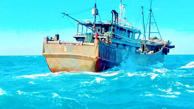
MAKING WAVES: China’s maritime militia could become a nontraditional threat in war, clogging up shipping lanes to prevent US or Japanese intervention, a report said About 1,900 Chinese ships flying flags of convenience and fishing vessels that participated in China’s military exercises around Taiwan last month and in January last year have been listed for monitoring, Coast Guard Administration (CGA) Deputy Director-General Hsieh Ching-chin (謝慶欽) said yesterday. Following amendments to the Commercial Port Act (商港法) and the Law of Ships (船舶法) last month, the CGA can designate possible berthing areas or deny ports of call for vessels suspected of loitering around areas where undersea cables can be accessed, Oceans Affairs Council Minister Kuan Bi-ling (管碧玲) said. The list of suspected ships, originally 300, had risen to about

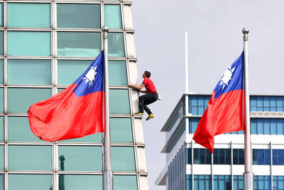
DAREDEVIL: Honnold said it had always been a dream of his to climb Taipei 101, while a Netflix producer said the skyscraper was ‘a real icon of this country’ US climber Alex Honnold yesterday took on Taiwan’s tallest building, becoming the first person to scale Taipei 101 without a rope, harness or safety net. Hundreds of spectators gathered at the base of the 101-story skyscraper to watch Honnold, 40, embark on his daredevil feat, which was also broadcast live on Netflix. Dressed in a red T-shirt and yellow custom-made climbing shoes, Honnold swiftly moved up the southeast face of the glass and steel building. At one point, he stepped onto a platform midway up to wave down at fans and onlookers who were taking photos. People watching from inside

Japan’s strategic alliance with the US would collapse if Tokyo were to turn away from a conflict in Taiwan, Japanese Prime Minister Sanae Takaichi said yesterday, but distanced herself from previous comments that suggested a possible military response in such an event. Takaichi expressed her latest views on a nationally broadcast TV program late on Monday, where an opposition party leader criticized her for igniting tensions with China with the earlier remarks. Ties between Japan and China have sunk to the worst level in years after Takaichi said in November that a hypothetical Chinese attack on Taiwan could bring about a Japanese

The WHO ignored early COVID-19 warnings from Taiwan, US Deputy Secretary of Health and Human Services Jim O’Neill said on Friday, as part of justification for Washington withdrawing from the global health body. US Secretary of State Marco Rubio on Thursday said that the US was pulling out of the UN agency, as it failed to fulfill its responsibilities during the COVID-19 pandemic. The WHO “ignored early COVID warnings from Taiwan in 2019 by pretending Taiwan did not exist, O’Neill wrote on X on Friday, Taiwan time. “It ignored rigorous science and promoted lockdowns.” The US will “continue international coordination on infectious