The Mercator world map, long a fixture in classrooms globally, makes the European Union appear almost as large as Africa. In reality, Africa is more than seven times bigger. It is a distortion that has prompted a new African initiative, “Correct the Map,” calling for depictions that show Africa’s true scale.
“For centuries, this map has minimized Africa, feeding into a narrative that the continent is smaller, peripheral and less important,” said Fara Ndiaye, co-founder of Speak Up Africa, which is leading the campaign alongside another advocacy group, Africa No Filter.
Accurately translating the Earth’s sphere into a flat map always calls for compromises, requiring parts to be stretched, cut or left out, experts said.
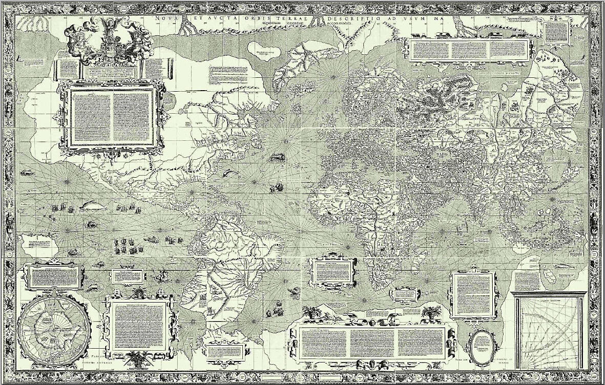
Photo courtesy of Wikimedia Commons
Historically, maps have reflected the worldview of their makers. Babylonian clay tablets from the sixth century BC placed their empire at the center of the world, while medieval European charts often focused on religious sites.
Choices must be made: a world map will look very different depending on whether Australia, Siberia or Europe is placed at its center.
Today’s most-used map was designed for maritime navigation by Flemish cartographer Gerardus Mercator in 1569. It focused on accurate depictions of the shapes and angles of land masses, but their relative sizes were often inaccurate.
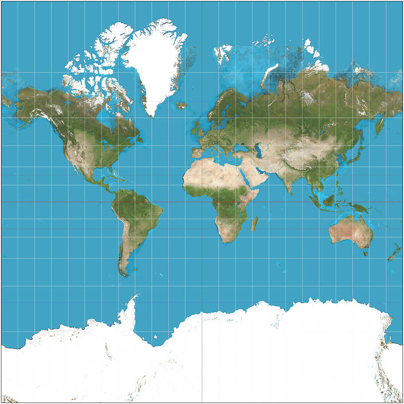
Photo courtesy of Wikimedia Commons
Mercator’s projection inflated northern regions and compressed equatorial ones, making Europe and North America appear much larger, while shrinking Africa and South America.
The distortions are stark: a 100-square-kilometer patch around Oslo, Norway, looks four times larger than the same area around Nairobi, Kenya. Greenland appears as large as Africa, even though it is 14 times smaller.
STRIKING A BALANCE
Photo courtesy of Wikimedia Commons
Alternatives to the Mercator emerged in the 20th century, including one from 1921 by Oswald Winkel and another in 1963 by Arthur Robinson that reduced distortions but sacrificed precision. The 1970s Gall-Peters projection restored proportional sizes but stretched shapes.
To strike a balance between accuracy and aesthetics, cartographers Tom Patterson, Bojan Savric and Bernhard Jenny launched the Equal Earth projection in 2018. It makes Africa, Latin America, South Asia and Oceania appear vastly larger.
“Equal Earth preserves the relative surface areas of continents and, as much as possible, shows their shapes as they appear on a globe,” Savric said. This is the projection now endorsed by the African Union. Speak Up Africa says the next steps of their campaign are to push for adoption by African schools, media and publishers.
“We are also engaging the UN and UNESCO (its cultural body), because sustainable change requires global institutions,” Ndiaye said.
’NAIVE’ CONTROVERSY
Some critics reject claims of bias.
“Any claim that Mercator is flagrantly misleading people seems naive,” said Mark Monmonier, a Syracuse University geography professor and author of How to Lie with Maps. “If you want to compare country sizes, use a bar graph or table, not a map.”
Despite its distortions, Mercator remains useful for digital platforms because its focus on accurate land shapes and angles makes “direction easy to calculate,” said Ed Parsons, a former geospatial technologist at Google.
“While a Mercator map may distort the size of features over large areas, it accurately represents small features which is by far the most common use for digital platforms,” he said.
Having accurate relative sizes, as with the Equal Earth map, can complicate navigation calculations, but technology is adapting.
“Most mapping software has supported Equal Earth since 2018,” Savric said. “The challenge is usage. People are creatures of habit.”
Some dismiss the whole thrust of the African campaign. Ghanaian policy analyst Bright Simons says the continent needs more than a larger size on maps to “earn global respect.”
“South Korea, no matter how Mercator renders it, has almost the same GDP as all 50 African countries combined,” he said.
But advocates remain convinced of their cause. “Success will be when children everywhere open their textbooks and see Africa as it truly is: vast, central and indispensable,” Ndiaye said.
Ajay Verma, a consultant gastroenterologist at Kettering general hospital in Northamptonshire, says our gut is a “complex machine.” “It is constantly providing us with the nutrition we need, initially to grow and develop, and then for us to survive, thrive and repair from injury and illness.” How can we keep it functioning well? Put simply: “Make sure what you put into it is balanced, and that you clear out its waste products adequately,” Verma says. “In a general gastroenterology clinic, the most common conditions we see are irritable bowel syndrome (IBS), gastroesophageal reflux disease, inflammatory bowel disease and constipation,” says Nisha
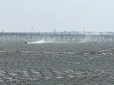
The arithmetic is straightforward and uncomfortable. By the end of 2025, Taiwan had committed itself to a 50-30-20 electricity mix — half natural gas, 30 per cent coal, 20 per cent renewables. The Ministry of Economic Affairs’s (MOEA) own monthly energy reports tell a different story. Natural gas reached 47.8 per cent of generation last year. Coal stood at 35.4 per cent, comfortably above its target ceiling. Renewables came in at 13.1 per cent, well short of the 20 per cent Taipei had pledged a decade earlier. Installed renewable capacity reached roughly half of the 12 gigawatts (GW) the government
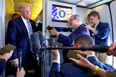
Last week US President Donald Trump was asked by a reporter whether he would speak on the phone to the President of Taiwan. “l’ll speak to him. I speak to everybody. We have that situation very well in hand,” Trump said. This marked the second time in a couple of weeks he had said he would talk to the President of Taiwan. In 2016 he famously took a call from then-president Tsai Ing-wen (蔡英文), when he was president-elect. Despite warnings that the apocalypse was nigh because of a phone call, the world quickly forgot about the conversation between two democratically-elected presidents.
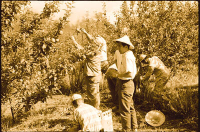
May 25 to May 31 Few believed that apples could be cultivated on a commercial scale in Taiwan’s high mountains. When horticulturalist Cheng Chao-hsiung (程兆熊) first proposed the idea in 1955, both American and Taiwanese colleagues dismissed it as implausible, arguing that temperate fruit could not be reliably grown on a subtropical island, especially on rugged terrain. However, it was this terrain in the Central Mountain Range where many Chinese Civil War veterans were resettled in the late 1950s. With limited job prospects and no family in Taiwan, they were placed on cooperative farms aimed toward self-sufficiency. Some say the conditions