In the mess hall of a Canadian military base a few hundred kilometers south of the Arctic Circle, Brigadier-General Daniel Riviere pointed to a map highlighting the region that is becoming a national priority.
“All eyes are on the Arctic today,” said Riviere, who heads the Canadian Armed Forces Joint Task Force North.
Thawing ice caused by climate change is opening up the Arctic and creating access to oil and gas resources, in addition to minerals and fish. That has created a new strategic reality for Canada, as nations with Arctic borders like the US and Russia intensify their focus on the region.
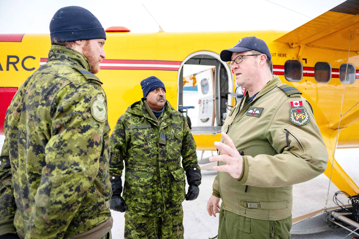
Photo: AFP
China, which is not an Arctic power, sees the area as “a new crossroads of the world,” the US warned in the final weeks of president Joe Biden’s administration. Ottawa has responded by announcing plans to reinforce its military and diplomatic presence in the Arctic, part of a broader effort to assert its sovereignty in a region that accounts for 40 percent of Canadian territory and 75 percent of its coastline.
Canada needs to act now because “the Northwest Passage will become a main artery of trade,” Riviere said, referring to the Arctic connection between the Atlantic and Pacific oceans.
Plans to bolster Canada’s Arctic presence include deploying new patrol ships, destroyers, icebreakers and submarines capable of operating under the ice cap, in addition to more planes and drones to monitor and defend territory.
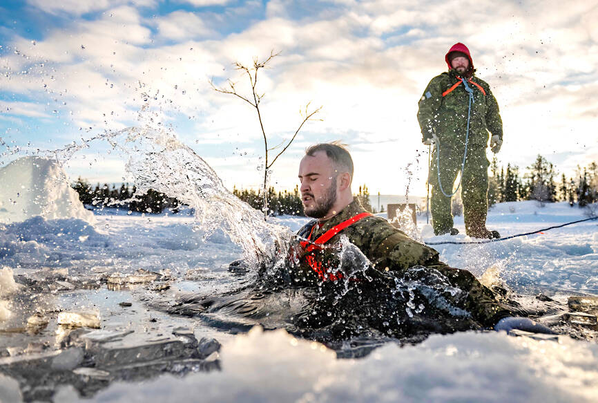
Photo: AFP
‘ASSERT SOVEREIGNTY’
At the Joint Task Force North’s headquarters in Yellowknife, the capital of Canada’s Northwest Territories, huge hangars house planes capable of landing on frozen lakes.
There is equipment designed to filter salt water from ice floes, and tents made for temperatures of -50 degrees Celsius.
Moving military resources around the area is complex work that is carried out by Twin Otters, a strategic transport aircraft that can operate in rugged environments.
On the tarmac after a flight over vast expanses of snow, forests and frozen lakes, Major Marlon Mongeon, who pilots one of the aircrafts, said that part of the military’s job is “to assert sovereignty of our borders and land.”
Canada has only a handful of northern military bases. To monitor the north, it relies on Canadian Rangers, reservists stationed in remote areas throughout the Arctic, many of whom are from the country’s Indigenous communities.
They’re known as “the eyes and ears of the north,” and some say their numbers need boosting in order to meet Canada’s evolving challenges. The Rangers monitor more than 4 million square kilometers, relying on their traditional knowledge of survival in this inhospitable area combined with modern military techniques.
They have been patrolling the country’s farthest regions since the Cold War began in the late 1940s, when military officials realized the Arctic was a vulnerable access point.
‘MOST HOSTILE THREAT’
“Having people from the area who know the land and the hazards, especially in the barren lands up there, to help assist you to get somewhere is vital,” said Canadian Ranger Les Paulson.
Because the military can’t deploy full-time soldiers across the entire region, the Rangers offer a rapid response option in remote communities, including in the event of “a breach of sovereignty” or airplane or shipping accidents, explained Paul Skrypnyk, 40, who is also a Ranger.
Climate change has made the Northwest Passage increasingly accessible to ships for navigation during summer months. That promises to shorten voyages from Europe to Asia by one to two weeks, compared to the Suez Canal route. Increased traffic, including among cruise ships, has compelled Canada to boost its capacities in the region to respond to accidents or emergencies.
In Yellowknife, training is being stepped up to prepare for a range of significant events, including how to respond to a fall into icy waters. Among those training was Canadian Ranger Thomas Clarke.
Still soaked from his jump into a hole dug in the sea ice, Clarke said that in the Arctic, the environment remains the greatest danger. “Mother nature... is the most hostile threat,” he said. “Mother nature will try to end you, before anything else.”

Ajay Verma, a consultant gastroenterologist at Kettering general hospital in Northamptonshire, says our gut is a “complex machine.” “It is constantly providing us with the nutrition we need, initially to grow and develop, and then for us to survive, thrive and repair from injury and illness.” How can we keep it functioning well? Put simply: “Make sure what you put into it is balanced, and that you clear out its waste products adequately,” Verma says. “In a general gastroenterology clinic, the most common conditions we see are irritable bowel syndrome (IBS), gastroesophageal reflux disease, inflammatory bowel disease and constipation,” says Nisha
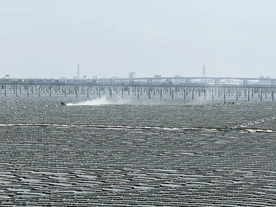
The arithmetic is straightforward and uncomfortable. By the end of 2025, Taiwan had committed itself to a 50-30-20 electricity mix — half natural gas, 30 per cent coal, 20 per cent renewables. The Ministry of Economic Affairs’s (MOEA) own monthly energy reports tell a different story. Natural gas reached 47.8 per cent of generation last year. Coal stood at 35.4 per cent, comfortably above its target ceiling. Renewables came in at 13.1 per cent, well short of the 20 per cent Taipei had pledged a decade earlier. Installed renewable capacity reached roughly half of the 12 gigawatts (GW) the government

Last week US President Donald Trump was asked by a reporter whether he would speak on the phone to the President of Taiwan. “l’ll speak to him. I speak to everybody. We have that situation very well in hand,” Trump said. This marked the second time in a couple of weeks he had said he would talk to the President of Taiwan. In 2016 he famously took a call from then-president Tsai Ing-wen (蔡英文), when he was president-elect. Despite warnings that the apocalypse was nigh because of a phone call, the world quickly forgot about the conversation between two democratically-elected presidents.
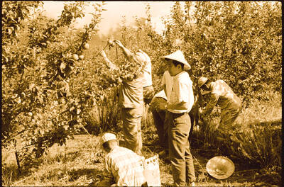
May 25 to May 31 Few believed that apples could be cultivated on a commercial scale in Taiwan’s high mountains. When horticulturalist Cheng Chao-hsiung (程兆熊) first proposed the idea in 1955, both American and Taiwanese colleagues dismissed it as implausible, arguing that temperate fruit could not be reliably grown on a subtropical island, especially on rugged terrain. However, it was this terrain in the Central Mountain Range where many Chinese Civil War veterans were resettled in the late 1950s. With limited job prospects and no family in Taiwan, they were placed on cooperative farms aimed toward self-sufficiency. Some say the conditions