Anyone who has been to Alishan (阿里山) is familiar with the railroad there: one line comes up from Chiayi City past the sacred tree site, while another line goes up to the sunrise viewing platform at Zhushan (祝山). Of course, as a center of logging operations for over 60 years, Alishan did have more rail lines in the past. Are any of these still around? Are they easily accessible? Are they worth visiting?
The answer to all three of these questions is emphatically: Yes!
One of these lines ran from Alishan all the way up to the base of Jade Mountain. Its beginning can still be walked today: from Jhaoping (沼平) Station (the original rail hub at Alishan) start downhill along the tracks and take the upper (left) rail line, which is now a publicly accessible trail that ends at the Shueishan Giant Tree.
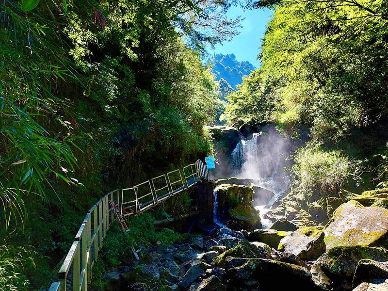
Photo: Tyler Cottenie
This was the Shueishan Main Line, and although the tracks now dead-end next to the giant tree, in the past, they continued another 200 meters through the bush to what is now Route 18, the highway that runs from Chiayi City to Alishan and up to the base of Jade Mountain. After this point on Route 18, the highway was actually built on the railbed of the old Shueishan Main Line, the remainder of which was dismantled.
Well, not quite all of it was. At the 92K mark, there appears to be a cave on the north side. This is a tunnel from the old Shueishan Main Line that the new highway was routed around without destroying. Have a look inside: railroad cars loaded with timber must have been a tight fit through here.
Further up the highway is Zihjhong (自忠). The Shueishan Main Line had been extended this far by 1931. A branch line called, somewhat confusingly, the Shueishan Branch Line, was then built southward. Fortunately, as this branch was not part of the new roadway for Route 18, the tracks were not all dismantled and can still be seen today. This line now sees throngs of tourists pouring in for a walk on the Tefuye Historic Trail (特富野古道).
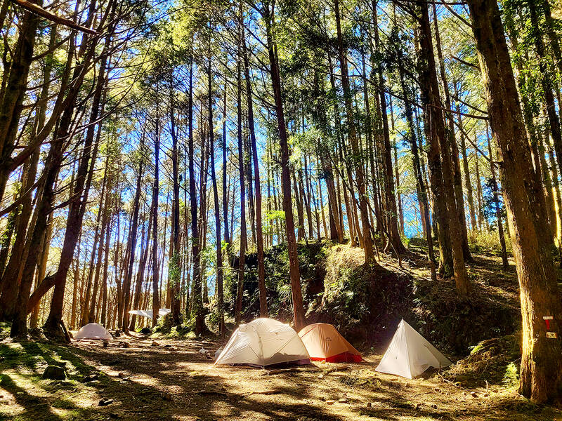
Photo: Tyler Cottenie
THE TEFUYE HISTORIC TRAIL
The trail is a hybrid, combining a steeper hiking section coming up from the Tefuye Village down below, and an easy, flat, walking trail along the old rail bed, ending at Zihjhong. Walking the entire trail is a logistical challenge, as the lower trailhead has to be accessed from a different road, over 30km away by car. For this reason, most people opt to do only the easier, upper portion of the trail, in and out from Zihjhong.
The trail is a lovely walk in just about any kind of weather. On a sunny day, the sunlight filtering down through the Japanese cedars — planted after the original forest was logged out — fills your whole field of view with soothing, golden-brown hues. On foggy days, when the tops of the trees above and the old railroad tracks ahead disappear into the mist, you walk along in a comforting white bubble, cut off from the rest of the world. Even on rainy days, a walk on this flat trail with an umbrella would still be pleasant.
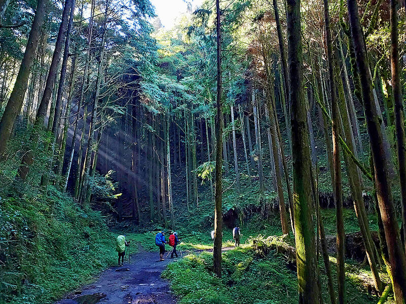
Photo: Tyler Cottenie
The tracks are preserved so well in places, it’s not hard to imagine an old steam locomotive pulling out from around the corner with its load of timber in tow. Many of the original bridges have had to be rebuilt, but the wooden supports are still faithful to the style of the original railroad.
A CRUCIAL INTERSECTION
About 2.7km past Zihjhong is a curve in the highway that most people drive by without so much as a glance. While logging operations were still active, however, this was the most important junction above Alishan. Shueishan Main Line split into three branches here, with the Tataka Branch Line continuing straight ahead where the highway now runs and the other two branching off to the south.
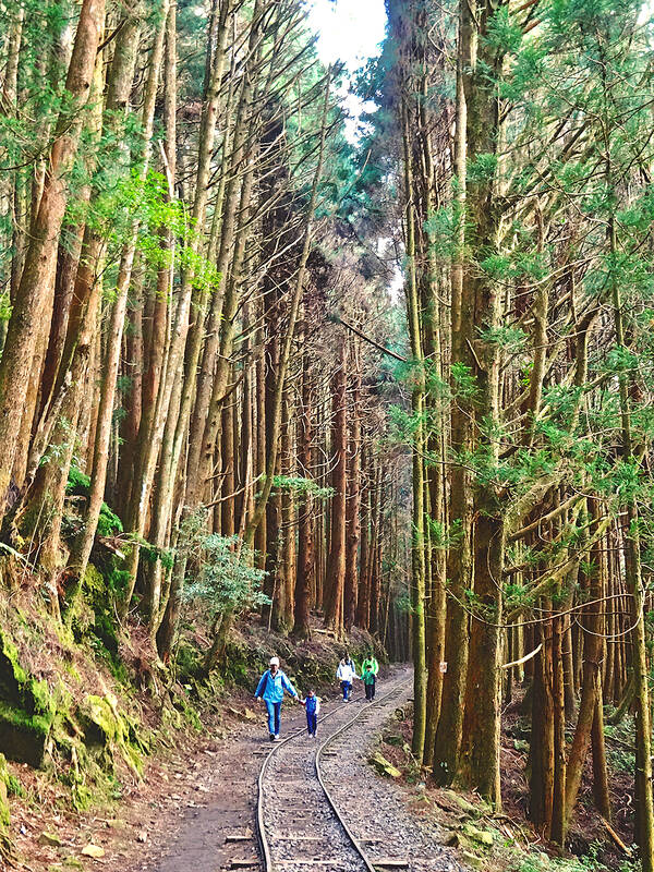
Photo: Tyler Cottenie
There were several buildings in the area, including dormitories, a camphor storage house and the station building itself. The location’s former economic importance is further highlighted by the fact that its camphor stores were bombed (successfully) by the US during World War II.
It also used to serve as the trailhead for hiking Jade Mountain, hence its names, Singaokou (新高口, from the Japanese) or Yushankou (玉山口), both of which describe an entrance to Taiwan’s highest mountain. The names do not appear on any sign now, so look for the “Lulinshan Major Wildlife Habitat” sign instead. There is plenty of space to park on the south side of the highway.
Two flat paths into the forest are obvious from here. The left path is the old Shihshan Branch Line. Unlike the Tefuye, the tracks have all been removed, but the old railbed is still in excellent condition and makes for a pleasant walk. This trail is not maintained to the same standard as the Tefuye, so there may be some muddy or overgrown sections, but the advantage is that there are far fewer people here.
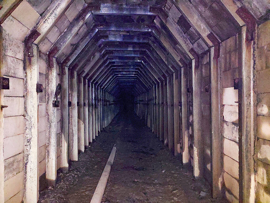
Photo: Tyler Cottenie
The trail now serves as the route for piping water down to the Alishan Forest Recreation Area, and the pipe is visible in places as you walk deeper into the forest. If you make it to the end, you’ll be treated to a small waterfall that is the source for the water pipe. Along the way are several metal catwalks and an old railroad tunnel, identical in design to the one at the 92K mark of Route 18, except that you can walk right through this one.
A FINE CAMPING AREA
Back at the parking area, if you take the right branch instead, you’ll be walking on the bed of the old Siashan Branch Line. This trail is in the worst shape of the three, yet apart from a few streambeds where you have to pick your way carefully across some rocks, and a few places where dirt has slid down to cover the original railbed, the trail is still remarkably intact. If you’ve got more time to spend exploring or you’re looking for an overnight camping trip, this is the line to choose.
With a keen eye, you’ll be able to spot traces of the area’s past all along your walk. Steel cables and scattered metal parts from logging machinery lie abandoned on the forest floor. Old bridges have collapsed, fully or partially. A wide, flat area littered with glass bottles and other refuse left by workers (look for the “Darkie” toothpaste) could serve as a campsite. This place is about an hour and fifteen minutes from the road on foot. Another hour and fifteen minutes gets you to an even better campsite with a soft floor of cedar needles.
From here, you can spend some time exploring the railbed further into the forest, where a few old rails still remain, spread across tree roots hanging in the air where the ground has collapsed, serving as makeshift bridges. If this sort of adrenaline rush isn’t for you, you could instead make the three-hour descent to an old camphor processing village and explore the dilapidated buildings that have been mostly abandoned since the 1960s.
Of course, you could do neither of the above as this idyllic treed campsite, several hours’ walk from the highway, is an enticing destination on its own. It’s too late to undo the damage done to the primeval forest by logging, but it is possible to enjoy the legacy that the days of unrestrained exploitation have left behind: old relics, easy trails and new forest that is still beautiful in its own way.

Towering high above Taiwan’s capital city at 508 meters, Taipei 101 dominates the skyline. The earthquake-proof skyscraper of steel and glass has captured the imagination of professional rock climber Alex Honnold for more than a decade. Tomorrow morning, he will climb it in his signature free solo style — without ropes or protective equipment. And Netflix will broadcast it — live. The event’s announcement has drawn both excitement and trepidation, as well as some concerns over the ethical implications of attempting such a high-risk endeavor on live broadcast. Many have questioned Honnold’s desire to continues his free-solo climbs now that he’s a

As Taiwan’s second most populous city, Taichung looms large in the electoral map. Taiwanese political commentators describe it — along with neighboring Changhua County — as Taiwan’s “swing states” (搖擺州), which is a curious direct borrowing from American election terminology. In the early post-Martial Law era, Taichung was referred to as a “desert of democracy” because while the Democratic Progressive Party (DPP) was winning elections in the north and south, Taichung remained staunchly loyal to the Chinese Nationalist Party (KMT). That changed over time, but in both Changhua and Taichung, the DPP still suffers from a “one-term curse,” with the

Lines between cop and criminal get murky in Joe Carnahan’s The Rip, a crime thriller set across one foggy Miami night, starring Matt Damon and Ben Affleck. Damon and Affleck, of course, are so closely associated with Boston — most recently they produced the 2024 heist movie The Instigators there — that a detour to South Florida puts them, a little awkwardly, in an entirely different movie landscape. This is Miami Vice territory or Elmore Leonard Land, not Southie or The Town. In The Rip, they play Miami narcotics officers who come upon a cartel stash house that Lt. Dane Dumars (Damon)

Today Taiwanese accept as legitimate government control of many aspects of land use. That legitimacy hides in plain sight the way the system of authoritarian land grabs that favored big firms in the developmentalist era has given way to a government land grab system that favors big developers in the modern democratic era. Articles 142 and 143 of the Republic of China (ROC) Constitution form the basis of that control. They incorporate the thinking of Sun Yat-sen (孫逸仙) in considering the problems of land in China. Article 143 states: “All land within the territory of the Republic of China shall