Short vacations to eastern Taiwan often require choosing between the Rift Valley with its pineapple fields, rice paddies and broader range of amenities, or the less populated coastal route for its ocean scenery. For those who can’t decide, why not try both? The Antong Traversing Trail (安通越嶺道) provides just such an opportunity.
Built 149 years ago, the trail linked up these two formerly isolated parts of the island by crossing over the Coastal Mountain Range. After decades of serving as a convenient path for local Amis, Han settlers, missionaries and smugglers, the trail fell into disuse once modern roadways were built through the mountains. Recently restored, the Antong Traversing Trail now makes for an enjoyable but demanding day hike.
Whether you hike only one side or the full traverse, the highlight will surely be the section of trail on the very top that runs along the border of Hualien and Taitung counties and offers views of the Pacific Ocean far below. The Antong hot springs are located nearby on Route 30 and pair very well with this hike: stay here the night before so you are ready for an early start to the hike, or come here afterward to soothe any sore muscles.
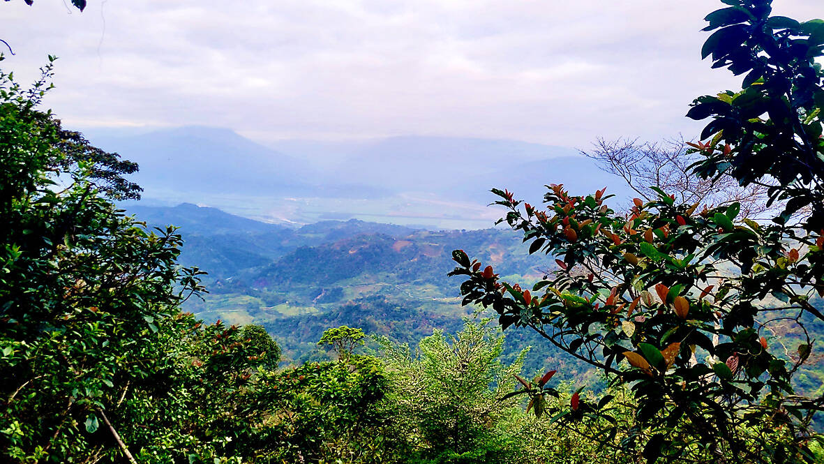
Photo: Tyler Cottenie
UP THROUGH HUALIEN
After one kilometer eastbound along Route 30 from the Antong Hot Spring Hotel, take the left turn marked by a sign for the “Antong Traversing Trail Entrance.” Continue following the brown signs along a series of farm roads all the way up to the trailhead. High-clearance vehicles with four-wheel drive and motorcycles will have no trouble getting all the way up, whereas others might have to park earlier. Be sure to follow the signs, as the original way up has been rerouted and one new section of road does not even exist in Google Maps. After 5km (not 4.1km as indicated at the initial turnoff) you will reach a tall wooden sign marking the trailhead.
The Hualien side of the trail is in surprisingly good shape. The trail has been cut wide enough to walk two abreast, vegetation overgrowth has been kept in check, and the steeper sections have solid railings and stairs dug into the hillside. Although this means the trail is not technically challenging, the trail does climb relentlessly upward and will have many people huffing and puffing before they are even halfway up to the top.
Photo: Tyler Cottenie
As you finally crest the ridge, the forest ahead gives way to open sky and the Pacific Ocean comes into view far below. You have now reached the county border: the steep hillside in front of you and the coastal villages at the foot of the mountain are all in Taitung County. Consider planning your hike in the early hours of the morning to arrive here in time for an unforgettable sunrise, with the ocean surface ablaze in a shimmering orange and the hillside below you glowing in the golden crepuscular light. If you arrive later in the day and the sky is clear, you will be treated to a beautiful expanse of water of that rich turquoise color that is so representative of the east coast.
There is a wooden platform with benches here where hikers can catch their breath and take in the view. The easiest and most scenic part of the trail is the next 750 meters, mercifully flat as it follows the ridge to another scenic outlook with a wooden platform. This marks a good turnaround point for those returning to the western trailhead. For those who want to continue to the eastern trailhead, get ready for tougher terrain.
DOWN THROUGH TAITUNG

Photo: Tyler Cottenie
As soon as the trail leaves the ridge, it drops quite steeply down into Taitung and feels more like a standard Taiwanese hiking trail. It is only wide enough for one person, there are no wooden boardwalks or stairs, and ropes have been added for hikers to hold through the steeper, muddier sections. Although you need to focus on your footing a lot more through this section, it is still a pleasant walk with some interesting changes of scenery.
After a half-hour of careful descent through steeper terrain, the grade becomes less steep. Among this flatter land is the site of an old settlement, formerly home to Han Chinese settlers and hired Amis farmhands who harvested camphor, rice and sugarcane. The only visible trace today is a pond that was used for irrigation.
Around 3.4km after leaving the ridge, the trail crosses a concrete dam to an old road on the other side. Flow in this river is very low and unless there’s been a heavy rain recently, you won’t even get your feet wet while crossing. This dam is the headwaters of a modern irrigation system that replaced an earlier one built by local indigenous in 1882. As you follow the road down to the coast below, listen carefully for the sound of water flowing: the rills, tunnels and pipes of this irrigation system often run right next to the road.
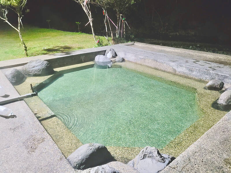
Photo: Tyler Cottenie
For about 1.5km the road below the dam is overgrown and impassable to vehicles but the last 3.5km down to the coastal town of Nanjhuhu (南竹湖) on Route 11 is well maintained. If you are leaving vehicles on both ends of the trail, you won’t need to walk this last 3.5km. If you have to walk, the final approach to Nanjhuhu is a pleasant stroll among verdant rice paddies, well watered thanks to the irrigation system. Congratulations: you have just crossed from the Rift Valley to the Pacific Ocean.
PLANNING YOUR TRIP
The best way to do the entire hike is to have either two vehicles or no vehicles. If you have two, leave a vehicle at each trailhead and walk the entire trail one way. Allow 4 hours for this 7km walk, and another hour and a half for shuffling the vehicles around. With no transportation of your own, take Bus 309 from the Yuli (玉里) train station at 10:20am, get off at Antong Hot Spring and start your 16.5km walk (allow 7 to 8 hours). Leave Nanjhuhu via Bus 1145 to Hualien (at 5:01pm or 7:01pm), or via Bus 8102 to Taitung City at 6:53pm.
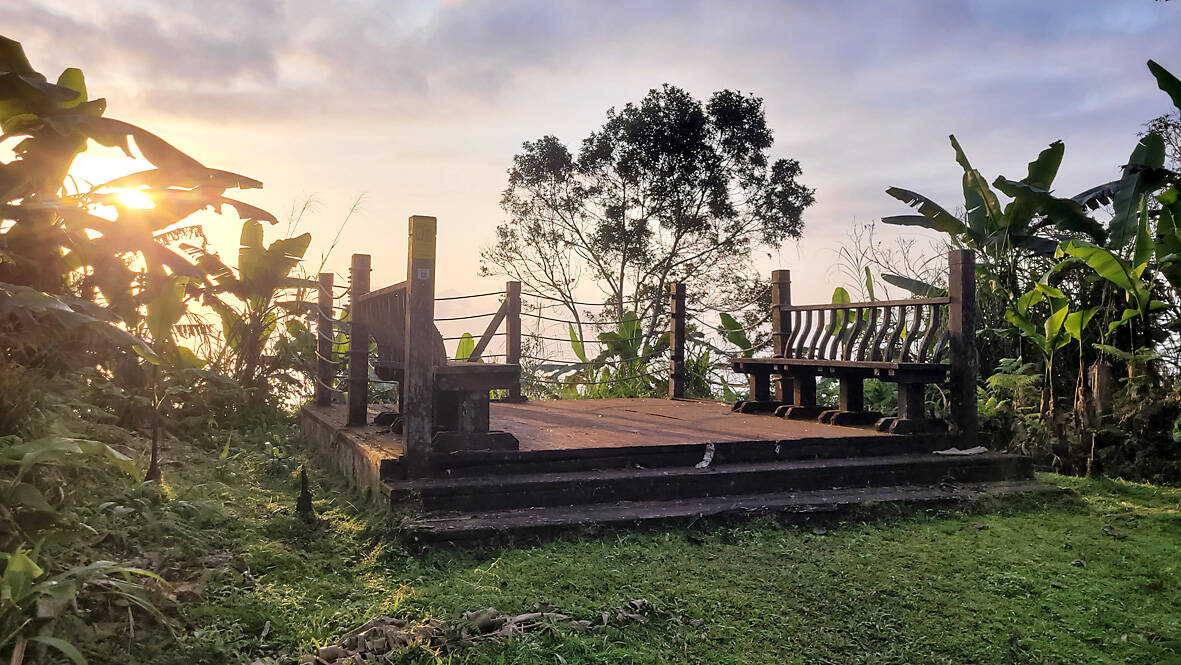
Photo: Tyler Cottenie
To do only one half of the hike, simply drive yourself to one of the trailheads, walk up to the ridge and then head back down. Do the west side for a more difficult drive but an easier walk, or the east side for an easier drive but more difficult walk.
Unfortunately, going with only one vehicle to do the entire trail is the most difficult way to arrange transportation, since the trailheads are on opposite sides of a mountain range and in different counties. One option is to park on the east coast at Ningpu (寧埔) in the morning, go north to Nanjhuhu on foot (45 minutes) or by bus (8105, 8102 or 8119, first bus is at 7:30am), then do the full traverse westbound, then finally take Bus 8181 at 7:01pm from Antong Hot Spring back to your car in Ningpu.
For an eastbound hike, start hiking early from Antong, then go from Nanjhuhu south to Ningpu on foot (45 minutes) or by bus (any bus stopping here will work), then catch Bus 8181 from Ningpu back to Antong Hot Spring at 1:06pm or 5:46pm. Using an app to track any bus you intend to catch is highly recommended as buses often arrive earlier than scheduled on the east coast.

Photo: Tyler Cottenie

Taiwan’s English education system is being pulled apart by three opposing forces. Bilingual Nation 2030 pulls students toward English and global communication. Artificial Intelligence (AI) readiness pulls them toward digital judgment, verification and AI-mediated work. But Taiwan’s old exam culture pulls them back toward memorization, grammar drills, timed reading and correct answers. If the education system keeps using old exams to define success, it risks producing graduates who are neither genuinely bilingual nor genuinely AI-ready, but trained for tasks machines can already perform. The first force is Bilingual Nation 2030. Launched in 2018, the policy aimed to “help Taiwan’s workforce connect

It seems every few days one bumps into one of those “real man” comments in which Taiwan is urged to “face reality” or similar, and “make a deal,” with the speaker implying that soon it will be too late. “Deal” advocates always present themselves as having a superior grip on reality, and the manly ability to make the “hard choice.” Their testosterone-laden language often echoes that of Taiwan sellout advocates. Note that such commentary always specifies a process (“make a deal, work with, make progress”), never the end state of what occupation by a violent authoritarian colonialist state will entail. In

“Taiwan’s Opposition Leader Comes to US With a Message Straight Out of Beijing” read a May 31 headline in the Wall Street Journal. Top US administration officials and members of Congress almost certainly read the WSJ, and if there was a bullet point takeaway that people in Washington should absorb ahead of Chinese Nationalist Party (KMT) Chair Cheng Li-wun’s (鄭麗文) arrival in DC on June 9, that headline is it. The last few columns have discussed this very topic, and the timing is not coincidental. While those top officials likely do not read the Taipei Times, judging by the number

As someone who normally steers clear of books with “transcendence” or “metaphysics” in their subtitles, this reviewer — a casual observer of local belief systems since the 1990s — found Fabian Graham’s Money God Temples in Taiwan a challenging read. Those who’ve only dipped their toes into temple culture will likely need to parse several sections with special care if they’re to keep up with the author, a British ethnographic researcher whose previous books have investigated religious practices among ethnic Chinese in Southeast Asia. This scholarly volume examines a facet of Taiwan’s religious landscape that didn’t exist a century ago, and