April 29 to May 5
One month before the Taipei-Keelung New Road (北基新路) was set to open, the news that US general Douglas MacArthur had died, reached Taiwan.
The military leader saw Taiwan as an “unsinkable aircraft carrier” that was of huge strategic value to the US. He’d been a proponent of keeping it out of Chinese Communist Party (CCP) hands. Coupled with the fact that the US had funded more than 50 percent of the road’s construction costs, the authorities at the last minute renamed it the MacArthur Thruway (麥帥公路) for his “great contributions to the free world and deep friendship toward the citizens of the ROC (Republic of China),” according to a Highway Bureau report from 1966.
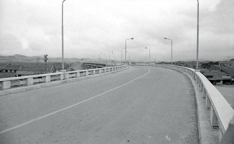
Photo courtesy of Academia Historica
After Roosevelt Road, it was the second, and last road in Taiwan to be named after a foreigner.
Inaugurated on May 2, 1964 to great fanfare, the two-lane, controlled-access highway was the first of its kind in Taiwan, cutting down travel time between Taipei and Keelung from 45 minutes to 25 minutes. Only cars, buses and trucks were allowed, and the speed limit was 100km per hour in the plains and 80km per hour in the hills.
Drivers paid a small toll to enter, and were handed a “time card” that was manually checked at the exit to see if they had been speeding.
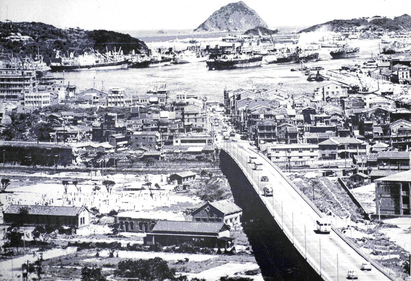
Photo courtesy of Taiwan Cultural Memory Bank
A Central News Agency report states that the design and construction were subpar, leading to 51 accidents during the first two years of operation. The lanes were less than eight meters wide and lacked a median, making it prone to head-on collisions. Motorcycles often snuck onto the road, and there were also several landslides.
Most of the thruway was incorporated into Freeway No. 1 in 1977, with the remaining 2km becoming today’s Nanjing E Road Section 6. Traces of the original path can still be identified, such as the Jhongsing Tunnel (中興隧道) and other landmarks that remain of interest.
CONNECTING CITIES
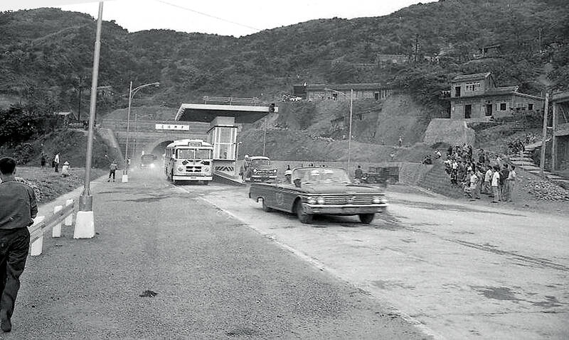
Photo courtesy of Academia Historica
The 1966 Construction Report on the MacArthur Highway (麥克阿瑟公路施工報告) indicates that the Highway Bureau in 1958 planned four major arteries connecting Taipei with the surrounding areas of Beitou, Sinjhuang (新莊), Sindian (新店) and Keelung to improve traffic and economic development. These roads were also meant to help with evacuation in case of airstrikes. However, the government did not have sufficient funding to carry out these projects.
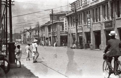
The first priority was the Taipei-Keelung route, as it would expedite transport between the capital and the largest port in northern Taiwan. Although the nation’s heavy industry centered in the south, light industry factories had sprung up along the Japanese-built highway (today’s Provincial Highway 5) between the two cities. With the surge in industrial activity, the mixed-use pathway was becoming congested and dangerous — statistics show that 4,200 cars, motorcycles, bicycles and handcarts traversed it per day in 1959. The situation would only worsen with the planned completion of the Lioudu Industry Park (六堵工業區) in 1965.
Instead of expanding the original highway on the southern bank of the Keelung River, a new expressway was planned on the northern side in case one road was destroyed during military conflict. Surveying began in February 1959, and the first proposed route had 86 bends, a number that was later reduced to 17.
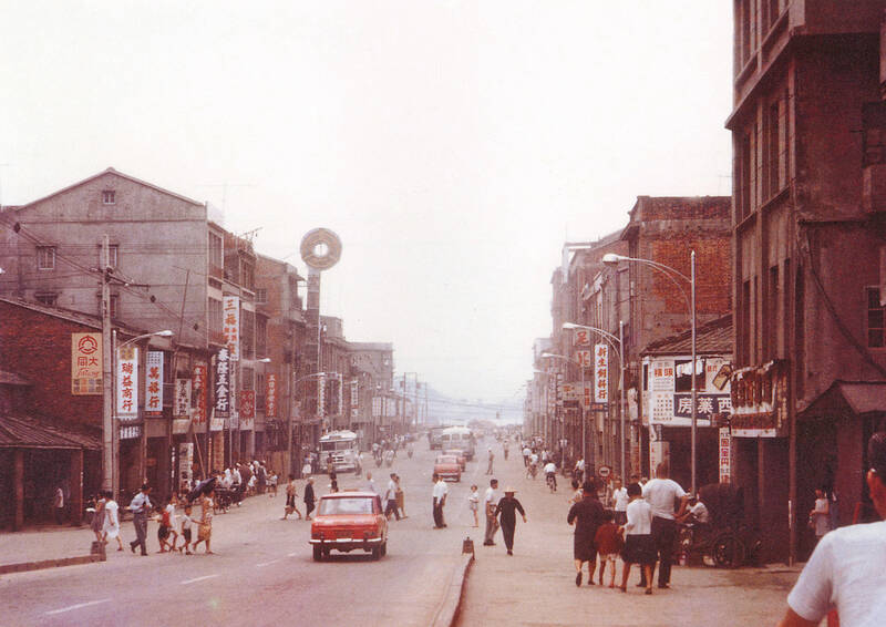
Photo courtesy of Keelung City Cultural Affairs Bureau
The thruway was originally named the Taipei-Keelung Second Road (北基二路), which was updated to Taipei-Keelung New Road (北基新路) before the final name change to honor MacArthur.
The final budget was set at NT$227.9 million, with NT$126.95 million of it coming from US aid. The 23.4km-long route began at Nanjing E Road Section 4 next to the Taipei Arena today, and ended in downtown Keelung. Unlike today, reports stated that sections 4 and 5 of Nanjing E Road did not see much traffic then, and much of the first part of the road in Taipei was still farmland.
DANGER ROAD
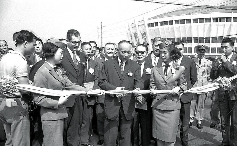
Photo courtesy of Academia Historica
The MacArthur Thruway took three years to complete with limited resources and crew members, and the 1966 report details the myriad challenges and ways they had to adapt on the fly. There was one fatality — excavator operator Chiang Lun-shun (江倫順) died in an accident while digging through one of the most difficult mountain sections right before Lioudu.
The report’s review section admits to hurriedly starting before they were fully ready due to funding restrictions, leading to miscalculations in the machinery and materials required. The road’s surface was already damaged on the first day as it could not handle the high traffic.
But the bigger problem was the accidents that killed or injured more than 200 people by 1966. In 1968, a taxi swerved on a wet road and collided with another taxi head on, leading to four dead and six injured.
There were no barriers on the side, and in 1968, one car fell into the ravine below. The tow truck that came to help extricate it failed to put up warning lights and an incoming truck slammed into it, leading to a multi-car accident.
According to research done by the Taiwan Highway Club, in addition to Nanjing E Rd Section 6, parts of Kangning Street (康寧路) in Sihjih District (汐止) and Shihchien Road Lane 253 (實踐路253巷) in Wudu District (五堵) are remnants from the McArthur Thruway. These two segments were bends that were cut out from the route of Freeway No. 1. Those who want to experience how narrow the thruway was can visit the part of Kangning Street east of today’s Huguang Borough Community Center (湖光里活動中心).
Taiwan in Time, a column about Taiwan’s history that is published every Sunday, spotlights important or interesting events around the nation that either have anniversaries this week or are tied to current events.

Taiwan’s English education system is being pulled apart by three opposing forces. Bilingual Nation 2030 pulls students toward English and global communication. Artificial Intelligence (AI) readiness pulls them toward digital judgment, verification and AI-mediated work. But Taiwan’s old exam culture pulls them back toward memorization, grammar drills, timed reading and correct answers. If the education system keeps using old exams to define success, it risks producing graduates who are neither genuinely bilingual nor genuinely AI-ready, but trained for tasks machines can already perform. The first force is Bilingual Nation 2030. Launched in 2018, the policy aimed to “help Taiwan’s workforce connect
It seems every few days one bumps into one of those “real man” comments in which Taiwan is urged to “face reality” or similar, and “make a deal,” with the speaker implying that soon it will be too late. “Deal” advocates always present themselves as having a superior grip on reality, and the manly ability to make the “hard choice.” Their testosterone-laden language often echoes that of Taiwan sellout advocates. Note that such commentary always specifies a process (“make a deal, work with, make progress”), never the end state of what occupation by a violent authoritarian colonialist state will entail. In
There are shadowy cabals plotting to sell out Taiwan to be annexed by China, by invasion if necessary. Fortunately, they are buffoons. In 2019, former Bamboo Union gangster and founder of the China Unification Promotion Party (CUPP), Chang An-le (張安樂, colorfully known as “White Wolf”), led a protest at the Legislative Yuan against comments made by then-premier Su Tseng-chang (蘇貞昌) that in the event of an attack by China, he would never surrender, but would protect the nation by fighting to the end, even if he only had a broom. Chang had party members bring a wooden casket that they
June 1 to June 7 "If all Taiwanese were as afraid of dying as you, then what would happen?” Physician Shih Chiang-nan (施江南) reportedly said this to his wife Chen Chiao-tung (陳焦桐) after she urged him to stop intervening on behalf of Taiwanese soldiers stranded overseas after serving in the Japanese Army during World War II. Shih had clashed with high-ranking officials over the issue, engaged in several heated arguments with Taiwan governor-general Chen Yi (陳儀) and allegedly shouted at general Ko Yuan-fen (柯遠芬), chief of staff of the Taiwan Garrison Command, over