Fencihu Township (奮起湖) in Chiayi County is a popular tourist destination, well-known as one of the stops on the Chiayi (嘉義) to Alishan (阿里山) mountain-line train route. Located at 1,100m above sea level and tucked away 10km off Provincial Highway No. 18 it could easily be bypassed, but that would be a mistake.
On weekends the bustling little town with its old street selling lunch boxes and a variety of local snacks is fun to visit and has the added attraction of a railway museum. Just outside the town on County Road No. 169 hikers will find the starting point for the Fenruei Historic Trail (奮瑞古道), which is easily accessible and a joy to hike.
The trail is seven kilometers one way from Fencihu through to Rueili Township (瑞里) and takes no longer than four hours to hike. If transport hasn’t been arranged for pick up at the other end there is the option of just hiking in for a few kilometers and returning to the point of origin.
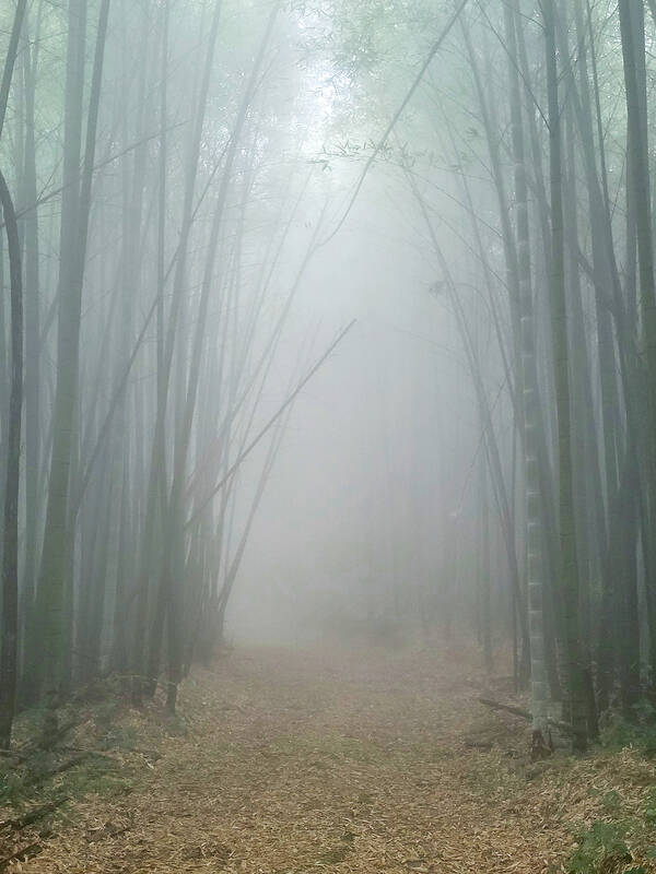
Photo: Mark Roche
TOWERING BAMBOO
The trail begins with a series of wooden stairs followed by concrete steps as the hiker ascends deep into the forest. Soon the noise from the road and town disappears and nature in the form of cicadas and bird song fills the air.
There is lookout platform here with excellent views of Fencihu Train Station and surrounding villages. On a misty afternoon it was like entering an alternate universe as the bamboo towers overhead. Stop for a minute and you can almost hear the voices from the past as goods were trudged up this path or locals traveled to neighboring towns.
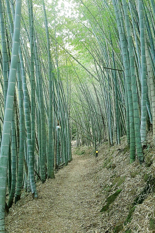
Photo: Mark Roche
There is an indigenous broadleaf forest made up of members of the laurel and beech families. Reforestation areas are predominantly covered by China fir, peacock fir, peacock pine and bamboo.
The trail is not so difficult to hike and there are multiple rest points with benches. Tall trees along the path accompany the hiker all the way. After a few turns and crossing an arch bridge a lush bamboo forest is entered.
STEEPED IN HISTORY
Photo: Mark Roche
The trail ranges in altitude between 1,100m and 1,600m and it has a fascinating history. Its origins date back to the Qing Dynasty (1644 to 1911) when it was established as a road for the residents of Rueili to reach Fencihu.
According to historical accounts, when the first settlers came to this area (around 1797), the area was a settlement of the indigenous Tsou called Haliwei. In the 1870s, Han Chinese settlers and the Tsou chieftains came to an agreement in which the settlers obtained the area in exchange for cloth, salt, knives, pots, matches and guns.
To facilitate transport and agricultural operations with the residents of Taihe Village (太和), Rueili settlers created the first Rueitai Historic Trail (瑞太古道), which is an extension of the Fenruei trail.

Photo: Mark Roche
FROM PAST TO PRESENT
The original trail was very steep, arduous and long. Therefore, in 1931, residents of the surrounding villages joined together to build a new trail, also known as the Rueitai Historic Trail. This trail takes a different route from the original trail because a school had been built and children needed to go between towns to get there.
In 1912, when the Alishan Railway was completed to Fencihu, Rueili residents could take the train from there to Chiayi City. They would take bamboo stems, bamboo shoots, palm leaves and climbing fig harvested in the mountains to Fencihu, where they could be sold for cash. Local Cinnamomum kanehirae (a type of camphor wood), which was used in the manufacture of cartwheels, was also cut and transported to Chiayi for sale.
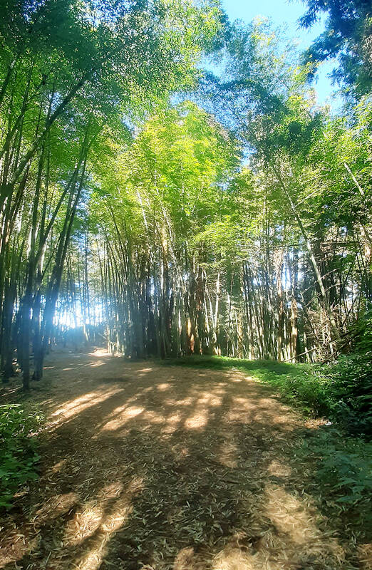
Photo: Mark Roche
In 1999, the trail system of the area was enhanced when the Chiayi office of the Forestry Bureau expanded it for outdoor activities.
LOST IN A FOREST
The Forest of Forgetting Sorrow (忘憂林) is one of the trail’s foremost attractions. The sound of the bamboo rustling in the breeze, or the golden light filtering through its leaves, ushers the hiker into an other-worldly environment.
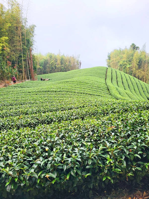
Photo: Mark Roche
The area is the habitat of a wide range of animals, including over 30 types of birds, Formosan squirrel, macaques, insects and lizards. I was lucky on this particular occasion to get a sighting of a Swinhoe’s pheasant.
It would be well worth while to hike through and get lunch or dinner at Teapot Restaurant (瑞里茶壺民宿、餐廳), which is 2km down the road from the exit of the trail at Rueili. It’s a popular restaurant and the perfect way to end the day, but better to call ahead for a reservation.
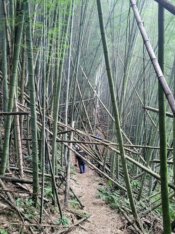
Photo: Mark Roche
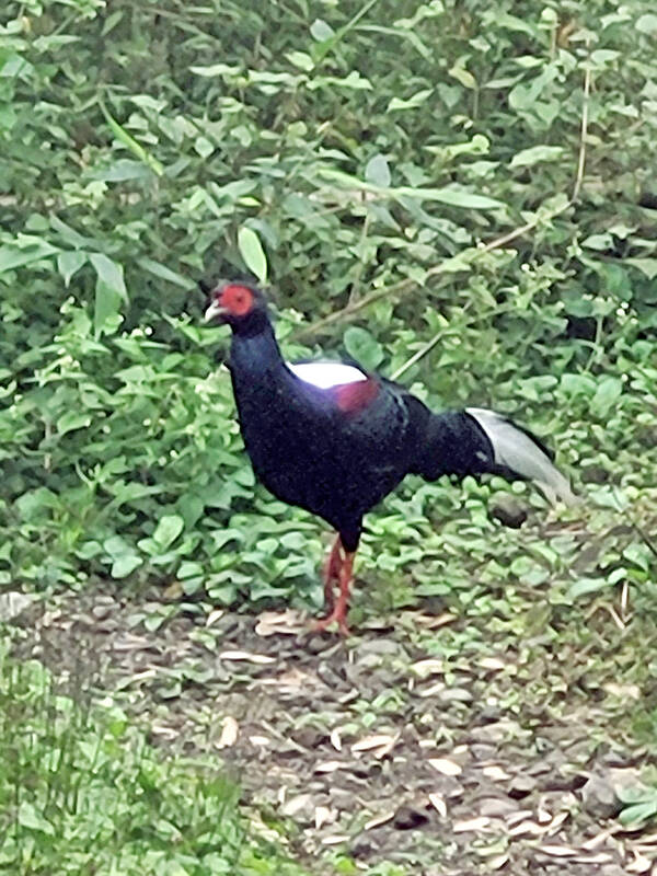
Photo: Mark Roche
If one asks Taiwanese why house prices are so high or why the nation is so built up or why certain policies cannot be carried out, one common answer is that “Taiwan is too small.” This is actually true, though not in the way people think. The National Property Administration (NPA), responsible for tracking and managing the government’s real estate assets, maintains statistics on how much land the government owns. As of the end of last year, land for official use constituted 293,655 hectares, for public use 1,732,513 hectares, for non-public use 216,972 hectares and for state enterprises 34 hectares, yielding

The small platform at Duoliang Train Station in Taitung County’s Taimali Township (太麻里) served villagers from 1992 to 2006, but was eventually shut down due to lack of use. Just 10 years later, the abandoned train station had become widely known as the most beautiful station in Taiwan, and visitors were so frequent that the village had to start restricting traffic. Nowadays, Duoliang Village (多良) is known as a bit of a tourist trap, with a mandatory, albeit modest, admission fee of NT$10 giving access to a crowded lane of vendors with a mediocre view of the ocean and the trains
Traditionally, indigenous people in Taiwan’s mountains practice swidden cultivation, or “slash and burn” agriculture, a practice common in human history. According to a 2016 research article in the International Journal of Environmental Sustainability, among the Atayal people, this began with a search for suitable forested slopeland. The trees are burnt for fertilizer and the land cleared of stones. The stones and wood are then piled up to make fences, while both dead and standing trees are retained on the plot. The fences are used to grow climbing crops like squash and beans. The plot itself supports farming for three years.

For many people, Bilingual Nation 2030 begins and ends in the classroom. Since the policy was launched in 2018, the debate has centered on students, teachers and the pressure placed on schools. Yet the policy was never solely about English education. The government’s official plan also calls for bilingualization in Taiwan’s government services, laws and regulations, and living environment. The goal is to make Taiwan more inclusive and accessible to international enterprises and talent and better prepared for global economic and trade conditions. After eight years, that grand vision is due for a pulse check. RULES THAT CAN BE READ For Harper Chen (陳虹宇), an adviser