Despite the not unreasonable claims among us northerners that Taipei is (and always will be) Taiwan’s greatest city, Kaohsiung is a pretty awesome place too, once you start exploring it. Taipei may have the larger number of historic buildings, the best public transport system and by far the finer range of day hikes and excursions. But look below the surface glitz and color of modern Kaohsiung, and it’s a surprisingly varied and interesting place, with a lot to see and explore.
Shoushan (壽山) is one of several outcrops of limestone (or rather ancient coral) that occur in southern Taiwan. The ridge, about six kilometers long and two kilometers wide, was lifted above the surface of the ocean eons ago, and the exposed rock has since been cracked by earthquakes and dissolved by rain to form a weird landscape of narrow clefts, jagged coral formations and caves. Sadly, those last features aren’t open to the public, and neither is the mysterious northern half of the ridge, which is still a controlled military area. The accessible area is still a great place for exploring, though, especially off the well-trodden main trails.
GEOLOGICAL RICHES
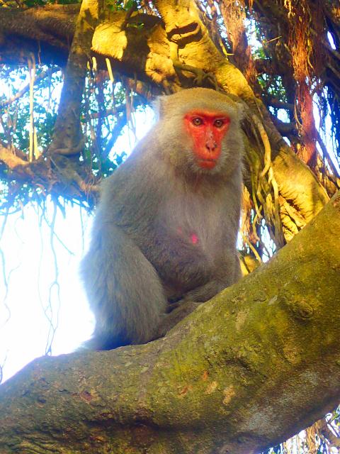
Photo: Richard Saunders
Shoushan, which is rich in geological, ecological and (pre)historic interest, became Taiwan’s first National Nature Park (established in October 2009). It’s divided into five distinct areas, all on the western side of Kaohsiung City. Shoushan ridge itself is the largest protected area, but two other smaller uplifted coral hills — Guishan (龜山) and Mount Banping (半屏山) — and even several historic relics, including part of the old walled city of Zuoying (左營) and a couple of minor prehistoric sites, also lie within the park’s multiple boundaries.
The long, wooded ridge of Shoushan is a conspicuous feature from many areas of Kaohsiung, but the three main trailheads all take a little effort to seek out, since they’re not especially well signposted. The easiest entry point to locate starts near the city zoo, at the southern end of the ridge, while the other two are close to each other, about half-way up the eastern side of the ridge. Once you’ve finally found a way onto the mountain, signage improves considerably: English language maps and signs are generously scattered along paths all over the mountain, so getting around is straightforward.
The best place to start exploring Shoushan is probably from the middle trailhead of the three, which starts at a large car park beside Qianguang Temple (千光宮). Walk past the unmanned visitor center, which has a map of the National Nature Park, and a small display explaining some of the geology, flora and fauna of the ridge, and take a raised wooden walkway that climbs quite steeply above the car park, past a huge old banyan tree. Shortly the boardwalk turns into an unattractive, dusty track winding up the wooded hillside. Hang in there; it does get more interesting later on.
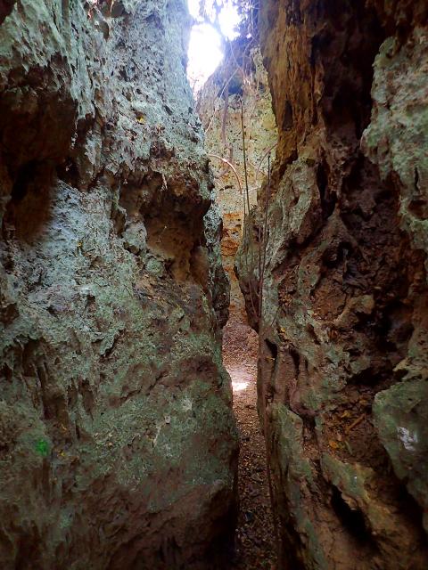
Photo: Richard Saunders
FORMOSAN MACAQUES
In about 20 minutes the track passes the Four Banyans (四棵榕), a row of old trees that provide the first good view over the city, from where several routes climb the hillside for about another half hour to the more impressive Rocky Banyan (盤榕), clinging to the side of a limestone crag and usually busy with Shoushan’s famous Formosan macaques (the only species of monkey native to Taiwan).
These critters might look cute, but treat them with respect. Years of sharing the ridge with the countless hikers that come up there each day has taught them not only to have no fear of humans, but also to see them as a source of food, so keep all edibles well hidden, even away from busy monkey stations such as here.
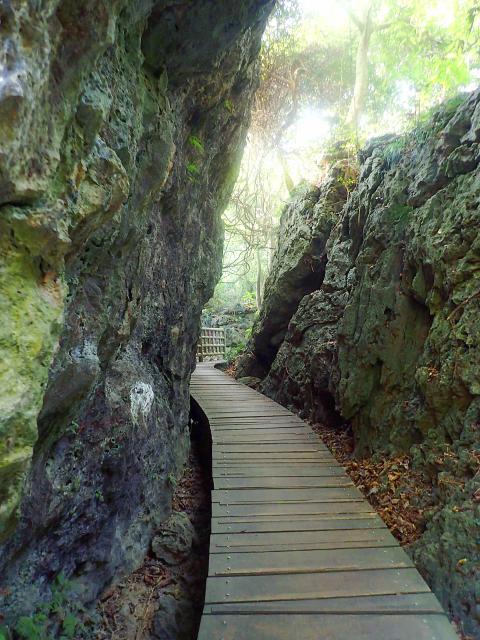
Photo: Richard Saunders
The Rocky Banyan is a useful landmark, as it’s the place where Shoushan really starts to get interesting; most of the best caves, gorges and other formations are within easy walking distance of it. Some of these are marked on the English-language maps, but the best plan is to choose a direction, get off the wide main trails as soon as possible and simply explore.
Worth a look before leaving the Rocky Banyan area is the nearby Lotus Cave (蓮花洞), a sinkhole beside the path. From here a trail strikes north past the Monkey View Pavilion (觀猴亭; guaranteed close encounters with loads more Formosan macaques), the bluff known as Monkey Rock (猴岩) and on to the deep cleft curiously known as Thailand Valley (泰國谷), perhaps the most impressive formation on the entire ridge.
For my favorite so-far discovered portion of Shoushan, however, head west from the Rocky Banyan along a dull but flat track leading to a flat terrace called the Longevity Rest Area (長壽園). Now turn west (right) off along any of the tiny dirt trails that branch off, and start wandering along the network of rough dirt trails towards the highest point of the entire ridge (349 meters), in search of some of Shoushan’s more intriguing features such as the Tiger Cave (虎洞), Monkey Cave (猴洞) and the Mountain Pig Cave (山豬洞).
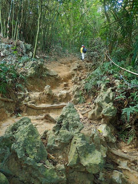
Photo: Richard Saunders
Richard Saunders is a classical pianist and writer who has lived in Taiwan since 1993. He’s the founder of a local hiking group, Taipei Hikers, and is the author of six books about Taiwan, including Taiwan 101 and Taipei Escapes. Visit his Web site at www.taiwanoffthebeatentrack.com.
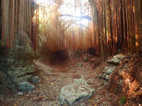
Photo: Richard Saunders
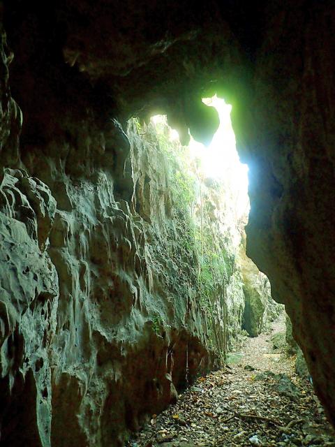
Photo: Richard Saunders
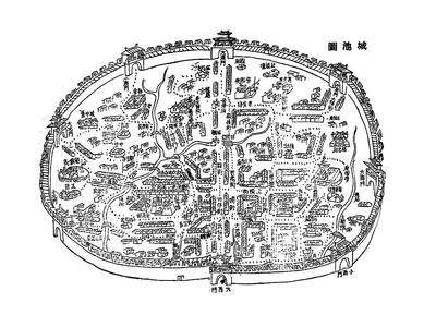
May 26 to June 1 When the Qing Dynasty first took control over many parts of Taiwan in 1684, it roughly continued the Kingdom of Tungning’s administrative borders (see below), setting up one prefecture and three counties. The actual area of control covered today’s Chiayi, Tainan and Kaohsiung. The administrative center was in Taiwan Prefecture, in today’s Tainan. But as Han settlement expanded and due to rebellions and other international incidents, the administrative units became more complex. By the time Taiwan became a province of the Qing in 1887, there were three prefectures, eleven counties, three subprefectures and one directly-administered prefecture, with

It’s an enormous dome of colorful glass, something between the Sistine Chapel and a Marc Chagall fresco. And yet, it’s just a subway station. Formosa Boulevard is the heart of Kaohsiung’s mass transit system. In metro terms, it’s modest: the only transfer station in a network with just two lines. But it’s a landmark nonetheless: a civic space that serves as much more than a point of transit. On a hot Sunday, the corridors and vast halls are filled with a market selling everything from second-hand clothes to toys and house decorations. It’s just one of the many events the station hosts,

Two moves show Taichung Mayor Lu Shiow-yen (盧秀燕) is gunning for Chinese Nationalist Party (KMT) party chair and the 2028 presidential election. Technically, these are not yet “officially” official, but by the rules of Taiwan politics, she is now on the dance floor. Earlier this month Lu confirmed in an interview in Japan’s Nikkei that she was considering running for KMT chair. This is not new news, but according to reports from her camp she previously was still considering the case for and against running. By choosing a respected, international news outlet, she declared it to the world. While the outside world
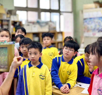
Through art and storytelling, La Benida Hui empowers children to become environmental heroes, using everything from SpongeBob to microorganisms to reimagine their relationship with nature. “I tell the students that they have superpowers. It needs to be emphasized that their choices can make a difference,” says Hui, an environmental artist and education specialist. For her second year as Badou Elementary’s artist in residence, Hui leads creative lessons on environmental protection, where students reflect on their relationship with nature and transform beach waste into artworks. Standing in lush green hills overlooking the ocean with land extending into the intertidal zone, the school in Keelung