Evan Centanni makes maps. Global maps, regional maps, geopolitical maps, cross-strait maps, conflict maps, trouble-spot maps. Based in Greater Kaohsiung where he has settled down with his wife after arriving here five years ago, Centanni grew up in Oregon and double-majored in linguistics and international studies at the University of Oregon.
Welcome to Political Geography Now (PolGeoNow), Centanni’s brainchild of a Web site that chronicles changes to the world’s countries, borders and capitals, as well as real territorial control in conflict zones and disputed territories.
“PolGeoNow is for anyone with an interest in the world’s countries, but it’s also designed to be a resource for professionals in the fields of geopolitics, political science, and political geography — that is, the geography of states, borders, and territories,” Centanni told the Taipei Times in an e-mail.
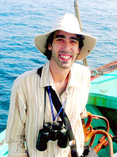
Photo Courtesy of www.polgeonow.com
Most of the content on the site is free, but some in-depth reports require a paid subscription, or can be purchased individually, Centanni, 28, said. There is also a Facebook page and Twitter feed.
MIDDLE EAST
The site is based in Taiwan, a hot spot in world geopolitics, so Centanni is well-positioned to be of use to journalists and academics. At the moment, the greatest amount of interaction comes in relation to his site’s reporting on territorial control in Syria and Iraq.
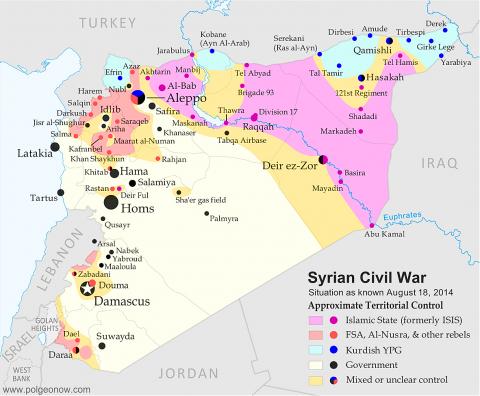
Photo Courtesy of www.polgeonow.com
“Lately I’ve been in contact with Noah Bonsey, senior Syria analyst at the International Crisis Group, who chose PolGeoNow’s Syria map to illustrate the organization’s recent report on the civil war,” Centanni said.
“I was once contacted by the Canadian embassy in Turkey, asking for information about the control situation along the Syrian-Turkish border, and I’ve also worked with an editor at the Bloomberg newsroom, cooperating on a map of ISIS [IS] control in Iraq to be used for the Bloomberg Terminal investors’ subscription service.”
In its own way, PolGeoNow could help put Taiwan on the map in a novel way, and Centanni is getting a sense of the future of his site already.
Revenue is small, but the Web site has potential to turn a profit later on, he said.
“Several publications have mentioned our name and cited us but none of the citations have contributed directly to revenue, but they have helped a great deal to build up a strong reader base and a reputation for reliability,” he said.
“The Perry-Castaneda Library at the University of Texas has been an especially big help in that area, by repeatedly linking to PolGeoNow reports on the home page of its map collection Web site. One of highest honors I’ve had so far was one of my announcements being retweeted by Ana Palacio, the former foreign minister of Spain.”
GROWTH POTENTIAL
To grow the site, Centanni is looking into larger-scale cooperation with press outlets and geopolitical consulting organizations worldwide, he said.
“At the moment the staff is me, some occasional contributing writers, and a new researcher who has just come on board,” Centanni said. “I’m in contact with several more people who will likely join soon in the writing and researching departments.”
According to Centanni, PolGeoNow doesn’t take sides in political or moral debates.
“In any trouble spot or with nations fighting over border issues, we report impartially on the real situation and the claims of all parties,” he said.
When asked how his Web site will cover disputes between Taiwan and China, for example, he had a ready answer.
“Taiwan and China are controlled by completely separate governments, both of whose constitutions claim sovereignty over both sides of the Strait,” he said, adding: “Most of our maps prioritize actual territorial control, so China and Taiwan would be marked in different colors. We apply this principle regardless of political alignment, so Russian-sponsored Abkhazia is marked as outside Georgia’s control just as Western-sponsored Kosovo is marked as outside Serbia’s control.”
CHILDHOOD OBSESSION
Centanni said his involvement with maps began in childhood.
“I’ve loved maps since elementary school, and as a kid I used to spend hours poring over the National Geographic Atlas of the World, and a second-hand atlas from the 1960s before that,” he said.
Other prized possessions as a kid were a topographic atlas of Oregon bought at a roadside convenience store, he added
For Centanni, maps are all in the family.
“It’s interesting to me that my youngest brother has followed in my footsteps,” he said. “I came home one summer to find he’d declared an independent country on my family’s one-acre property. This spring he placed in the top 10 at the Oregon Geographic Bee, and he’s already contributed several articles to PolGeoNow.”
Centanni said that it was the advent of Wikipedia that got him first thinking about doing something like this. Once-esoteric knowledge, such as lists of all the unrecognized countries in the world, was suddenly online for anyone to access, he said. But there didn’t seem to be one place to go to keep up with all the changes to the world political map, whether it was the declaration of a new country, changing borders and flags, or changes to actual territorial control within countries.
That’s when Centanni’s vision bloomed, he said.
“I envisioned a Web site that could be the go-to destination for that kind of news, while also casting light on the shadows and cracks in the nation-state system that are often ignored by official accounts and paper atlases,” he said.
“It started as just a fun project, but also with the idea that maybe I could eventually make a modest living off of it someday.”

Michael slides a sequin glove over the pop star’s tarnished legacy, shrouding Michael Jackson’s complications with a conventional biopic that, if you cover your ears, sounds great. Antoine Fuqua’s movie is sanctioned by Jackson’s estate and its producers include the estate’s executors. So it is, by its nature, a narrow, authorized perspective on Jackson. The film ends before the flood of allegations of sexual abuse of children, or Jackson’s own acknowledgment of sleeping alongside kids. Jackson and his estate have long maintained his innocence. In his only criminal trial, in 2005, Jackson was acquitted. Michael doesn’t even subtly nod to these facts.
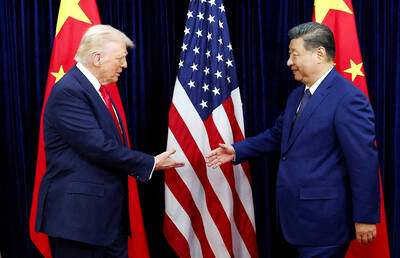
The March/April volume of Foreign Affairs, long a purveyor of pro-China pablum, offered up another irksome Beijing-speak on the issues and solutions for the problems vexing the People’s Republic of China (PRC) and the US: “America and China at the Edge of Ruin: A Last Chance to Step Back From the Brink” rang the provocative title, by David M. Lampton and Wang Jisi (王緝思). If one ever wants to describe what went wrong with US-PRC relations, the career of Wang Jisi is a good place to start. Wang has extensive experience in the US and the West. He was a visiting
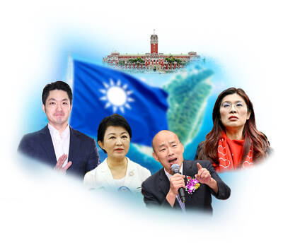
The January 2028 presidential election is already stirring to life. In seven or eight months, the primary season will kick into high gear following this November’s local elections. By this point next year, we will likely know the Democratic Progressive Party (DPP) candidate and whether the Taiwan People’s Party (TPP) will be fielding a candidate. Also around this time, the Chinese Nationalist Party (KMT) will either have already completed their primary, or it will be heading into the final stretch. By next summer, the presidential race will be in high gear. The big question is who will be the KMT’s
If one asks Taiwanese why house prices are so high or why the nation is so built up or why certain policies cannot be carried out, one common answer is that “Taiwan is too small.” This is actually true, though not in the way people think. The National Property Administration (NPA), responsible for tracking and managing the government’s real estate assets, maintains statistics on how much land the government owns. As of the end of last year, land for official use constituted 293,655 hectares, for public use 1,732,513 hectares, for non-public use 216,972 hectares and for state enterprises 34 hectares, yielding