Chinese oil rigs have been sighted just 26 nautical miles (42km), from Taiwan’s exclusive economic zone (EEZ) near Pratas Island (Dongsha Island, 東沙島), posing a threat to Taiwan’s sovereignty if left unchallenged, a brief published by the Jamestown Foundation on Tuesday said.
Pratas Island, 444km from Kaohsiung, is northeast of the South China Sea and houses a Taiwanese garrison.
The brief, titled “Rigging the Game: PRC Oil Structures Encroach on Taiwan’s Pratas Island” — referring to the People’s Republic of China — analyzed photographs and said that Beijing’s tools to pressure Taiwan now include oil rigs.
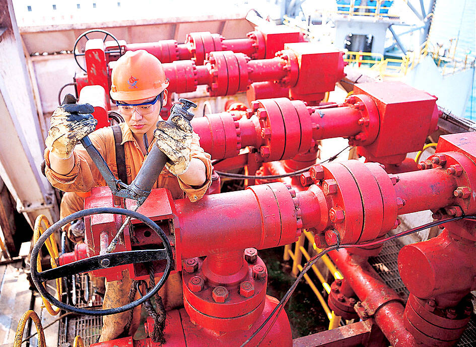
Photo: Reuters
“Oil rigs now constitute part of Beijing’s multidimensional campaign to undermine Taiwan’s sovereignty,” the report read.
There were 12 permanent or semi-permanent structures controlled by the Chinese state-owned China National Offshore Oil Corp (CNOOC) located near Pratas Island’s EEZ, it said.
“Intruding rigs that exploit natural resources without permission typify maritime gray zone operations conducted by the People’s Republic of China,” it said.
The rigs’ construction, extant since at least May 2020, demonstrates that China “rejects Taiwan’s jurisdiction” by building in areas where Taipei demands explicit permission to “construct, use, modify, or dismantle artificial islands, installations or structures,” it said.
CNOOC’s “jackets” — steel space-frame substructures of fixed offshore platforms that support the weight of an oil drilling rig — are capable of hosting infrastructure to facilitate military operations against the Pratas Islands specifically and Taiwan more generally, it said.
Structures primarily composed of jackets are easily modified and can be temporary or permanent, commercial or military, it said.
The rigs could accommodate surface-search navigation radars, other signals intelligence equipment and small-caliber guns, while the structure’s helipads could be used to launch attack helicopters, it said.
The persistent clouds over Pratas shield PRC movements and activities, making it difficult to monitor, and only countries with all-weather imaging and specialized human resources at their disposal can monitor the region, the report said.
CNOOC has deployed drilling rigs in Taiwan’s EEZ in a way that it failed to do in Vietnam’s, the report said, but added that it is both possible and essential to counter Chinese employment of dual-use infrastructure to undermine sovereignty.
While “cognizance of CNOOC’s structures and judiciously opposing them will not end all pernicious efforts ... it could slow or halt PRC progress,” while “silence and inaction, by contrast, risk encouraging further advances,” the report said.
Taiwan’s Presidential Office spokesperson Karen Kuo (郭雅慧) said yesterday that Beijing should halt its illegal marine drilling operations in waters around Taiwan.
NATIONAL SECURITY: Authorities are working to confirm the identities of the military personnel involved and investigating possible illegal conduct and regulatory violations Authorities are probing possible national security implications after Kinmen police and immigration officers on Sunday found a Chinese woman allegedly posing as a tourist while engaging in prostitution involving more than 10 military personnel. The woman, surnamed Chen (陳), has since been deported, authorities said, adding that investigators are still working to confirm the identities of those implicated, as the records only listed code names and aliases. The case stemmed from a report received by the Kinmen District Prosecutors’ Office on Friday last week from the Jinhu Precinct of the Kinmen County Police Bureau. On Sunday, police, along with the National Immigration

GLOBALGIVING: ‘ Caving to external pressure is not acceptable for an organization that has cultivated justice reform and human rights for 30 years,’ one NGO said A slew of non-government organizations (NGOs) have withdrawn from the GlobalGiving fundraising platform after it announced it would use “Chinese Taipei” instead of “Taiwan” from next month. The Taiwan Good Rice Association wrote on Facebook on Friday that it was informed on April 28 via a teleconference call of the change, which was made because the platform wanted to operate in China. Taiwan Good Rice is to terminate all cooperative relationships with GlobalGiving in response to the platform’s “unilateral and non-negotiable” decision to remove references to Taiwan, the NGO said. “Taiwan is in the official name of Taiwan Good Rice Association and the

HEAVY WEATHER: Typhoon Jangmi is due to crash straight into the Ryukyus as airlines look to shift flights to larger aircraft or cancel flights to Okinawa entirely Taiwan’s international air carriers announced flight adjustments over the weekend as Typhoon Jangmi is forecast to hit the Ryukyu Islands today and tomorrow. The Central Weather Administration (CWA) upgraded Jangmi from a tropical storm to a typhoon at 8am yesterday, with the eye located 580km south of Naha city. It was moving north at 19kph. Today, China Airlines’ CI-120, CI-121, CI-122 and CI-123 flights between Taoyuan and Naha, Okinawa, have been canceled as well as CI-132 and CI-133 between Kaohsiung and Naha. EVA Air’s BR-112, BR-113, BR-186 and BR-185 flights between Taoyuan and Naha are also canceled. Low-cost carrier Tigerair Taiwan canceled IT-230,

Chinese Nationalist Party (KMT) Chairwoman Cheng Li-wun (鄭麗文) yesterday briefed her party’s Central Standing Committee regarding her scheduled visit to the US between Monday next week and June 16, saying that her purpose would be to persuade the US that the Republic of China (ROC) Constitution was a “one China” constitution that would foster stable and peaceful cross-strait relations. The ROC Constitution is the most important defense for all Taiwanese citizens, as it upholds our democracy and has contributed to our robust economy, which aligns with international and US interests, she said. “We would not be troublemakers and drag the US under,”