Tropical Storm Usagi strengthened to a typhoon this morning and remains on track to brush past southeastern Taiwan between Friday and Sunday, the Central Weather Administration (CWA) said.
The storm, which as of 8am was still 1,100km southeast of southern Taiwan, is currently expected to enter the Bashi Channel and then turn north, moving into waters southeast of Taiwan, the CWA said.
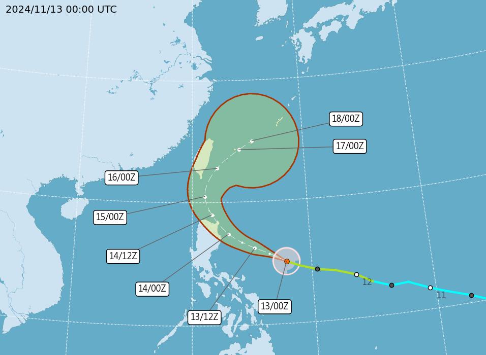
Photo courtesy of the Central Weather Administration
Because of its rapid speed — 28kph as of 8am — a sea warning for the storm could be issued tonight, rather than tomorrow, as previously forecast, the CWA said.
In terms of its impact, Usagi is to bring scattered or isolated rain showers to much of Taiwan, particularly in the east and on the Hengchun Peninsula (恆春) in the south, when it comes nearest to Taiwan between Friday and the early hours of Sunday, the CWA said.
In addition to Usagi, there are currently two other tropical storms in the Western Pacific — Toraji and Man-yi — although neither is expected to directly impact Taiwan's weather, the CWA said.
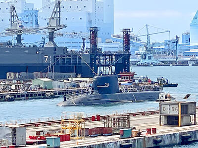
AGING: While Japan has 22 submarines, Taiwan only operates four, two of which were commissioned by the US in 1945 and 1946, and transferred to Taiwan in 1973 Taiwan would need at least 12 submarines to reach modern fleet capabilities, CSBC Corp, Taiwan chairman Chen Cheng-hung (陳政宏) said in an interview broadcast on Friday, citing a US assessment. CSBC is testing the nation’s first indigenous defense submarine, the Hai Kun (海鯤, Narwhal), which is scheduled to be delivered to the navy next month or in July. The Hai Kun has completed torpedo-firing tests and is scheduled to undergo overnight sea trials, Chen said on an SET TV military affairs program. Taiwan would require at least 12 submarines to establish a modern submarine force after assessing the nation’s operational environment and defense
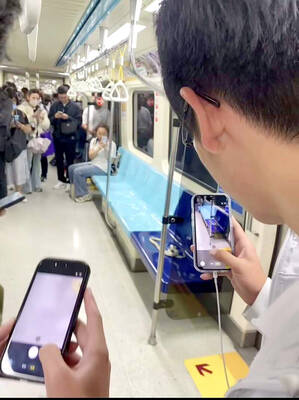
A white king snake that frightened passengers and caused a stir on a Taipei MRT train on Friday evening has been claimed by its owner, who would be fined, Taipei Rapid Transit Corp (TRTC) said yesterday. A person on Threads posted that he thought he was lucky to find an empty row of seats on Friday after boarding a train on the Bannan (Blue) Line, only to spot a white snake with black stripes after sitting down. Startled, he jumped up, he wrote, describing the encounter as “terrifying.” “Taipei’s rat control plan: Release snakes on the metro,” one person wrote in reply, referring
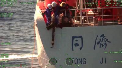
The coast guard today said that it had disrupted "illegal" operations by a Chinese research ship in waters close to the nation and driven it away, part of what Taipei sees a provocative pattern of China's stepped up maritime activities. The coast guard said that it on Thursday last week detected the Chinese ship Tongji (同濟號), which was commissioned only last year, 29 nautical miles (54km) southeast of the southern tip of Taiwan, although just outside restricted waters. The ship was observed lowering ropes into the water, suspected to be the deployment of scientific instruments for "illegal" survey operations, and the coast
Taiwan’s two cases of hantavirus so far this year are on par with previous years’ case numbers, and the government is coordinating rat extermination work, so there should not be any outbreaks, Centers for Disease Control (CDC) Director-General Philip Lo (羅一鈞) said today in an interview with the Liberty Times (the Taipei Times’ sister newspaper). An increase in rat sightings in Taipei and New Taipei City has raised concerns about the spread of hantavirus, as rats can carry the disease. In January, a man in his 70s who lived in Taipei’s Daan District (大安) tested positive posthumously for hantavirus, Taiwan’s