More than 30 popular coastal areas in Taiwan are potential rip current hot spots, National Cheng Kung University’s Coastal Ocean Monitoring Center said on Monday.
The findings are the result of a study the center conducted with backing from the Central Weather Bureau that utilized satellite images and coastal photographs.
The hot spots include Baishawan (白沙灣) beach in New Taipei City’s Shihmen District (石門), Yuguang Island (魚光島) in Tainan, Sizihwan Bay (西子灣) in Kaohsiung and Pingtung County’s Kenting (墾丁), all of which should consider installing alarm systems, center director Doong Dong-jiing (董東璟) said.

Photo: CNA
Rip currents are offshore currents that move perpendicular to the coastline. They are formed by coastal terrain and waves breaking near the shore.
They are one of the major causes of swimming injuries and drowning, Doong said.
Rip currents are difficult to spot with the naked eye due to their irregular occurrence, but more accurate observations have become possible with advanced technology such as satellite imagery and video monitoring, he said.
Each method has its restrictions, Doong said.
The satellites used in the study could take only one picture per day, while a video camera can record useful footage only during daytime, he said.
People caught in a rip current should wave their hands to draw attention, but not struggle against the current to save their strength so that they can make it back to the shore when the current abates, he said.
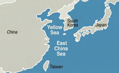
China has reserved offshore airspace in the Yellow Sea and East China Sea from March 27 to May 6, issuing alerts usually used to warn of military exercises, although no such exercises have been announced, the Wall Street Journal (WSJ) reported yesterday. Reserving such a large area for 40 days without explanation is an “unusual step,” as military exercises normally only last a few days, the paper said. These alerts, known as Notice to Air Missions (Notams), “are intended to inform pilots and aviation authorities of temporary airspace hazards or restrictions,” the article said. The airspace reserved in the alert is
South Korea is planning to revise its controversial electronic arrival card, a step Taiwanese officials said prompted them to hold off on planned retaliatory measures, a South Korean media report said yesterday. A Yonhap News Agency report said that the South Korean Ministry of Foreign Affairs is planning to remove the “previous departure place” and “next destination” fields from its e-arrival card system. The plan, reached after interagency consultations, is under review and aims to simplify entry procedures and align the electronic form with the paper version, a South Korean ministry official said. The fields — which appeared only on the electronic form

A bipartisan group of US senators has introduced a bill to enhance cooperation with Taiwan on drone development and to reduce reliance on supply chains linked to China. The proposed Blue Skies for Taiwan Act of 2026 was introduced by Republican US senators Ted Cruz and John Curtis, and Democratic US senators Jeff Merkley and Andy Kim. The legislation seeks to ease constraints on Taiwan-US cooperation in uncrewed aerial systems (UAS), including dependence on China-sourced components, limited access to capital and regulatory barriers under US export controls, a news release issued by Cruz on Wednesday said. The bill would establish a "Blue UAS

More than 6,000 Taiwanese students have participated in exchange programs in China over the past two years, despite the Mainland Affairs Council’s (MAC) “orange light” travel advisory, government records showed. The MAC’s publicly available registry showed that Taiwanese college and university students who went on exchange programs across the Strait numbered 3,592 and 2,966 people respectively. The National Immigration Agency data revealed that 2,296 and 2,551 Chinese students visited Taiwan for study in the same two years. A review of the Web sites of publicly-run universities and colleges showed that Taiwanese higher education institutions continued to recruit students for Chinese educational programs without