The Philippine government yesterday said that it has filed a diplomatic protest against Beijing after Chinese jets flew dangerously close and fired a volley of flares in the path of a Philippine air force patrol plane over a disputed shoal in the South China Sea.
The Chinese jets’ hostile actions against the Philippine military’s NC-212i light transport plane over the Scarborough Shoal (Huangyan Island, 黃岩島) on Thursday last week was the first such aerial encounter since hostilities between Beijing and Manila in the busy seaway started to flare last year.
Philippine military chief General Romeo Brawner Jr did not report any injuries or damage, but condemned the Chinese actions, which he said could have had tragic consequences.
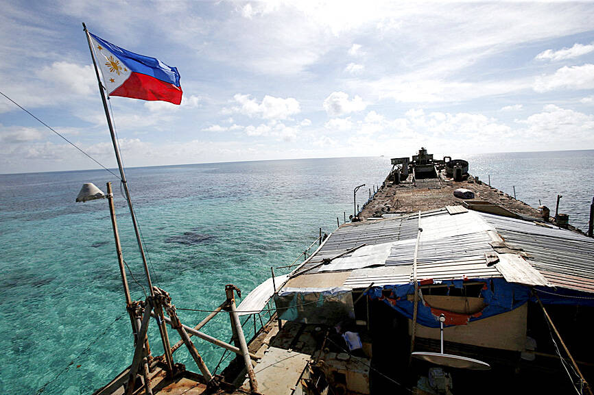
Photo: Reuters
“If the flares came into contact with our aircraft, these could have been blown into the propeller or the intake or burned our plane,” Brawner told reporters. “It was very dangerous.”
Philippine Department of Foreign Affairs spokesperson Teresita Daza said without elaborating that a diplomatic protest has been sent to China.
Philippine President Ferdinand Marcos Jr over the weekend said that the actions by the Chinese air force jets were “unjustified, illegal and reckless.”
“We call on the government of the People’s Republic of China [PRC] to cease all forms of provocative and hazardous acts that could undermine the safety of Filipino military and civilian personnel in the waters or in the skies, destabilize regional peace, and erode the trust and confidence of the international community in the PRC,” a Philippine government task force overseeing the South China Sea said on Monday.
Despite the encounter, Philippine monitoring of its airspace would be intensified, the task force said.
The Southern Theater Command of the Chinese People’s Liberation Army on Saturday said that a Philippine air force plane “illegally” entered the airspace above the shoal, which China claims disrupted combat training activities.
The command sent jets and ships to identify, track and drive away the Philippine aircraft, it added.
The command warned the Philippines to “stop its infringement, provocation, distortion and hyping-up.”
China in 2013 announced a new air defense identification zone over the East China Sea that covers a chain of disputed islands also claimed by Japan. Beijing said then that all aircraft entering the zone must notify Chinese authorities and they would be subject to emergency military measures if they did not identify themselves or obey orders from Beijing.
Washington and its allies said the move was invalid and refused to recognize it.
Chinese officials had warned that Beijing could establish a similar air defense identification zone over the South China Sea if its sovereignty over the sea passage, a key global trade and security route, was threatened.
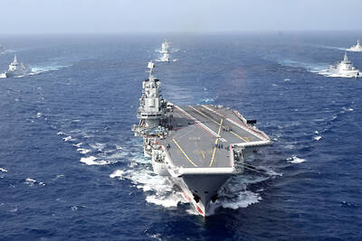
PROVOCATIVE: Chinese Deputy Ambassador to the UN Sun Lei accused Japan of sending military vessels to deliberately provoke tensions in the Taiwan Strait China denounced remarks by Japan and the EU about the South China Sea at a UN Security Council meeting on Monday, and accused Tokyo of provocative behavior in the Taiwan Strait and planning military expansion. Ayano Kunimitsu, a Japanese vice foreign minister, told the Council meeting on maritime security that Tokyo was seriously concerned about the situation in the East China and South China seas, and reiterated Japan’s opposition to any attempt to change the “status quo” by force, and obstruction of freedom of navigation and overflight. Stavros Lambrinidis, head of the EU delegation to the UN, also highlighted South China Sea
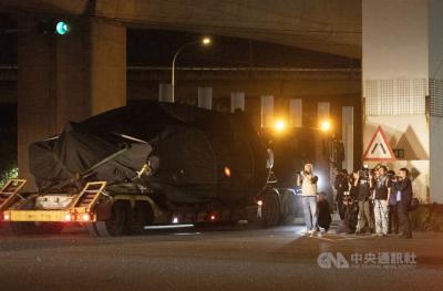
The final batch of 28 M1A2T Abrams tanks purchased from the US arrived at Taipei Port last night and were transported to the Armor Training Command in Hsinchu County’s Hukou Township (湖口), completing the military’s multi-year procurement of 108 of the tanks. Starting at 12:10am today, reporters observed more than a dozen civilian flatbed trailers departing from Taipei Port, each carrying an M1A2T tank covered with black waterproof tarps. Escorted by military vehicles, the convoy traveled via the West Coast Expressway to the Armor Training Command, with police implementing traffic control. The army operates about 1,000 tanks, including CM-11 Brave Tiger
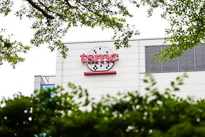
Taiwan Semiconductor Manufacturing Co (TSMC, 台積電), the world’s largest contract chipmaker, said it expects its 2-nanometer (2nm) chip capacity to grow at a compound annual rate of 70 percent from this year to 2028. The projection comes as five fabs begin volume production of 2-nanometer chips this year — two in Hsinchu and three in Kaohsiung — TSMC senior vice president and deputy cochief operating officer Cliff Hou (侯永清) said at the company’s annual technology symposium in Silicon Valley, California, last week. Output in the first year of 2-nanometer production, which began in the fourth quarter of last year, is expected to
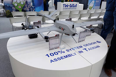
Taiwan’s drone exports surged past US$100 million in the first quarter, exceeding last year’s full-year total, with the Czech Republic emerging as the largest buyer, the Ministry of Economic Affairs said. Exports of complete drones reached US$115.85 million in the period, about 1.2 times the total recorded for all of last year, the ministry said in a report. Exports to the Czech Republic accounted for about US$100 million, far outpacing other markets. Poland, last year’s top destination, recorded about US$11.75 million in the first quarter. Taiwan’s drone exports have expanded rapidly in the past few years, with last year’s total