A large locomotive stands out among the murals depicting farming life on the walls surrounding Yingqiao Elementary School (螢橋國小). Located on busy Tingzhou Road (汀州路) in the heart of Taipei City, the school’s name translates to “firefly bridge,” indicating it’s rural past.
After doing some research, I found out that the entire Tingzhou Road, which I walk on every day, was once part of the Wanxin Railway (萬新鐵路) connecting Wanhua and New Taipei City’s Xindian District.
Discontinued in 1965, very few traces of this railroad remain, most of them subtle clues: for example, Yingqiao Elementary School’s main gate is located in a back alley instead of the main road to prevent children from walking too close to the train tracks.
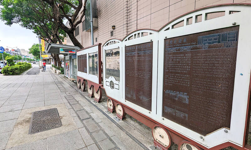
Photo: Han Cheung, Taipei Times
I decide to spend a day following the ghosts of the train tracks, which also makes for some decent urban wandering through quaint, twisting alleys.
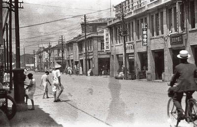
DISAPPEARED TRACKS
The 10.4km-long railroad was established in 1921 under Japanese rule, at first to transport coal from the hills south of the city. There were 17 stops in total, some of them just 500m apart. Some were freight and service stations and did not take passengers.
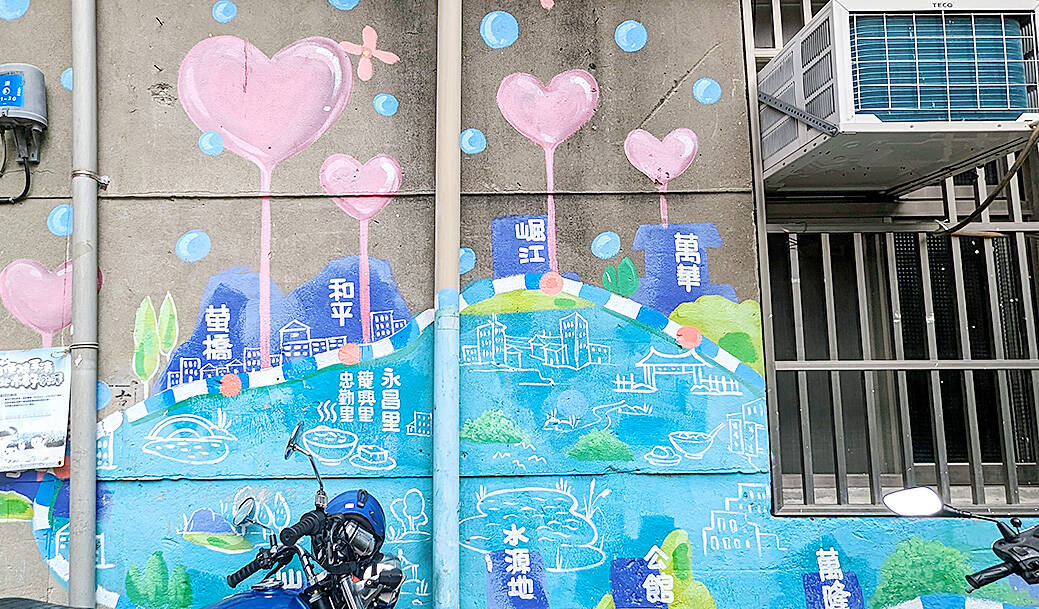
Photo: Han Cheung, Taipei Times
The railway went into decline after the completion of Beixin Road (北新路) and the advent of bus travel, and it was mostly shut down by 1965. A tiny section between Wanhua and Juejiang (堀江) stations survived as a freight line until 1970.
The first major passenger stop after Wanhua was Heping Station, located at the intersection of Tingzhou Road and Nanhai Road (南海路). No trace of it is left, but there’s a cute cartoon mural at nearby Wanxin Park (萬新綠地, 19, Lane 242, Tingzhou Rd) depicting the railroad and its various stations.
Yingqiao is next; the black tiled roof of the old station at 75 Tingzhou Road is still intact, although it is now one of the dozens of kitchenware shops in that area.
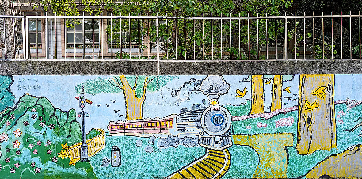
Photo: Han Cheung, Taipei Times
Guting Station follows, the station was located across the street from Heti Elementary School (河堤國小). The Xindian Culture and History Exhibition (新店文史館) interviewed local borough warden Wang Yao-shu (王耀樹), who recalls riding the train to Xindian with his grandmother to pray at a temple there. The station was a one-story brick and wood structure with black tile roofing, and it was converted into a grocery shop after the railroad was discontinued. It was demolished in the 1970s, Wang says, and today is a timber shop.
Five of the 17 stops were shut down by the Chinese Nationalist Party (KMT) after World War II; Xiangong Temple Station (仙公廟) was one of them. It was named after the alternate name for the Buddhist Shengling Temple (聖靈宮), located at the intersection of Tingzhou Road and Xinhai Road (辛亥路).
REMAINS AND A MONUMENT
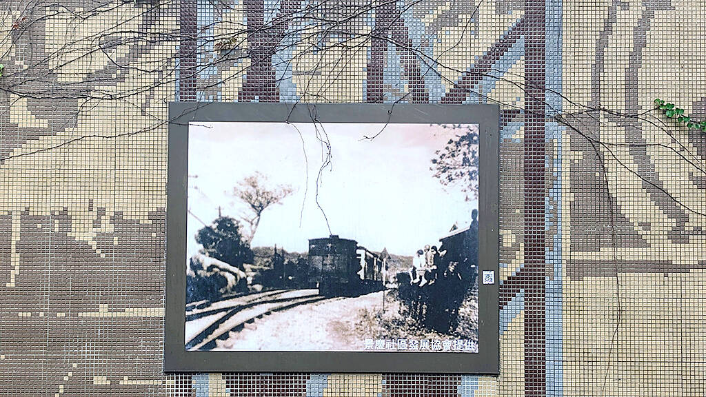
Photo: Han Cheung, Taipei Times
The first concrete indication that the railroad existed is further down the road at the former Taiwan Railways Administration dorms that were refurbished in 2010 and converted into restaurants. A plaque in front briefly details the railroad’s history.
Gongguan Station is now a Taiwan Power Co (台電) parking lot, but a metal art installation in front reminds people of what was once there. Tucked inside the alley behind is Shuiyuanding Park (水源町公園), whose entrance pathway is designed to resemble train tracks. There is a bilingual sign that further explains the history of the railway, and a pleasant elevated walkway that takes visitors through lush greenery to Treasure Hill Artist Village, a brief respite from all the concrete and exhaust.
Google Maps showed “Wanlong Station Ruins” near the MRT station of the same name, but I couldn’t find anything visible. But not too far from it, at a bus stop near Lane 39 Roosevelt Road Sec 6 (羅斯福路六段39巷), is a train-shaped monument to the railroad that offers a detailed history and old photos in both Chinese and English.
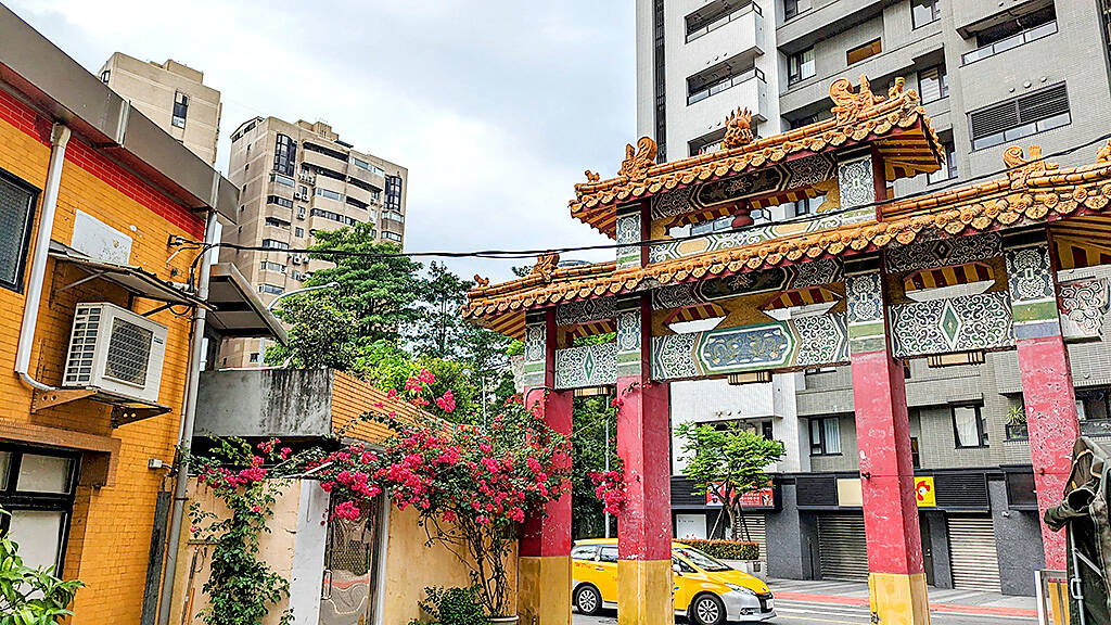
Photo: Han Cheung, Taipei Times
Seibinkaisha-Mae, meaning “in front of Bottle Making Company” is next; this is another stop that was closed down in 1945. The company is long gone, its memory preserved in the station name.
No trace of Jingmei Station remains, but the name of the street it faced, Cheqian Road (車前路, Train Front Road), is a reminder of its existence. Just 83m long, it is believed to be one of the shortest named roads in Taipei City.
There’s a few old photos of the railroad at the Beixin Bridge underpass, but after that I couldn’t find any more related sites. The rest of the route roughly follows the MRT green line to Xindian Station. The old Xindian station was located at 45 Guangming Road (光明路). Guangming Eatery (光明食堂) was a popular spot for miners getting off the train, and it was still open until several years ago.
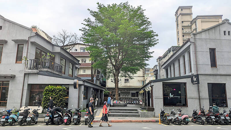
Photo: Han Cheung, Taipei Times
In 1931, the Japanese extended the line to Wenshan District Office (文山郡役所), which also no longer exists. Located at the crossroads between Han and indigenous people, that area also has a fascinating history that warrants further exploration.
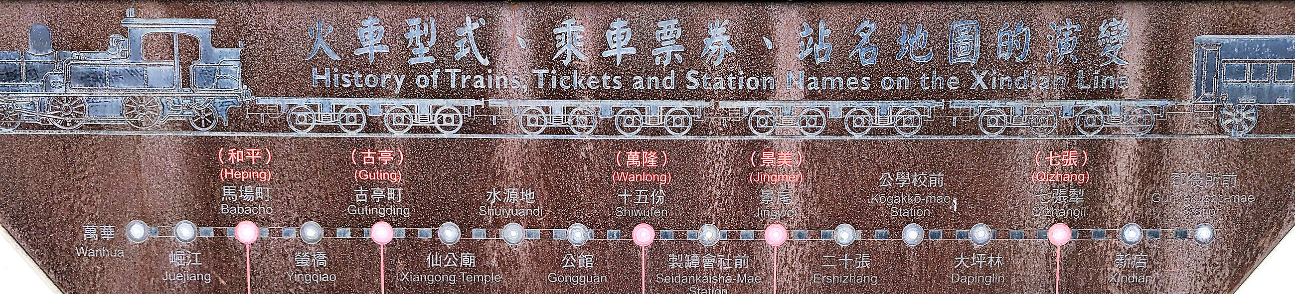
Photo: Han Cheung, Taipei Times

Taiwan’s English education system is being pulled apart by three opposing forces. Bilingual Nation 2030 pulls students toward English and global communication. Artificial Intelligence (AI) readiness pulls them toward digital judgment, verification and AI-mediated work. But Taiwan’s old exam culture pulls them back toward memorization, grammar drills, timed reading and correct answers. If the education system keeps using old exams to define success, it risks producing graduates who are neither genuinely bilingual nor genuinely AI-ready, but trained for tasks machines can already perform. The first force is Bilingual Nation 2030. Launched in 2018, the policy aimed to “help Taiwan’s workforce connect

It seems every few days one bumps into one of those “real man” comments in which Taiwan is urged to “face reality” or similar, and “make a deal,” with the speaker implying that soon it will be too late. “Deal” advocates always present themselves as having a superior grip on reality, and the manly ability to make the “hard choice.” Their testosterone-laden language often echoes that of Taiwan sellout advocates. Note that such commentary always specifies a process (“make a deal, work with, make progress”), never the end state of what occupation by a violent authoritarian colonialist state will entail. In
There are shadowy cabals plotting to sell out Taiwan to be annexed by China, by invasion if necessary. Fortunately, they are buffoons. In 2019, former Bamboo Union gangster and founder of the China Unification Promotion Party (CUPP), Chang An-le (張安樂, colorfully known as “White Wolf”), led a protest at the Legislative Yuan against comments made by then-premier Su Tseng-chang (蘇貞昌) that in the event of an attack by China, he would never surrender, but would protect the nation by fighting to the end, even if he only had a broom. Chang had party members bring a wooden casket that they
June 1 to June 7 "If all Taiwanese were as afraid of dying as you, then what would happen?” Physician Shih Chiang-nan (施江南) reportedly said this to his wife Chen Chiao-tung (陳焦桐) after she urged him to stop intervening on behalf of Taiwanese soldiers stranded overseas after serving in the Japanese Army during World War II. Shih had clashed with high-ranking officials over the issue, engaged in several heated arguments with Taiwan governor-general Chen Yi (陳儀) and allegedly shouted at general Ko Yuan-fen (柯遠芬), chief of staff of the Taiwan Garrison Command, over