There’s a rather charming idiom by which Chinese-speakers describe some of their most enchanting landscapes: renjianxianjing (人間仙境), which means “fairyland on earth.” It’s become a bit of a tourist cliche, but enchanting is definitely the word for the majestic mountain fastness of Taiwan’s wild interior, which is covered in great forests, where ancient god-like giants tower above the surrounding trees, their limbs stretching high above their competitors in search of the sun. These aren’t monsters from some fairy tale, however, but huge red cypress trees that grow to a prodigious age and vast dimensions in the cool, moist and undisturbed remoteness of the nation’s interior.
The lower temperatures and prevailing mistiness at these medium-high altitudes are perfect conditions for the cloud forests that clothe the mountains there. Here, in a wide arc stretching from the New Taipei City-Taoyuan border all the way to the slopes of Dawu Mountain (大武山) in southern Pingtung, Taiwan red cypress trees once grew to the mind-boggling age of 2,000 or even 3,000 years. Unfortunately, the Japanese saw these magnificent trees as a perfect hardwood source. Tree numbers have dwindled greatly since the colonial period, and continue to be depleted thanks to illegal logging activities of so-called “mountain rats (山老鼠).” Even today though, some of the world’s largest trees can still be found here, if you look in the right places: sheltered slopes above mountain streams at altitudes between 900m and 2,600m.
For the average visitor, the easiest ancient trees to reach are in the famous grove at Lalashan (拉拉山) in southern Taoyuan — a group of about twenty majestic trees that can be enjoyed over a long day trip from Taipei by visitors with their own transport. Next up, and possibly even more popular than Lalashan nowadays, is Smangus Village in Hsinchu County, which features the third largest tree in Taiwan, with a circumference near the base of 16m.
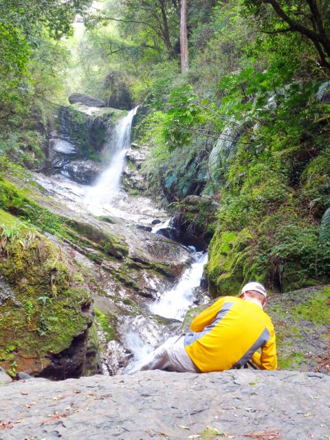
Photo: Richard Saunders
Rather than joining the tourists at Smagus, though, if you can spare two days a bit more effort, head instead for the quieter groves at nearby Jhensibao (鎮西堡). Just a decade ago, this place was still largely unknown to the general public, and although the overflow from Smangus is now heading here, the trails are a little longer, a little rougher and a lot steeper, which naturally keeps visitor numbers down.
The trip begins at the Atayal Aboriginal village of Singuang (新光) in a remote corner of southern Hsinchu County, from where it’s a further seven kilometers to the trailhead. With the increasing popularity of Jhensibao, this road is bound to be improved sometime soon, but as of my last visit it was still very slow going and rough. The trailhead is marked by a couple of small shacks (where snacks and drinks are sold on weekends) and a parking area.
Just after the car park, take the track that veers off to the right, and in a few minutes, it turns into a dirt trail, climbing steadily through the forest zigzagging to a clearly signposted junction (2.5km from the trailhead).
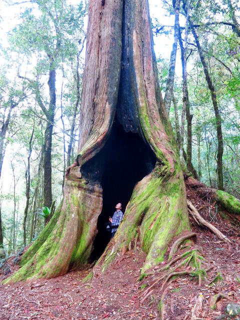
Photo: Richard Saunders
It’s decision time.
Jhensibao has two ancient tree groves. The more popular by far is Grove B, which is an easier hike (4-5 hours return) and has the largest number of impressive trees. Grove A is a much steeper walk, and apart from one huge monster, the trees aren’t quite as impressive. However, there’s a good chance you’ll meet no one on the walk up there and back, and fit hikers can scramble all the way up to the small but mysterious Dulongtan (毒龍潭), literally “Poison Dragon Pool,” allow at least six hours for the return trip if planning to go this far.
To explore Grove B simply follow the clear trail straight ahead uphill for another kilometer, until it forks again at the start of the loop trail around giant trees with names such as the King, the Queen, Adam and Eve.
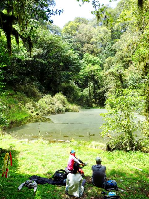
Photo: Richard Saunders
For Grove A, turn right at the junction near the 2.5km mark and climb steeply, reaching the first tree after about 40 tiring minutes. From here, follow the plastic trail-marking ribbons carefully to keep to the correct route. About 15 minutes after the first giant tree is the “squashed flat” tree, which, as the name implies, is strangely deformed. To the left and behind it, a trail leads to Dulongtan, high in the hills above. It’s a steep three-hour walk from this point up to the lake and back, however, so check there’s plenty of time to get up and back to the trailhead before dark.
Richard Saunders is a classical pianist and writer who has lived in Taiwan since 1993. He’s the founder of a local hiking group, Taipei Hikers, and is the author of six books about Taiwan, including Taiwan 101 and Taipei Escapes. Visit his Web site at www.taiwanoffthebeatentrack.com.
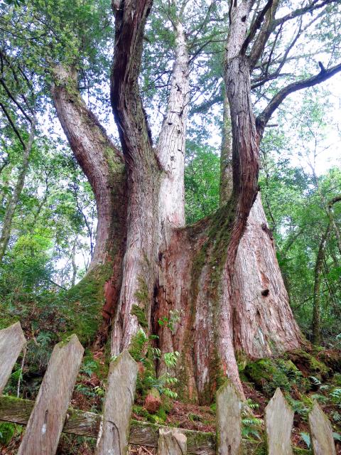
Photo: Richard Saunders
If one asks Taiwanese why house prices are so high or why the nation is so built up or why certain policies cannot be carried out, one common answer is that “Taiwan is too small.” This is actually true, though not in the way people think. The National Property Administration (NPA), responsible for tracking and managing the government’s real estate assets, maintains statistics on how much land the government owns. As of the end of last year, land for official use constituted 293,655 hectares, for public use 1,732,513 hectares, for non-public use 216,972 hectares and for state enterprises 34 hectares, yielding

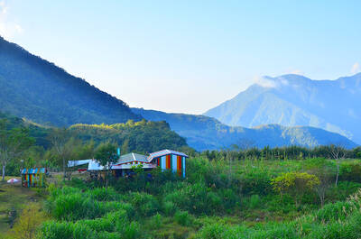
The small platform at Duoliang Train Station in Taitung County’s Taimali Township (太麻里) served villagers from 1992 to 2006, but was eventually shut down due to lack of use. Just 10 years later, the abandoned train station had become widely known as the most beautiful station in Taiwan, and visitors were so frequent that the village had to start restricting traffic. Nowadays, Duoliang Village (多良) is known as a bit of a tourist trap, with a mandatory, albeit modest, admission fee of NT$10 giving access to a crowded lane of vendors with a mediocre view of the ocean and the trains
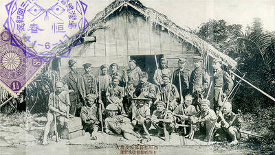
Traditionally, indigenous people in Taiwan’s mountains practice swidden cultivation, or “slash and burn” agriculture, a practice common in human history. According to a 2016 research article in the International Journal of Environmental Sustainability, among the Atayal people, this began with a search for suitable forested slopeland. The trees are burnt for fertilizer and the land cleared of stones. The stones and wood are then piled up to make fences, while both dead and standing trees are retained on the plot. The fences are used to grow climbing crops like squash and beans. The plot itself supports farming for three years.

For many people, Bilingual Nation 2030 begins and ends in the classroom. Since the policy was launched in 2018, the debate has centered on students, teachers and the pressure placed on schools. Yet the policy was never solely about English education. The government’s official plan also calls for bilingualization in Taiwan’s government services, laws and regulations, and living environment. The goal is to make Taiwan more inclusive and accessible to international enterprises and talent and better prepared for global economic and trade conditions. After eight years, that grand vision is due for a pulse check. RULES THAT CAN BE READ For Harper Chen (陳虹宇), an adviser