The Centers for Disease Control (CDC) cautioned travelers planning to visit China to avoid coming into contact with fowl, after the country reported the world’s second confirmed case of avian influenza strain H10N8 infecting a human.
The CDC said it confirmed with Chinese health authorities that the second case of H10N8 was detected in Jiangxi Province, which is where the first-ever incident of a human contracting the bird flu subtype was reported in November last year.
The agency urged the public to heed a second-level travel alert that has been issued for Jiangxi; as well as for the Chinese provinces of Guangdong, Zhejiang, Jiangsu, Hunan and Fujian; and the cities of Shanghai and Beijing.
The rest of China — excluding Hong Kong and Macau — is under “watch” status, it added.
The H10N8 virus was previously detected at a live poultry market in China’s Guangdong Province and in its South Dongting Lake wetland, as well as in samples from migratory birds and poultry in Japan, South Korea, the US, Italy and Sweden, the agencies said.
The Council of Agriculture in 2005 detected the virus in feces at an aquatic bird habitat in Taiwan, but has not found the strain in any local poultry, the CDC said.
Experiments have shown that H10N8 is low pathogenic virus — meaning that it will likely be asymptomatic or cause only mild illness in birds, as opposed to the severe disease brought on by a highly pathogenic strain — the centers said, but added that the flu subtype requires further monitoring as it has the potential to infect mammals virulently.
However, the CDC said that genetic analysis of the H10N8 strain isolated from the Chinese patient has not shown any indication of genetic recombination with human flu viruses, suggesting that there is little risk of widespread human-to-human transmission.
None of the 250,000 samples collected from flu and unexplained pneumonia patients in Taiwan since 1999 have contained the H10N8 subtype, the agency added.

Taiwan Semiconductor Manufacturing Co (TSMC, 台積電), the world’s largest foundry service provider, yesterday said that global semiconductor revenue is projected to hit US$1.5 trillion in 2030, after the figure exceeds US$1 trillion this year, as artificial intelligence (AI) demand boosts consumption of token and compute power. “We are still at the beginning of the AI revolution, but we already see a significant impact across the whole semiconductor ecosystem,” TSMC deputy cochief operating officer Kevin Zhang (張曉強) said at the company’s annual technology symposium in Hsinchu City. “It is fair to say that in the past decade, smartphones and other mobile devices were
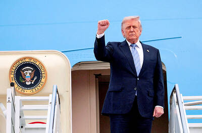
US-CHINA SUMMIT: MOFA welcomed US reassurance of no change in its Taiwan policy; Trump said he did not comment when Xi talked of opposing independence US President Donald Trump yesterday said he has not made a decision on whether to move forward with a major arms package for Taiwan after hearing concerns about it from Chinese President Xi Jinping (習近平). Trump’s comments on Taiwan came as he flew back to Washington after wrapping up critical talks in which both leaders said important progress was made in stabilizing US-China relations even as deep differences persist between the world’s two biggest powers on Iran and Taiwan. “I will make a determination,” Trump said, adding: “I’ll be making decisions. But, you know, I think the last thing we need right
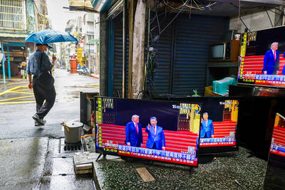
TAIWAN ISSUE: US treasury secretary Scott Bessent said on the first day of meetings that ‘it wouldn’t be a US-China summit without the Taiwan issue coming up’ There were no surprises on the first day of the summit between US President Donald Trump and Chinese President Xi Jinping (習近平), the Mainland Affairs Council (MAC) said yesterday, as the government reiterated that cross-strait stability is crucial to the Asia-Pacific region, as well as the world. As the two presidents met for a highly anticipated summit yesterday, Chinese state media reported that Xi warned Trump that missteps regarding Taiwan could push their two countries into “conflict.” Trump arrived in China with accolades for his host, calling Xi a “great leader” and “friend,” and extending an invitation to visit the White House
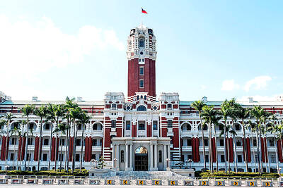
SECURITY: Taipei presses the US for arms supplies, saying the arms sales are not only a reflection of the US security commitment to Taiwan but also serve as a mutual deterrent against regional threats Taiwan is committed to preserving the cross-strait “status quo” and contributing to regional peace and stability, the Presidential Office said yesterday. “It is an undeniable fact that the Republic of China is a sovereign and independent democratic nation,” Presidential Office spokeswoman Karen Kuo (郭雅慧) reiterated, adding that Beijing has no right to claim sovereignty over Taiwan. The statements came after US President Donald Trump warned against Taiwanese independence. Trump wrapped up a state visit to Beijing on Friday, during which Chinese President Xi Jinping (習近平) had pressed him not to support Taiwan. Taiwan depends heavily on US security backing to deter China from carrying