Britain said yesterday it had thwarted "at least" four major terror attacks since the July 7 bombings last year, while up to 24 separate threats were under investigation, as police probed the foiled bid to explode aircraft en route to the US.
Police had swooped on key suspects on Thursday over an alleged plot to wreak mass murder by smuggling liquids in hand baggage onto US-bound planes to assemble into bombs.
Questioned about how many terrorist attacks had been stopped since the London bombings in July last year, Home Secretary John Reid told the BBC News 24 television channel on yesterday: "I can tell you that at least four major plots have been thwarted."
Reid said that the plots would have led to significant loss of life and indicated that up to two dozen terror investigations were currently being pursued, confirming reports that police were hunting that number of terror cells in Britain.
"I'm not going to confirm an exact number but I wouldn't deny that that would indicate the number of major conspiracies that we are trying to look at," Reid said.
Regarding Thursday's terror raids, a Metropolitan Police spokewoman said yesterday that enquiries were ongoing and searches continuing while 23 suspects remained in custody.
"We think we have the main suspects in this particular plot," Reid added.
"I have to be honest and say on the basis of what we know, there could be others out there ... so the threat of a terrorist attack in the UK is still very substantial," he said.
Britain on Thursday upped its security alert to "critical."
Meanwhile, the global investigation into last week's alleged plot has turned increasingly to Pakistan and Osama bin Laden's al-Qaeda network, amid fears that worse plans could be afoot.
The Times yesterday said one of the suspects under arrest could be "Al-Qaeda's leader" in Britain. However, the newspaper did not name the suspect.
also see stories:
Terrorism experts cast doubt on al-Qaeda tie to arrests
Britons and others cast skeptical eyes on terror plot claims
Foiled UK terror plot casts cloud on airline industry
Taiwan has arranged for about 8 million barrels of crude oil, or about one-third of its monthly needs, to be shipped from the Red Sea this month to bypass the Strait of Hormuz and ease domestic supply pressures, CPC Corp, Taiwan (CPC, 台灣中油) said yesterday. The state-run oil company has worked with Middle Eastern suppliers to secure routes other than the Strait of Hormuz, through which about 20 percent of the world’s oil and liquefied natural gas typically passes, CPC chairman Fang Jeng-zen (方振仁) said at a meeting of the legislature’s Economics Committee in Taipei. Suppliers in Saudi Arabia have indicated they
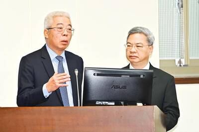
South Korea has adjusted its electronic arrival card system to no longer list Taiwan as a part of China, a move that the Ministry of Foreign Affairs said would help facilitate exchanges between the two sides. South Korea previously listed “Taiwan” as “Taiwan (China)” in the drop-down menus of its online arrival card system, where people had to fill out where they came from and their next destination. The ministry had requested South Korea make a revision and said it would change South Korea’s name on Taiwan’s online immigration system from “Republic of Korea” to “Korea (South),” should the issue not be

CCP ‘PAWN’? Beijing could use the KMT chairwoman’s visit to signal to the world that many people in Taiwan support the ‘one China’ principle, an academic said Chinese Nationalist Party (KMT) Chairwoman Cheng Li-wun (鄭麗文) yesterday arrived in China for a “peace” mission and potential meeting with Chinese President Xi Jinping (習近平), while a Taiwanese minister detailed the number of Chinese warships currently deployed around the nation. Cheng is visiting at a time of increased Chinese military pressure on Taiwan, as the opposition-dominated Legislative Yuan stalls a government plan for US$40 billion in extra defense spending. Speaking to reporters before going to the airport, Cheng said she was going on a “historic journey for peace,” but added that some people felt uneasy about her trip. “If you truly love Taiwan,

Tainan, Taipei and New Taipei City recorded the highest fines nationwide for illegal accommodations in the first quarter of this year, with fines issued in the three cities each exceeding NT$7 million (US$220,639), Tourism Administration data showed. Among them, Taipei had the highest number of illegal short-term rental units, with 410. There were 3,280 legally registered hotels nationwide in the first quarter, down by 14 properties, or 0.43 percent, from a year earlier, likely indicating operators exiting the market, the agency said. However, the number of unregistered properties rose to 1,174, including 314 illegal hotels and 860 illegal short-term rental