Support has sunk further for Japan’s embattled ruling coalition, a new poll showed yesterday, after Japanese Prime Minister Shigeru Ishiba’s party suffered its worst election result in 15 years.
Backing for the government nosedived to 34 percent, while its disapproval rating was 51 percent, the Yomiuri Shimbun survey showed.
The survey showed that 51 percent supported Ishiba’s Cabinet, while 32 percent did not.

Photo: EPA-EFE
Ishiba took office on Oct. 1.
A separate poll by Kyodo News released on Tuesday had 53 percent saying they did not want the ruling coalition of the Liberal Democratic Party (LDP) and Komeito to stay in power.
Sunday’s snap election left the coalition short of a majority for the first time since 2009 — when it was booted out of power for three years — 18 seats short of the 233 needed.
Ishiba has already indicated he would seek to govern a minority administration and seek approval from other parties to get legislation through parliament.
That expectation was reinforced late on Tuesday when the head of potential kingmaker the Democratic Party for the People (DPP), which has 28 seats, ruled out joining the LDP in a coalition government.
“We will give all of our strength to achieve our policies and we will not join the coalition,” DPP head Yuichiro Tamaki told a news conference.
However, Ishiba is still courting other parties to secure parliamentary approval to remain prime minister in a vote reportedly slated for Nov. 11.
To win their support, analysts said that Ishiba might agree to tax cuts and stimulus spending that the DPP campaigned for in the run-up to the snap election.
Also likely seeking to become prime minister will be Yoshihiko Noda, head of the Constitutional Democratic Party, whose seat tally rose from 96 in the last election to 148.

SECURITY: As China is ‘reshaping’ Hong Kong’s population, Taiwan must raise the eligibility threshold for applications from Hong Kongers, Chiu Chui-cheng said When Hong Kong and Macau citizens apply for residency in Taiwan, it would be under a new category that includes a “national security observation period,” Mainland Affairs Council (MAC) Minister Chiu Chui-cheng (邱垂正) said yesterday. President William Lai (賴清德) on March 13 announced 17 strategies to counter China’s aggression toward Taiwan, including incorporating national security considerations into the review process for residency applications from Hong Kong and Macau citizens. The situation in Hong Kong is constantly changing, Chiu said to media yesterday on the sidelines of the Taipei Technology Run hosted by the Taipei Neihu Technology Park Development Association. With

CARROT AND STICK: While unrelenting in its military threats, China attracted nearly 40,000 Taiwanese to over 400 business events last year Nearly 40,000 Taiwanese last year joined industry events in China, such as conferences and trade fairs, supported by the Chinese government, a study showed yesterday, as Beijing ramps up a charm offensive toward Taipei alongside military pressure. China has long taken a carrot-and-stick approach to Taiwan, threatening it with the prospect of military action while reaching out to those it believes are amenable to Beijing’s point of view. Taiwanese security officials are wary of what they see as Beijing’s influence campaigns to sway public opinion after Taipei and Beijing gradually resumed travel links halted by the COVID-19 pandemic, but the scale of

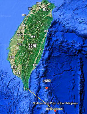
A US Marine Corps regiment equipped with Naval Strike Missiles (NSM) is set to participate in the upcoming Balikatan 25 exercise in the Luzon Strait, marking the system’s first-ever deployment in the Philippines. US and Philippine officials have separately confirmed that the Navy Marine Expeditionary Ship Interdiction System (NMESIS) — the mobile launch platform for the Naval Strike Missile — would take part in the joint exercise. The missiles are being deployed to “a strategic first island chain chokepoint” in the waters between Taiwan proper and the Philippines, US-based Naval News reported. “The Luzon Strait and Bashi Channel represent a critical access

Pope Francis is be laid to rest on Saturday after lying in state for three days in St Peter’s Basilica, where the faithful are expected to flock to pay their respects to history’s first Latin American pontiff. The cardinals met yesterday in the Vatican’s synod hall to chart the next steps before a conclave begins to choose Francis’ successor, as condolences poured in from around the world. According to current norms, the conclave must begin between May 5 and 10. The cardinals set the funeral for Saturday at 10am in St Peter’s Square, to be celebrated by the dean of the College