Centuries ago, a Bunun woman who had married into the Rukai tribe was banished for eating snake meat. For the Rukai, the snake is a sacred animal from whom they are descended and hunting or eating it is forbidden. The exiled woman agreed to wait for her husband at a rock on a remote mountain, but he never came. As she waited, she passed the time drawing figures in the rock, before finally returning to her community. This is the legendary origin of Taiwan’s only known prehistoric rock carvings: the Wanshan petroglyphs (萬山岩雕) in Kaohsiung.
Archaeologists are still unclear who actually carved these, why they did so or when, although the current estimate is between 500 and 1600 years ago. The petroglyphs were first reported in academia in 1978 with the site TKM1. Subsequent sites were discovered or reported in 1979 (TKM2), 1984 (TKM3) and 2002 (TKM4).
THE APPROACH
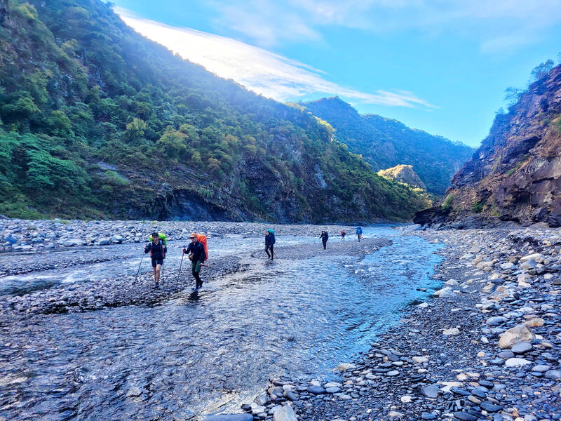
Photo by Tyler Cottenie
A visit to the petroglyphs is a big commitment, requiring three to four days for the return trip. The journey starts near the end of the road in Maolin District (茂林), a mountainous area settled by the Rukai in Kaohsiung. From Duona (多納), go downstream a short distance then turn right and go upstream along the Jhuokou River (濁口溪) for several kilometers until the point where it splits into the Shanhuanunu River (山花奴奴溪) on the right and the Malishan River (馬里山溪) on the left. Finally, proceed a short distance up the Malishan until reaching the trailhead.
This first part of the journey can now be done in a 4x4 vehicle arranged locally, but we chose to walk in to save money. As it turned out, the walk itself was quite beautiful and worth doing slowly on foot. The river winds around the base of Zumu Mountain (足母山), the valley features stunning vertical walls in places and the water is pristine. River tracing shoes are recommended as the river must be crossed over 20 times.
From the unmarked trailhead, the trail ascends steeply to a high point and then descends gradually on the other side to another stream. A steel cable at the high point bears witness to logging operations done in the area in decades past. The remains of the foot path to Wanshan (萬山, oponoho) tribe’s original village location near here can also be seen during the hike, and makes for a good side trip on the way to or from the petroglyphs.
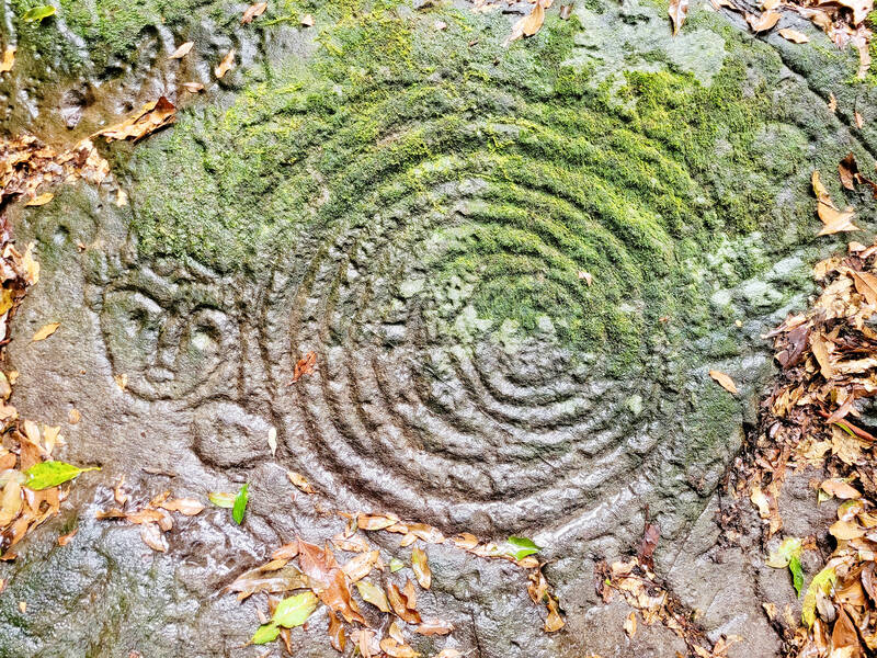
Photo by Tyler Cottenie
After reaching the next stream, it is best to make camp for the night. Legally, this must be done on the south side of the stream on a large sandy patch, as the north side of the stream is a nature reserve. However, locals have set up a magnificent campsite on the north side just a short walk up the hill, complete with a tarp lean-to, stone tables and chairs, a fireplace and running water piped in from a stream. Beware of traps near the trail; on the day we visited the petroglyphs, we came across a masked palm civet caught in a spring trap that had broken its front legs. It did not survive the day.
THE FOUR SITES
The following day, the first three of the four known sites can be visited, or all four if you’re very ambitious. It starts with a short walk upstream to a fork in the river where you turn right. Only a minute or two up this stream there is a new wooden bridge and ropes on the opposite bank showing the way up. The trail is rugged and seldom walked but quite obvious, despite the lack of ribbons marking the way.
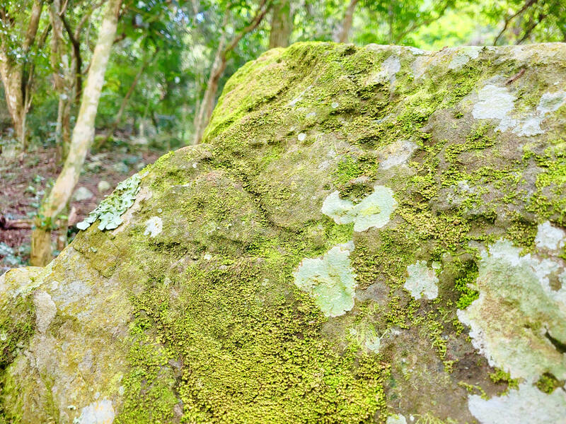
Photo by Tyler Cottenie
The first site you will pass is TKM2 (祖布里里, translated as tsubulili or copolrilri). The main feature here is a series of footprints formed not by carved lines but by a multitude of dimples arranged to form the outline of footprints. We were only able to spot one of these footprints on our visit, as the rest were likely covered in moss. Most of the Wanshan petroglyphs are in fact covered by moss or weathered so much that it is hard to make them out. As they are in such a remote location, preserving them while also making them more accessible and visible to the public poses quite a challenge.
The next site, TKM4 (大軋拉烏, dagalawu, dagala-u or takalravoe), was the most recent discovery, and the one with the greatest number of glyphs, though they are perhaps the most difficult to make out. Apparently, the majority are concentric circles, but we were actually unable to find any on our visit. There are cameras set up here, as at the other sites, to monitor the activities of all visitors and discourage any damage to the site. Even guided by these cameras, we were unable to see anything in the rocks at which they were aimed.
After TKM4, the trail descends to a creek and then goes up the other side to TKM1 (孤巴察峨, kopaca’e or gubatsaeh). The carvings here are the most obvious, in terms of both how clear they are and how recognizable they are. Dozens of spirals adorn the rock, as do several human faces, snake figures and a standing human figure. The latter is likely a representation of the Snake King who protects the ancestral home of the Rukai, Little Ghost Lake. To get a closer look at the carvings, one can stand on the rock itself but shoes must first be removed.
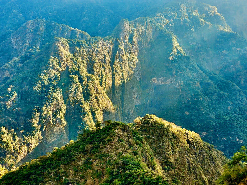
Photo by Tyler Cottenie
After returning to the fork in the river, heading up the stream on the other side takes you to the final petroglyph site, TKM3 (莎娜奇勒娥, sanaginaeh or salrakinae). The trip involves a risky crossing of a steep landslide with no handholds, so a new route to this site will likely be needed in the near future. TKM3’s carvings are the most abstract of all, mostly a collection of lines and dimples in the sandstone, perhaps representing the origin and spread of the Rukai people.
LOGISTICS
Visiting the petroglyphs (legally) is no simple task; in addition to the time commitment, there is a lot of bureaucracy to deal with. Taiwan’s mountains are already infamous for their convoluted permit processes, but the Wanshan petroglyphs take it to the next level. Three permits from three different agencies are required and the order of application matters. Of course, no English application service is available, either.
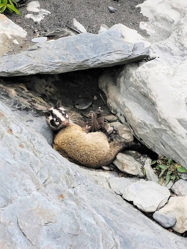
Photo by Tyler Cottenie
A mountain entry permit from the police must be obtained first. This can be done online (nv2.npa.gov.tw), although the Wanshan petroglyphs are not in their list of destinations, so your best bet is to pick one of the options for Maolin District. The access trail on Day 1 passes through the Chuyun Mountain Nature Reserve (出雲山自然保留區), so a separate permit (pa.forest.gov.tw) for this is required. Your planned campsite on the opposite side of the river must be listed with latitude and longitude, as they don’t want you staying at the beautiful established campsite within the reserve itself. One or two phone calls may be necessary to push the approval process along as well, which was stalled for a week when I applied.
It’s important to get these two permits approved first, as they must both be secured before the final permit application can take place, for the petroglyphs themselves. Your visit must be registered with the Ministry of Culture, and this is done on behalf of applicants by the Kaohsiung Bureau of Cultural Affairs (heritage.kcg.gov.tw). An agreement must be signed by each member of the group (all signatures on the same page) and submitted with proof of the other two permits. No permit is actually issued; it is simply a registration process. Knowing whether or not you’ve actually been registered may also require a phone call or two: their notification system “had a glitch” and didn’t notify me when the process was completed.

Ajay Verma, a consultant gastroenterologist at Kettering general hospital in Northamptonshire, says our gut is a “complex machine.” “It is constantly providing us with the nutrition we need, initially to grow and develop, and then for us to survive, thrive and repair from injury and illness.” How can we keep it functioning well? Put simply: “Make sure what you put into it is balanced, and that you clear out its waste products adequately,” Verma says. “In a general gastroenterology clinic, the most common conditions we see are irritable bowel syndrome (IBS), gastroesophageal reflux disease, inflammatory bowel disease and constipation,” says Nisha
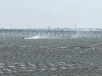
The arithmetic is straightforward and uncomfortable. By the end of 2025, Taiwan had committed itself to a 50-30-20 electricity mix — half natural gas, 30 per cent coal, 20 per cent renewables. The Ministry of Economic Affairs’s (MOEA) own monthly energy reports tell a different story. Natural gas reached 47.8 per cent of generation last year. Coal stood at 35.4 per cent, comfortably above its target ceiling. Renewables came in at 13.1 per cent, well short of the 20 per cent Taipei had pledged a decade earlier. Installed renewable capacity reached roughly half of the 12 gigawatts (GW) the government

Last week US President Donald Trump was asked by a reporter whether he would speak on the phone to the President of Taiwan. “l’ll speak to him. I speak to everybody. We have that situation very well in hand,” Trump said. This marked the second time in a couple of weeks he had said he would talk to the President of Taiwan. In 2016 he famously took a call from then-president Tsai Ing-wen (蔡英文), when he was president-elect. Despite warnings that the apocalypse was nigh because of a phone call, the world quickly forgot about the conversation between two democratically-elected presidents.
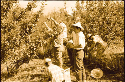
May 25 to May 31 Few believed that apples could be cultivated on a commercial scale in Taiwan’s high mountains. When horticulturalist Cheng Chao-hsiung (程兆熊) first proposed the idea in 1955, both American and Taiwanese colleagues dismissed it as implausible, arguing that temperate fruit could not be reliably grown on a subtropical island, especially on rugged terrain. However, it was this terrain in the Central Mountain Range where many Chinese Civil War veterans were resettled in the late 1950s. With limited job prospects and no family in Taiwan, they were placed on cooperative farms aimed toward self-sufficiency. Some say the conditions