Wherever I go, I always seem to end up in a graveyard. This time around, the cemetery belonged to an Aboriginal village in the northeastern part of Pingtung County. Sagaran, known to Chinese-speakers as Koushe (口社), is dominated by members of the Austronesian Paiwan community, Taiwan’s second-largest indigenous ethnic group.
Wanting to stretch my legs after a 90-minute motorbike ride, I parked on the edge of the village, and set off on foot down a narrow road. Just as I’d begun to relish the butterfly-rich forest to my left, the tarmac petered out in a dense and somewhat chaotic cluster of graves.
CEMETERY OF SECRETS
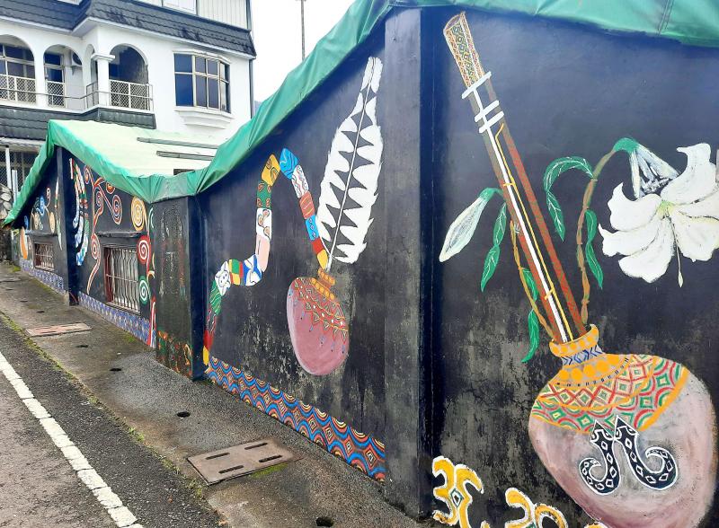
Photo: Steven Crook
There are several family tombs in Sagaran’s little cemetery, and the more prominent surnames include Chan (詹), Chang (張) and Liu (劉). These names aren’t, of course, remotely Austronesian. They were foisted on Paiwan households soon after Chiang Kai-shek’s (蔣介石) Chinese Nationalist Party (KMT) took control of Taiwan at the end of World War II.
Taiwanese Aborigines have been taking non-indigenous names since the Qing dynasty. Subsumed by waves of Han migrants from China, and often facing severe discrimination, some communities opted to disguise their ethnic origins.
During the final decade of the 1895-1945 period of rule by Tokyo, many Aborigines were forced to adopt Japanese names. When the KMT arrived, those identities were dropped, and Han civil servants began assigning Chinese family and given names to those who lacked them.
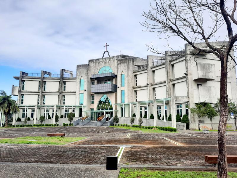
Photo: Steven Crook
As was typical of KMT governance, this was done in an arbitrary and insensitive manner. Some indigenous communities were saddled with surnames that are almost unknown in Taiwan. So much for assimilation. In several instances, siblings ended up with different surnames, and some men received different family names to their paternal grandfathers. So much for Han traditionalists insisting that bloodlines are all-important.
In a few burial grounds — like the one at Wutai (霧台), 9km east of Sagaran as the crow flies — the majority of graves aren’t marked in Chinese script, but in the local Austonesian language, rendered in the Latin alphabet.
I scoured Sagaran’s cemetery for romanized Paiwan names, and found several. Most intriguing of all was a tombstone that bears three languages: Paiwan, Chinese and Japanese.
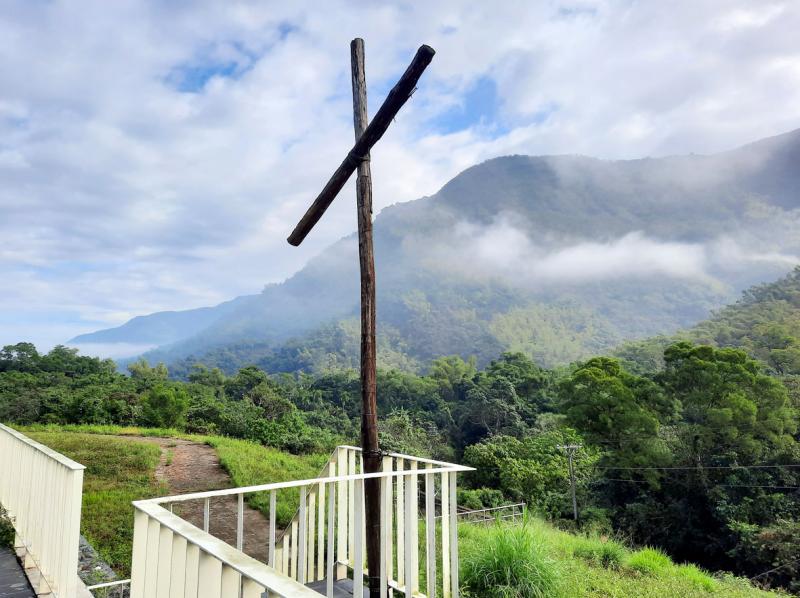
Photo: Steven Crook
The five people interred there died between 1939 and 1980. Two infants who passed away before 1945 are listed with their Paiwan and Japanese names, while three individuals who met their maker after World War II have Paiwan and Chinese names. (All birth and death dates are shown according to the Republic of China calendar.)
The tombstone itself looks almost pristine. It wouldn’t surprise me if it replaced monolingual markers carved during less pluralistic times.
TOURIST ATTRACTIONS
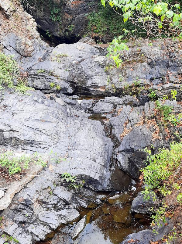
Photo: Steven Crook
Even though I spent most of my time in Sagaran looking at graves, I should mention a couple of conventional tourist attractions near the village.
After the cemetery, I walked to Koushe Waterfall (口社瀑布), a few hundred meters northwest of the village. This being the dry season, it was an unimpressive trickle.
The road to the waterfall, Shasi Forestry Road (沙溪林道), attracts mountain bikers and cross-country motorcycle enthusiasts. According to the Forestry Bureau’s Web site, it’s currently possible to get a two-wheeler from the 0km point (just outside Sagaran on Road 185) up to the 23.5km point. Hikers, it seems, can go a few kilometers further.
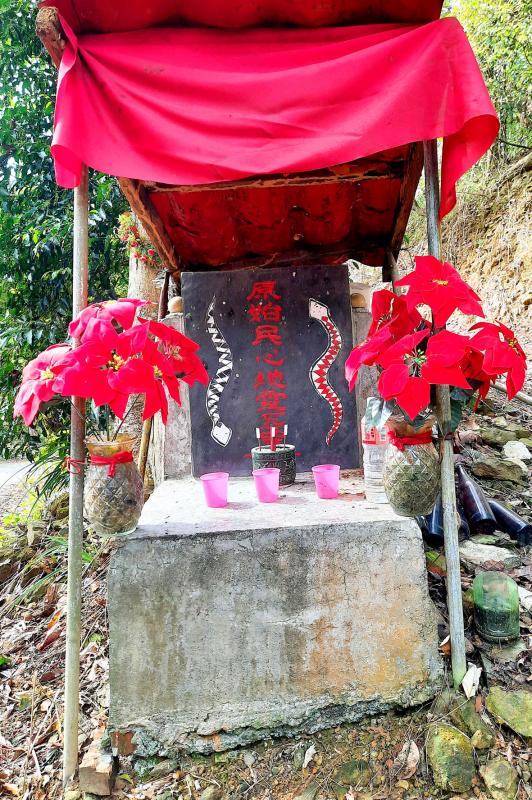
Photo: Steven Crook
After riding northwest along Road 185 for around 300m, I turned right onto an unnumbered road that forms the southern end of the Anpo Tourist Bikeway (安坡觀光自行車道). This 12km-long cycling route connects the paragliding hotspot of Saichia (賽嘉) in the south with the Paiwan community of Cavak (also known as Cingshan, 青山) in north, via two other Aboriginal villages I planned to look at.
Unfortunately, none of these settlements are reachable by public bus.
Before reaching Valjulu (in Chinese: Maer, 馬兒), I noticed a lopsided cross, and a short detour brought me to a garden of remembrance atop a ridge. The view from it was superb — another instance of Taiwan’s dead being given the very best spots.
Hoping to find even better scenery, I tramped up a nearby hill. When I reached the other side, I found myself in the middle of an abandoned pineapple plantation. The land hereabouts is between 100m and 200m above sea level — not so high that this tropical fruit can’t be commercially cultivated.
Standing among the pineapples, I turned on my smartphone’s compass function and figured out that the two towns I could see were Ligang (里港) and Cishan (旗山).
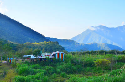
Like many other indigenous settlements, Valjulu is a compact cluster of homes arranged on a slope. Judging by the state of these dwellings, very few of which have more than two stories, some of the households are far more prosperous than others.
Some of the walls in Valjulu feature colorful murals, similar to the ones I’ve seen in several other Aboriginal communities. I’ve always wondered: Are these paintings make-work schemes for local artisans? Or are they commissioned to ensure that tourists aren’t disappointed by a lack of “local color” when they visit Taiwan’s Austronesian districts? And why do they always depict life as it once was (or how people imagine it used to be), not life as it is now?
To reach Djineljepan (in Chinese: Anpo, 安坡), the third of the four villages I’d set out to see, I had to ride toward Gaoshu Township (高樹) on the lowlands, then take Pingtung Local Road 7 (屏7) uphill back into Sandimen Township (三地門).
En route, I had another “brush with death.” What I first thought was a church of impressive dimensions turned out to be a complex containing mourning halls, an ossuary and a columbarium.
‘ECCLESIASTICAL BRUTALISM’
The grounds of Pingtung Christian Sunlight Garden (屏東基督教日光園) are nicely kept. As for its architecture, the words that come to mind are “ecclesiastical brutalism.”
On the hillside inland of Djineljepan, just beyond an unfinished Presbyterian church, there’s a bilingual sign for Beauty Mountain Walkway (美人山步道). I was ready for a short hike — but very soon I turned back, because the trail was overgrown.
The stretch of Pingtung Local Road 7 linking Djineljepan with Cavak is a delight to ride, and Cavak itself seemed a bit livelier than the other villages.
While in the vicinity of Cavak, I finally got to a scenic spot I first heard about back in the 1990s.
Haishengong (海神宮; some bilingual signs in the area translate it as “Sea God Palace”) is a stretch of creek that offers gorge-type scenery, swimming holes and a popular river-tracing route.
Online sources say there’s an entrance charge of NT$50 per person. When I arrived, however, the gate was open and the ticket booth was deserted.
On a cool and cloudy day, I saw no reason to hang around Haishengong. But I’m sure that, when the water level is higher and the temperature is in the 30s, it’s a lovely spot to while away a few hours. When the weather’s warmer, I’ll be back.
Steven Crook has been writing about travel, culture and business in Taiwan since 1996. He is the author of Taiwan: The Bradt Travel Guide and co-author of A Culinary History of Taipei: Beyond Pork and Ponlai.
If one asks Taiwanese why house prices are so high or why the nation is so built up or why certain policies cannot be carried out, one common answer is that “Taiwan is too small.” This is actually true, though not in the way people think. The National Property Administration (NPA), responsible for tracking and managing the government’s real estate assets, maintains statistics on how much land the government owns. As of the end of last year, land for official use constituted 293,655 hectares, for public use 1,732,513 hectares, for non-public use 216,972 hectares and for state enterprises 34 hectares, yielding

The small platform at Duoliang Train Station in Taitung County’s Taimali Township (太麻里) served villagers from 1992 to 2006, but was eventually shut down due to lack of use. Just 10 years later, the abandoned train station had become widely known as the most beautiful station in Taiwan, and visitors were so frequent that the village had to start restricting traffic. Nowadays, Duoliang Village (多良) is known as a bit of a tourist trap, with a mandatory, albeit modest, admission fee of NT$10 giving access to a crowded lane of vendors with a mediocre view of the ocean and the trains
Traditionally, indigenous people in Taiwan’s mountains practice swidden cultivation, or “slash and burn” agriculture, a practice common in human history. According to a 2016 research article in the International Journal of Environmental Sustainability, among the Atayal people, this began with a search for suitable forested slopeland. The trees are burnt for fertilizer and the land cleared of stones. The stones and wood are then piled up to make fences, while both dead and standing trees are retained on the plot. The fences are used to grow climbing crops like squash and beans. The plot itself supports farming for three years.

President William Lai (賴清德) on Nov. 25 last year announced in a Washington Post op-ed that “my government will introduce a historic US$40 billion supplementary defense budget, an investment that underscores our commitment to defending Taiwan’s democracy.” Lai promised “significant new arms acquisitions from the United States” and to “invest in cutting-edge technologies and expand Taiwan’s defense industrial base,” to “bolster deterrence by inserting greater costs and uncertainties into Beijing’s decision-making on the use of force.” Announcing it in the Washington Post was a strategic gamble, both geopolitically and domestically, with Taiwan’s international credibility at stake. But Lai’s message was exactly