Never again! This is what I decided after my first walk along the Nenggao-Andongjun trail (能高安東軍), an experience full of miserable weather, hypothermia, sketchy water sources, difficulty finding the trail and horrible overgrowth. I would never do this trail again, at least not in bad weather, and certainly not south to north again. But hikers are known to have short memories for unpleasant experiences, so when I was recently asked to work as porter for a trip along this route (in the same direction), I agreed to the job despite my misgivings.
Normally, this route is done from north to south, ending with a walk along the Wanda South River. However, there is always the risk that heavy rain could make the riverbed impassable by the last day of the trip, so we opted to do the trip in reverse, getting the riverbed section out of the way on Day 1. We thus started out in the Aowanda National Forest Recreation Area (奧萬大國家森林遊樂區), where tourists flock every winter to see the maple trees. After walking through the park and crossing the impressive Aowanda Suspension Bridge, we left the tourist area behind and set out on the Nenggao-Andongjun route proper.
UP TO THE SPINE
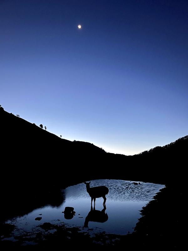
Photo courtesy of hiker Gia W
The first day took us through the forest for a time before descending to the riverbed again further upstream. In the afternoon, we followed the riverbed, requiring four crossings in water only knee-high but with quite a strong current, made more difficult by the weight on our backs. The second day consisted of a long ascent along a side stream with crossings on slippery rocks, and sections of damp forest with towering cypress trees that escaped the logging binge of last century. This is a grueling climb that culminates at the spine of the Central Mountain Range, with expansive views in all directions finally revealing themselves at the end of the day.
Once the ridgeline has been reached, the fun really begins. The Nenggao-Andongjun ridge has more alpine lakes than any other high-mountain route, five of the 100 Peaks, long sections of gorgeous bamboo and an abundance of sambar deer. We summited Andongjun Mountain (安東軍山) the next morning — a short side trip to the south — before returning to camp to pack up and carry on to the north.
Throughout the day, we passed the Tunlu Sister Pond (屯鹿妹池), the Tunlu Pond (屯鹿池) and the Wanli Pond (萬里池) before reaching our next camp beside Baishi Pond (白石池). Unlike many ponds in the high mountains that are full of unappetizing coffee-colored tannin-rich water, these ponds are surprisingly clear and make for great water sources along the way. The trail also passed over the summit of Baishi Mountain (白石山, literally “White Rock Mountain”), another of the 100 Peaks, named for a nearby rock that is the legendary ancestral home of the first Seediq people.
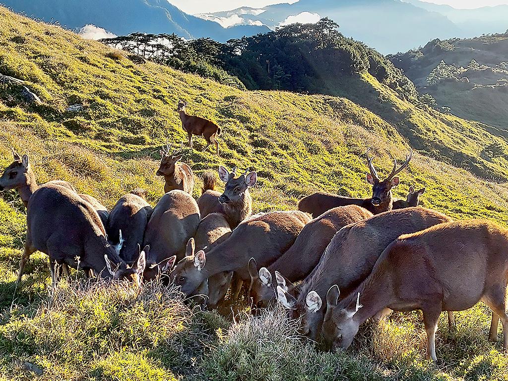
Photo: Tyler Cottenie
BAMBOO MEADOWS AND WILDLIFE
Shining our headlamps on the hills surrounding Baishi Pond at night, we could see dozens of bright yellow dots: not stars, however, as these dots bounced around like cell phone lights in the crowd at a concert. These were the eyes of sambar deer, waiting patiently for one of us to leave urine behind on the grass, a salt-containing liquid gift on which they would pounce at the earliest opportunity, even fighting each other to obtain the best access. The deer visited us at every campsite along the spine, but they were most numerous at Baishi Pond: from my low vantage point on the shore, I counted 42, but surely there were even more just out of sight. Nights on Nenggao-Andongjun provide a rare opportunity to observe these wild mammals up close for long periods of time in relative safety.
North of Baishi Pond, the trail gets a little more rugged, but the scenery is arguably even more spectacular. Our fourth morning started out with a difficult push through a narrow forest trail. As most hiking groups do the trail in one direction, tree branches tend to get pushed in one direction, grow in that direction and are trimmed to help those walking in that direction. As we were walking in the reverse direction, the vegetation conspired to poke at us and prevent our forward progress, much as a barbed fishhook slides easily one way but not the other.
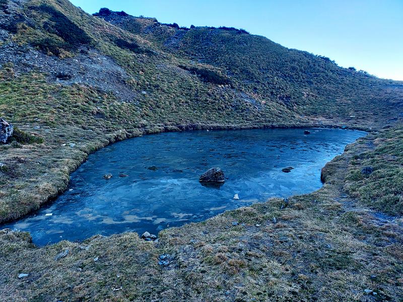
Photo: Tyler Cottenie
After forcing our way through this overgrowth, we had to cross a barren landslide and scale a vertical wall with ropes in order to arrive at the next of the 100 Peaks, Guangtou Mountain (光頭山). From here onward, the trail passed through an endless sea of Yushan cane bamboo — less than one meter in height, affording continuous views of Nantou and Hualien on either side of the trail — all the way to Nenggao South Peak (能高南峰). This long stretch of gentle green rolling hills is, in the author’s opinion, one of the most pleasant walks in all of Taiwan’s high mountains.
A resident serow greeted me as I reached the summit of Nenggao South, also the highest point on the Nenggao-Andongjun trail at 3,349 meters. After lingering long enough for me to snap quite a few photos, it deftly descended the steep rocks on the far side of the summit and ambled on out of sight. Much like the sambar deer, this serow seems to have become accustomed to the presence of humans.
THE CAUTIOUS TREK BACK
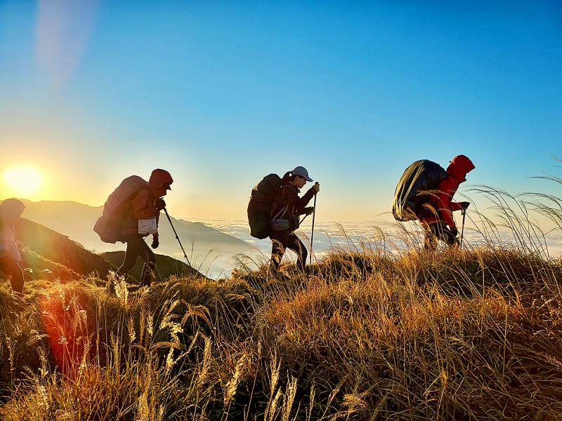
Photo: Tyler Cottenie
The descent from Nenggao South was perhaps the most treacherous section of the trail, with several steep sections with ropes, and several more where there should be ropes. Progress through here slowed to under 1 km/h as we carefully navigated through loose rocks and alongside cliff faces. After 12 hours of walking, we finally reached our campsite for the night, Dalu Pond (大陸池), in full darkness.
Approximately an hour farther up the trail, there is a Taiwan-shaped pond named “Taiwan Pond”; one can only surmise that the pond at our campsite was named Dalu Pond — literally “Mainland (China) Pond” — in jest for its proximity to Taiwan Pond. Unfortunately, this campsite was absolutely covered in trash. A recent mountain trash cleanup team led by Taiwanese hiker Tri Fish (三條魚) managed to haul over 200kg of trash off the mountain from Nenggao-Andongjun. Despite their success, they didn’t have enough manpower to haul everything they had gathered into burlap sacks off the mountain. The sacks that remained here and in two other locations have already been ripped open, allowing the trash to spill out again. It is an unpleasant reminder of the need for a change in attitudes about personal responsibility while in the outdoors.
The following day took us up to Nenggao Main Peak (能高主峰) and down the other side through bothersome thorny overgrowth and tall bamboo. After passing under the high-voltage transmission lines that link western and eastern Taiwan, we reached the tall stone monument commemorating the completion of this project in the 1950s. The fifth and final night can be spent at nearby Tianchi Lodge (天池山莊) if bed or camping spots are secured ahead of time. From here, hikers finally leave the spine of the Central Mountain Range and descend on Day 6 via the Nenggao Cross-Ridge Historic Trail (能高越嶺道) to the west into Nantou or the east into Hualien, a pleasant finish on a well-maintained trail after days of much more challenging conditions.
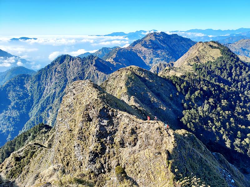
Photo: Tyler Cottenie
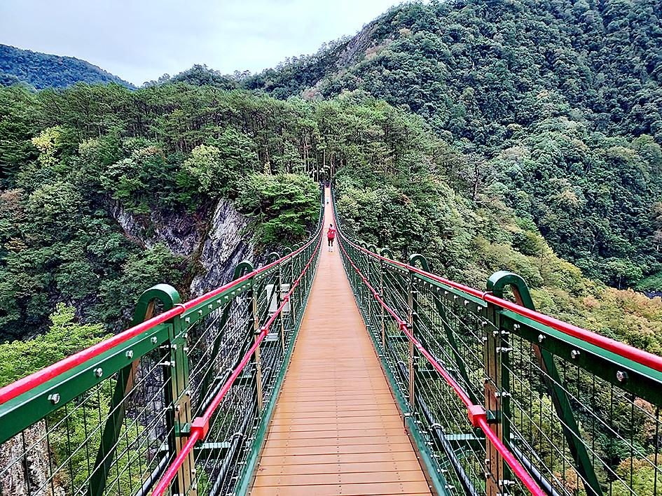
Photo: Tyler Cottenie
Photo: Tyler Cottenie

Taiwan’s English education system is being pulled apart by three opposing forces. Bilingual Nation 2030 pulls students toward English and global communication. Artificial Intelligence (AI) readiness pulls them toward digital judgment, verification and AI-mediated work. But Taiwan’s old exam culture pulls them back toward memorization, grammar drills, timed reading and correct answers. If the education system keeps using old exams to define success, it risks producing graduates who are neither genuinely bilingual nor genuinely AI-ready, but trained for tasks machines can already perform. The first force is Bilingual Nation 2030. Launched in 2018, the policy aimed to “help Taiwan’s workforce connect

It seems every few days one bumps into one of those “real man” comments in which Taiwan is urged to “face reality” or similar, and “make a deal,” with the speaker implying that soon it will be too late. “Deal” advocates always present themselves as having a superior grip on reality, and the manly ability to make the “hard choice.” Their testosterone-laden language often echoes that of Taiwan sellout advocates. Note that such commentary always specifies a process (“make a deal, work with, make progress”), never the end state of what occupation by a violent authoritarian colonialist state will entail. In

“Taiwan’s Opposition Leader Comes to US With a Message Straight Out of Beijing” read a May 31 headline in the Wall Street Journal. Top US administration officials and members of Congress almost certainly read the WSJ, and if there was a bullet point takeaway that people in Washington should absorb ahead of Chinese Nationalist Party (KMT) Chair Cheng Li-wun’s (鄭麗文) arrival in DC on June 9, that headline is it. The last few columns have discussed this very topic, and the timing is not coincidental. While those top officials likely do not read the Taipei Times, judging by the number
As someone who normally steers clear of books with “transcendence” or “metaphysics” in their subtitles, this reviewer — a casual observer of local belief systems since the 1990s — found Fabian Graham’s Money God Temples in Taiwan a challenging read. Those who’ve only dipped their toes into temple culture will likely need to parse several sections with special care if they’re to keep up with the author, a British ethnographic researcher whose previous books have investigated religious practices among ethnic Chinese in Southeast Asia. This scholarly volume examines a facet of Taiwan’s religious landscape that didn’t exist a century ago, and