Two Chinese Nationalist Party (KMT) presidential hopefuls yesterday called on the party to make a decision about how to handle its primary to choose a candidate for next year’s election.
KMT Legislator Wang Jin-pyng (王金平), who served as legislative speaker for 17 years, said that the party’s mercurial approach to nomination regulations made it difficult to comment or react, while former New Taipei City mayor Eric Chu (朱立倫) said that regardless of the options, the party must decide soon.
As long as a candidate is chosen fairly, everyone would support the decision, Wang added.
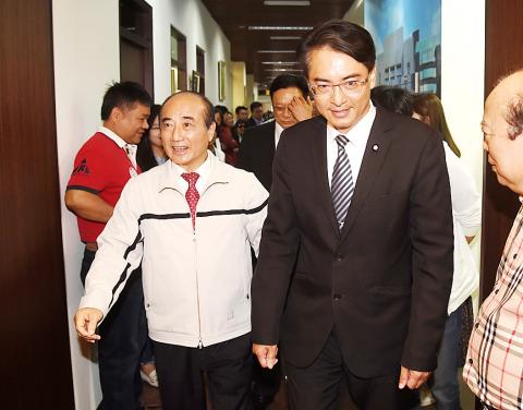
Photo: Huang Yao-cheng, Taipei Times
They were responding to a series of comments by KMT officials, such as KMT Chairman Wu Den-yih’s (吳敦義) insinuation on Saturday last week that the party would consider drafting Kaohsiung Mayor Han Kuo-yu (韓國瑜) as a potential candidate.
KMT Organizational Development Committee director Lee Che-hua (李哲華) on Wednesday proposed that the party sit down with Chu and Wang for “pre-primary negotiations” about listing Han among them in public opinion polls and party member surveys, as Han is unlikely to register for the primary himself.
Chu said that he would not rule out support for drafting Han if it is the best option for the party.
However, Lee’s proposal would cause others who have dropped the idea of running to reconsider, Chu said, naming Taipei City Councilor Lo Chih-chiang (羅智強), former Taipei County commissioner Chou Hsi-wei (周錫偉) and Sun Yat-sen School president Chang Ya-chung (張亞中) as examples.
Lee yesterday said that his proposal would prevent the possibility of the KMT National Congress selecting another candidate over the person who won the party primary.
“We would have liked for Chu and Wang to consider including Han as a possible candidate, as it would mean that regardless of who prevails, the party has selected its best candidate,” Lee said.
However, if Wang and Chu will not settle matters via negotiations, then the primary would continue as planned, Lee added.
Additional reporting by Shih Hsiao-kuang
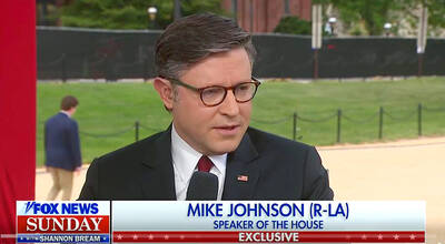
RESOLUTE BACKING: Two Republican senators are planning to introduce legislation that would impose immediate sanctions on China if it attempts to invade Taiwan US House of Representatives Speaker Mike Johnson on Sunday reaffirmed US congressional support for Taiwan, saying the US and “all freedom-loving people” have a stake in preventing China from seizing Taiwan by force. Johnson made the remarks in an interview with Fox News Sunday on US President Donald Trump’s summit with Chinese President Xi Jinping (習近平) last week. In an interview that aired on Friday on Fox News, just as Trump wrapped up a high-stakes visit to China, he said he has yet to green-light a new US$14 billion arms package to Taiwan and that it “depends on China.” “It’s a very good
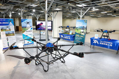
DRONE CENTRAL: Taiwan aims to become Asia’s democratic hub for drones, with most exports focused on high-quality military-grade models, an official said Taiwan’s drone industry is expected to expand significantly by 2030, producing 100,000 units per month and exporting half of them, the Ministry of Economic Affairs said yesterday. Current drone production capacity is about 15,000 units per month, but the industry can quickly scale up as demand increases, Industrial Development Administration Director-General Chiou Chyou-huey (邱求慧) told a news conference in Taipei. Taiwan’s drone output grew 2.5-fold last year to NT$12.9 billion (US$408.3 million) under a government program to develop the uncrewed vehicle sector, he said. The Executive Yuan in October last year approved plans to invest NT$44.2 billion into domestic production of uncrewed aerial
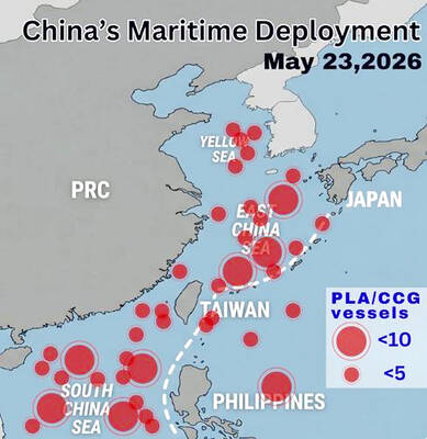
WARNING: China should stop engaging in actions that undermine regional peace and stability, as it would only build resentment among people across the Strait, the CGA said China has deployed more than 100 navy, coast guard and other vessels in waters from the Yellow Sea to the South China Sea and the western Pacific since US President Donald Trump and Chinese President Xi Jinping (習近平) met in Beijing, National Security Council Secretary-General Joseph Wu (吳釗燮) said yesterday. “In this part of the world, #China is the one & only PROBLEM wrecking the #StatusQuo & threatening regional peace & stability,” Wu wrote on X. In a separate post, he said Beijing was coercing Taiwan’s maritime domain, calling it illegal and provocative, after the Coast Guard Administration (CGA) expelled a
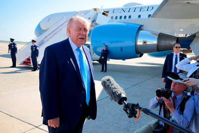
US President Donald Trump yesterday said he would speak to President William Lai (賴清德) as his administration considers whether to move ahead with a US$14 billion weapons sale to Taiwan — a potential arms deal that has drawn criticism from China. “Well, I’ll speak to him. I speak to everybody,” Trump told reporters yesterday when asked if he had any plans to call his counterpart, although he did not offer a time frame for when such a conversation could take place. Trump previously said he would speak to the person “that’s running Taiwan,” without specifying who he meant. “We have that situation very