A new “carrier killer” missile that has become a symbol of China’s rising military might will not force the US Navy to change the way it operates in the Pacific, a senior Navy commander said.
Defense analysts say the Dong Feng 21D missile could upend the balance of power in Asia, where US aircraft carrier battle groups have ruled the waves since the end of World War II.
However, Vice Admiral Scott van Buskirk, commander of the US 7th Fleet, said that the Navy does not see the much-feared weapon as creating any insurmountable vulnerability for the US carriers — the Navy’s crown jewels.
“It’s not the Achilles heel of our aircraft carriers or our Navy — it is one weapons system, one technology that is out there,” Van Buskirk said in an interview this week on the bridge of the USS George Washington, the only carrier that is home-based in the western Pacific.
The DF-21D is unique in that it is believed capable of hitting a powerfully defended moving target — like the USS George Washington — with pinpoint precision. That objective is so complex that the Soviets gave up on a similar project.
The missile would penetrate defenses because its speed from launch would not allow enough time for carriers or other large ships to complete countermeasures.
That could seriously weaken Washington’s ability to intervene in any potential conflict over Taiwan or North Korea, as well as deny US ships safe access to international waters near China’s long coastline.
Van Buskirk, whose fleet is responsible for most of the Pacific and Indian oceans, with 60-70 ships and 40,000 sailors and Marines under its command, said the capabilities of the Chinese missile are as yet unproven. However, he acknowledged it does raise special concerns.
“Any new capability is something that we try to monitor,” he said.
“If there wasn’t this to point to as a game changer, there would be something else,” he said. “That term has been bandied about for many things. I think it really depends on how you define the game, whether it really changes it or not. It’s a very specific scenario for a very specific capability — some things can be very impactful.”
The development of the missile comes as China is increasingly venturing further out to sea and is becoming more assertive around its coastline and in disputes over territory.
Late last year, China and Japan were locked in a heated diplomatic row over several islands both claim in the East China Sea, an area regularly patrolled by US Navy vessels. A flotilla of 10 Chinese warships, including advanced submarines and destroyers, passed through the Miyako Strait last April in the biggest transit of its kind to date.
Experts saw it as an attempt by China to test Japan and the US and demonstrate its open water capabilities.
Van Buskirk said the US Navy has no intention of altering its mission because of the new threat and will continue to operate in the seas around Japan, South Korea, the Philippines and anywhere else it deems necessary.
“We won’t change these operations because of this specific technology that might be out there, but we will carefully monitor and adapt to it,” he said.
The faster-than-expected development of the missile has set off alarm bells in Washington.
In December, Admiral Robert Willard, the head of the US Pacific Command, told Japan’s Asahi Shimbun he believed the missile program had achieved “initial operational capability,” meaning a workable design had been settled on and was being further developed.
At its most capable, the DF-21D could be launched from land with enough accuracy to penetrate the defenses of even the most advanced moving aircraft carrier at a distance of more than 1,500km.
To allay regional security fears, van Buskirk said, China needs to be more forthcoming about its intentions.
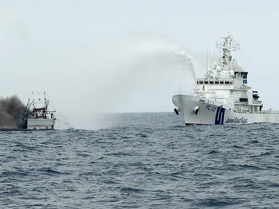
CREDIT-GRABBER: China said its coast guard rescued the crew of a fishing vessel that caught fire, who were actually rescued by a nearby Taiwanese boat and the CGA Maritime search and rescue operations do not have borders, and China should not use a shipwreck to infringe upon Taiwanese sovereignty, the Coast Guard Administration (CGA) said yesterday. The coast guard made the statement in response to the China Coast Guard (CCG) saying it saved a Taiwanese fishing boat. The Chuan Yu No. 6 (全漁6號), a fishing vessel registered in Keelung, on Thursday caught fire and sank in waters northeast of Diaoyutai Islands (釣魚台). The vessel left Keelung’s Badouzih Fishing Harbor (八斗子漁港) at 3:35pm on Sunday last week, with seven people on board — a 62-year-old Taiwanese captain surnamed Chang (張) and six

RISKY BUSINESS: The ‘incentives’ include initiatives that get suspended for no reason, creating uncertainty and resulting in considerable losses for Taiwanese, the MAC said China’s “incentives” failed to sway sentiment in Taiwan, as willingness to work in China hit a record low of 1.6 percent, a Ministry of Labor survey showed. The Directorate-General of Budget, Accounting and Statistics (DGBAS) also reported that the number of Taiwanese workers in China has nearly halved from a peak of 430,000 in 2012 to an estimated 231,000 in 2024. That marked a new low in the proportion of Taiwanese going abroad to work. The ministry’s annual survey on “Labor Life and Employment Status” includes questions respondents’ willingness to seek employment overseas. Willingness to work in China has steadily declined from

LEVERAGE: China did not ‘need to fire a shot’ to deny Taiwan airspace over Africa when it owns ‘half the continent’s debt,’ a US official said, calling it economic warfare The EU has raised concerns about overflight rights following the delay of President William Lai’s (賴清德) planned state visit to the Kingdom of Eswatini after three African nations denied overflight clearance for his charter at the last minute. Taiwanese allies Paraguay and Saint Kitts and Nevis, as well as several US lawmakers and the Inter-Parliamentary Alliance on China (IPAC) condemned China for allegedly pressuring the countries. Lai was scheduled to fly directly to Taiwan’s only African ally from yesterday to Sunday to celebrate the 40th anniversary of King Mswati III’s accession and his 58th birthday, but Seychelles, Mauritius and Madagascar suddenly revoked

The number of pet cats in Taiwan surpassed that of pet dogs for the first time last year, reaching 1,742,033, a 32.8 percent increase from 2023, the Ministry of Agriculture said yesterday, citing a survey. By contrast, the number of pet dogs declined slightly by 1.2 percent over the same period to 1,462,528, the ministry said. Despite the shift, households with dogs still slightly outnumber those with cats by 1.2 percent. However, while the number of households with multiple dogs has remained relatively stable, households keeping more than two cats have increased, contributing to the overall rise in the feline population. The trend