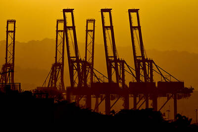
The Central Weather Bureau (CWB) could issue a sea alert this morning for Tropical Storm Fengshen after it swept through the Philippines over the weekend.
As of 6pm, the center of Fengshen was located 100km northwest of Manila. It was moving northwesterly at a speed of 14kph.
The storm’s maximum wind speed reached 110kph, with gusts topping 140kph. The radius of the storm was measured at 200km.
After forming on Friday and developing into a typhoon, Fengshen swept through central parts of the Philippines on Saturday.
The system was downgraded to a tropical storm yesterday afternoon.
Whether the storm would affect Taiwan depends on its intensity after it enters the South China Sea, the bureau said.
“The next 24 hours will be crucial for the weather bureau as it monitors the storm and decides what to do,” said Wu Teh-jung (吳德榮), director of the bureau’s Weather Forecast Center.
“If it [the storm] quickly turns into a tropical low air pressure system after entering the South China Sea, there will be no need to issue an alert,” bureau forecaster Tang Shuen-lan (湯舜然) said.
“However, if the storm remains strong after it passes through the South China Sea and enters the Taiwan Strait, we will possibly issue a sea alert early tomorrow morning,” he said yesterday.
The weather nationwide was sunny yesterday, with temperatures reaching a maximum of 36.8˚C.
High temperatures are expected in northern, central and southern areas today, with rain forecast tomorrow as the storm approaches the west coast.
ADDITIONAL REPORTING BY CNA
A subsidiary of a Hong Kong-based company that has lost control of two critical ports on the Panama Canal said it is seeking US$2 billion of compensation in damages from Panama over its “illegal” takeover of the ports. Panama Ports Co, a unit of Hong Kong’s CK Hutchison Holdings (長江和記實業), on Friday said in a statement that it is demanding the sum under international arbitration proceedings that it had already started. The Panamanian government last week seized control of the Balboa and Cristobal ports on each end of the Panama Canal, after the country’s Supreme Court declared earlier that a concession allowing
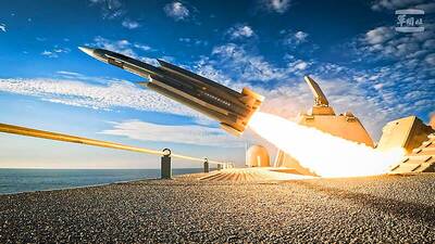
DETERRENCE: With 1,000 indigenous Hsiung Feng II and III missiles and 400 Harpoon missiles, the nation would boast the highest anti-ship missile density in the world With Taiwan wrapping up mass production of Hsiung Feng II and III missiles by December and an influx of Harpoon missiles from the US, Taiwan would have the highest density of anti-ship missiles in the world, a source said yesterday. Taiwan is to wrap up mass production of the indigenous anti-ship missiles by the end of year, as the Chungshan Institute of Science and Technology has been meeting production targets ahead of schedule, a defense official with knowledge of the matter said. Combined with the 400 Harpoon anti-ship missiles Taiwan expects to receive from the US by 2028, the nation would have

POSSIBILITIES EMERGE: With Taiwan’s victory and Japan’s narrow win over Australia, Taiwan now have a chance to advance if South Korea also beat the Aussies Taiwan has high hopes that the national baseball team would advance to the World Baseball Classic (WBC) quarter-finals after clinching a crucial 5-4 victory over South Korea in a nail-biting extra-inning game at the Tokyo Dome yesterday. Boosted by three home runs — two solo shots by Yu Chang (張育成) and Cheng Tsung-che (鄭宗哲) and a two-run homer by Stuart Fairchild — the triumph gave Taiwan a much-needed second victory in the five-team Pool C, where only the top two finishers would advance to the knockout stage in Miami, Florida. Entering extra innings with the game tied at four apiece, Taiwan scored
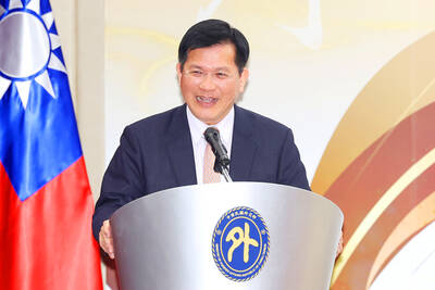
MISSION OF PEACE: The foreign minister urged Beijing to respect Taiwan’s existence as an independent nation, and work together to ensure peace and stability in the region Minister of Foreign Affairs Lin Chia-lung (林佳龍) yesterday rejected Chinese Minister of Foreign Affairs Wang Yi’s (王毅) comments about Taiwan, criticizing China as a “troublemaker” in the international community and a disruptor of cross-strait peace. Speaking at a news conference on the sidelines of the Chinese National People’s Congress, Wang said that Taiwan has always been a territory of China and that it would be impossible for it to become its own country. The “return” of Taiwan to China was the natural outcome of the Chinese people’s resistance against Japan in World War II, and that any pursuit of independence was “doomed