Super Typhoon Sinlaku strengthened yesterday into a dangerous storm, following a path that could lead it very close to Taiwan this weekend, the Central Weather Bureau said.
At 8:30pm yesterday, Sinlaku was centered 400km east of Oluanpi — the nation’s southernmost tip — packing maximum sustained winds of 184kph and moving north at 7kph, the bureau’s data showed.
Sinlaku’s radius had already expanded to 250km yesterday afternoon, the bureau said, advising ships operating in the Bashi Channel (巴士海峽) and in waters southeast and northeast of Taiwan to be cautious.
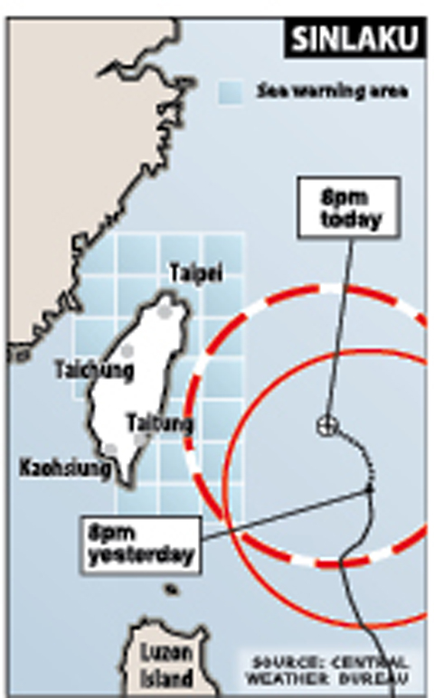
SOURCE: CENTRAL WEATHER BUREAU
The bureau forecast that the typhoon would continue to pick up strength and could expand in size.
LAND WARNING
A land warning for the typhoon might be issued early today, the bureau said.
Tsai Pu-tien (蔡甫甸), a senior forecaster at the bureau, said the slow-moving typhoon had an intact structure and could bring heavy rains if it moved closer to the country.
Tsai advised the public to take proper precautions.
Northeastern Taiwan and the mountainous areas in northern Taiwan started experiencing torrential rains yesterday.
MOON-LESS
Tsai said that residents in the northern, northeastern and central regions might not be able to catch a glimpse of the moon during the Mid-Autumn Festival on Sunday because the slow-moving typhoon would continue to linger in waters north of Taiwan.
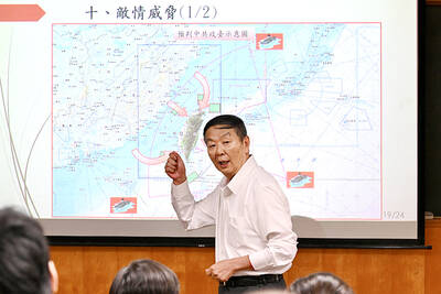
RETHINK? The defense ministry and Navy Command Headquarters could take over the indigenous submarine project and change its production timeline, a source said Admiral Huang Shu-kuang’s (黃曙光) resignation as head of the Indigenous Submarine Program and as a member of the National Security Council could affect the production of submarines, a source said yesterday. Huang in a statement last night said he had decided to resign due to national security concerns while expressing the hope that it would put a stop to political wrangling that only undermines the advancement of the nation’s defense capabilities. Taiwan People’s Party Legislator Vivian Huang (黃珊珊) yesterday said that the admiral, her older brother, felt it was time for him to step down and that he had completed what he
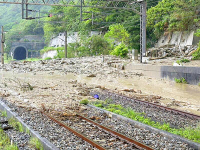
ROLLER-COASTER RIDE: More than five earthquakes ranging from magnitude 4.4 to 5.5 on the Richter scale shook eastern Taiwan in rapid succession yesterday afternoon Back-to-back weather fronts are forecast to hit Taiwan this week, resulting in rain across the nation in the coming days, the Central Weather Administration said yesterday, as it also warned residents in mountainous regions to be wary of landslides and rockfalls. As the first front approached, sporadic rainfall began in central and northern parts of Taiwan yesterday, the agency said, adding that rain is forecast to intensify in those regions today, while brief showers would also affect other parts of the nation. A second weather system is forecast to arrive on Thursday, bringing additional rain to the whole nation until Sunday, it

CONDITIONAL: The PRC imposes secret requirements that the funding it provides cannot be spent in states with diplomatic relations with Taiwan, Emma Reilly said China has been bribing UN officials to obtain “special benefits” and to block funding from countries that have diplomatic ties with Taiwan, a former UN employee told the British House of Commons on Tuesday. At a House of Commons Foreign Affairs Committee hearing into “international relations within the multilateral system,” former Office of the UN High Commissioner for Human Rights (OHCHR) employee Emma Reilly said in a written statement that “Beijing paid bribes to the two successive Presidents of the [UN] General Assembly” during the two-year negotiation of the Sustainable Development Goals. Another way China exercises influence within the UN Secretariat is
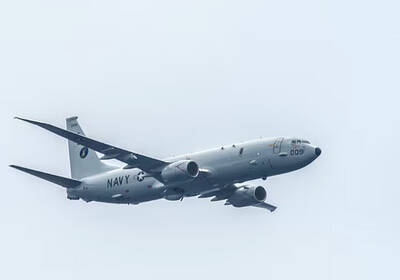
CHINA REACTS: The patrol and reconnaissance plane ‘transited the Taiwan Strait in international airspace,’ the 7th Fleet said, while Taipei said it saw nothing unusual The US 7th Fleet yesterday said that a US Navy P-8A Poseidon flew through the Taiwan Strait, a day after US and Chinese defense heads held their first talks since November 2022 in an effort to reduce regional tensions. The patrol and reconnaissance plane “transited the Taiwan Strait in international airspace,” the 7th Fleet said in a news release. “By operating within the Taiwan Strait in accordance with international law, the United States upholds the navigational rights and freedoms of all nations.” In a separate statement, the Ministry of National Defense said that it monitored nearby waters and airspace as the aircraft