I set out certain of nothing — except that it would rain, and rain repeatedly. My objective was a road in Kaohsiung’s mountainous interior that once connected the hot spring resort of Baolai (寶來) with a less well-known cluster of hot-springs hotels called Bulao (不老, literally “not old”).
Ten years ago, this part of the south was savaged by Typhoon Morakot and the massive rainfall it brought. The disaster is also known as the Eight-Eight Floods (八八水災), because the typhoon reached Taiwan’s eastern shores on August 8, 2009. In the Baolai area, more than 1,700mm of rain fell in 48 hours.
The only major road linking Baolai with the lowlands is Highway 20, also known as the South Cross-Island Highway (南橫公路). Before it was torn up by Morakot, this road connected Tainan with Taitung via Yushan National Park (玉山國家公園). It was popular with tourists on account of the park’s superb high-mountain scenery, and a good number of travelers stopped for a soak at Baolai. Since losing its status as a way station, the town has struggled to regain its former prosperity.
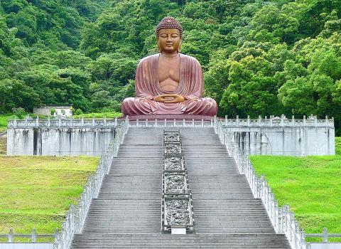
Photo: Steven Crook
I hadn’t been back to Bulao since Morakot, and I wanted to see first-hand the condition of Local Road 133 (高133), a back-country route between Baolai and Hsinfa (新發, in Kaohsiung’s Liouguei District, 六龜) via Bulao. A friend who knows this part of Taiwan much better than me said the route has been closed for a while, and that business owners in Bulao were still hoping the authorities would spend hundreds of millions of New Taiwan dollars to fix it.
Google Street View, however, allowed me to take a virtual “drive” from one end to the other, using images dated May 2011 and December 2013 (a few years after Morakot, in other words). What’s more, Kaohsiung City Government’s Public Works Bureau still lists Local Road 133 as a public route. The bureau’s Web site says it connects Baolai with Hsinfa, and that its total length is 9.914 km — details which precisely matched what Google Maps was telling me.
Dressed for a drenching, I jumped on my motorcycle just after first light, and headed for Chiahsian (甲仙). I rode through a couple of squalls before reaching that little town. Wet weather doesn’t bother me, except when rain hits my face with such force I can barely see where I’m going. And where I was going, memories of Morakot are fresh and raw; it would’ve been insensitive to complain about a bit of precipitation.
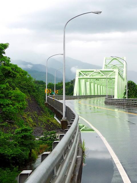
Photo: Steven Crook
Beyond Chiahsian, Highway 20 climbs and twists through forested hill country. The road crests at around 600m above sea level before dropping down to the village that shares its name with the adjacent river, Laonong (荖濃, elevation 369m). Hardly any farming goes on between Chiahsian and Laonong, but one uninhabited spot bears the curious toponym Kafeihsiang (咖啡巷, “coffee lane”).
Laonong is where the northern end of Highway 27 merges into Highway 20. I turned south onto the former road, crossed Hsinfa Big Bridge (新發大橋) — built after Morakot and paid for by China Steel — and 3km later found the southern end of Local Road 133.
Less than 1km down the road, I stopped to take photographs of the river and the bridge. Precisely 2km from the turnoff, I parked at Liouguei Big Buddha (六龜大佛). The seated Buddha here was cast using 167 tonnes of bronze.
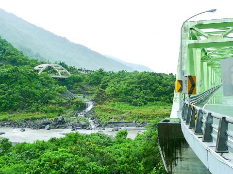
Photo: Steven Crook
During installation, several years before Morakot, a worker fell from the statue’s face to the concrete below. When his head struck the ground, it’s said to have made a clang like that of a bell ringing. He was rushed to a nearby hospital; the doctors there doubted he would survive the injury. His family then transferred him to a larger hospital, where his recovery stunned those in attendance. Within a few days, he was ready to return to his job. At the time of my visit, landscaping work (scheduled for completion in October) made it difficult to get close to the Big Buddha.
On the other side of Local Road 133, Hsinkai 88 Memorial Park (新開88紀念公園) commemorates those who died during Morakot. The park’s most notable feature is a sculpture of a butterfly emerging from a chrysalis, representing the community’s rebirth and recovery following the disaster. The installation is made of brick fragments, smashed tiles, bits of rebar, and other rubble retrieved from houses destroyed by the typhoon.
When I got to the main cluster of hot-spring hotels, 3.6km from the intersection with Highway 27, I saw more tourists than I’d expected to on a weekday in the hot season. Half a dozen were waiting for the bus, while a few others were taking advantage of a break in the rain to snap some photos. Hardly enough to keep one spa resort in business, though, let alone several.

Photo: Steven Crook
When I stopped at a mom-and-pop store, I was told that some of the people running tourism businesses here were effectively trapped. They couldn’t find buyers, and they hadn’t made enough to retire.
The local government hasn’t given up on Bulao, however. A new 260m-long wooden walkway, the Bulao Trail (不老步道) is nearly ready. Along it, bilingual information boards do a good job of introducing the area. From one of these, I learned that the toponym Bulao isn’t of indigenous origin, as I’d always assumed, but describes the rejuvenating effect of the hot springs here. And it wasn’t dreamed up by a marketing genius, either, but by Han farmers who enjoyed taking a dip, and joked it was so pleasant it would restore their youth.
I rode north slowly, and not just because the road surface was wet. Thanks to a sign that also warned drivers about conditions ahead, I found the spot where the post-Morakot version of Local Road 133 breaks away from the original route.
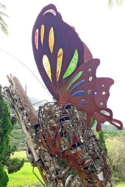
Photo: Steven Crook
The replacement road plunges steeply down toward the river. It’s narrow and rutted, and within 100m it disappears beneath black gravel. I couldn’t tell if part of the hillside had collapsed onto it, if a rising river had dumped sediment all over it, or if both calamities had happened. I’d have kept going if I was on a mountain bike, but as far as riding a motorcycle was concerned, I’d reached the end of the road.
Steven Crook has been writing about travel, culture, and business in Taiwan since 1996. He is the co-author of A Culinary History of Taipei: Beyond Pork and Ponlai, and author of Taiwan: The Bradt Travel Guide, the third edition of which has just been published.

Last week Joseph Nye, the well-known China scholar, wrote on the Australian Strategic Policy Institute’s website about how war over Taiwan might be averted. He noted that years ago he was on a team that met with then-president Chen Shui-bian (陳水扁), “whose previous ‘unofficial’ visit to the US had caused a crisis in which China fired missiles into the sea and the US deployed carriers off the coast of Taiwan.” Yes, that’s right, mighty Chen caused that crisis all by himself. Neither the US nor the People’s Republic of China (PRC) exercised any agency. Nye then nostalgically invoked the comical specter
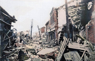
April 15 to April 21 Yang Kui (楊逵) was horrified as he drove past trucks, oxcarts and trolleys loaded with coffins on his way to Tuntzechiao (屯子腳), which he heard had been completely destroyed. The friend he came to check on was safe, but most residents were suffering in the town hit the hardest by the 7.1-magnitude Hsinchu-Taichung Earthquake on April 21, 1935. It remains the deadliest in Taiwan’s recorded history, claiming around 3,300 lives and injuring nearly 12,000. The disaster completely flattened roughly 18,000 houses and damaged countless more. The social activist and

Over the course of former President Ma Ying-jeou’s (馬英九) 11-day trip to China that included a meeting with Chinese Communist Party (CCP) leader Xi Jinping (習近平) a surprising number of people commented that the former president was now “irrelevant.” Upon reflection, it became apparent that these comments were coming from pro-Taiwan, pan-green supporters and they were expressing what they hoped was the case, rather than the reality. Ma’s ideology is so pro-China (read: deep blue) and controversial that many in his own Chinese Nationalist Party (KMT) hope he retires quickly, or at least refrains from speaking on some subjects. Regardless

Approaching her mid-30s, Xiong Yidan reckons that most of her friends are on to their second or even third babies. But Xiong has more than a dozen. There is Lucky, the street dog from Bangkok who jumped into a taxi with her and never left. There is Sophie and Ben, sibling geese, who honk from morning to night. Boop and Pan, both goats, are romantically involved. Dumpling the hedgehog enjoys a belly rub from time to time. The list goes on. Xiong nurtures her brood from her 8,000 square meter farm in Chiang Dao, a mountainous district in northern Thailand’s