The Taipei area is blessed with some amazing day hikes, including plenty of exciting ridge walks, although two old favorites, Huangdidian (皇帝殿) and Wuliaojian (五寮尖), have sadly lost some of their former appeal due to some well-meaning but invasive meddling by the local authorities. Perhaps Taipei’s foremost day hike is Stegosaurus Ridge (劍龍稜) east of Keelung — more on that in an up-coming column — but hardly less rewarding, and certainly less popular, is the stunning (if challenging) traverse of the Fengtou Peak ridge above Jingtong (菁桐) and Pingsi (平溪) villages, on the headwaters of the Keelung River.
There are several ways to attempt the ridge, which can be chopped into a couple of more manageable stages, but walking its entire length in one go is certainly within the range of fairly fit walkers armed with stamina and good weather, and there’s a real sense of achievement at the end.
Just one thing: absolutely don’t attempt the hike in wet weather. Definitely avoid windy weather as well — you’ll see why once you’re up there.
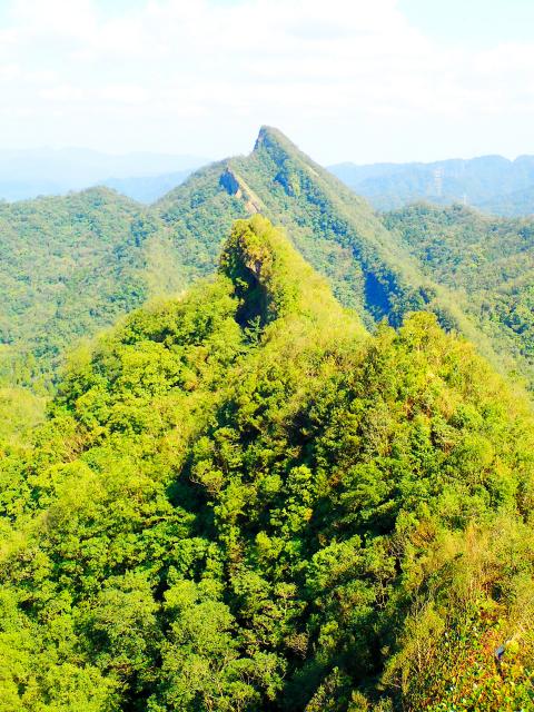
Photo: Richard Saunders
The first couple of hours of the hike to the summit of Fengtou Peak (峰頭尖; 582 meters) is the toughest part, but hang in there and the rewards soon start arriving in the form of a sequence of amazing views, first of the hidden pinnacle of Fengtou Peak itself, and later some breathtaking, abrupt panoramas of the larger, pyramidal crags of Fengtou East Peak (峰頭尖東峰) and the imposing Zhongyang Peak (中央尖) beyond.
The hike starts at Yongding Bridge (永定橋), a minute’s walk from Yongding Coal Mine bus stop. Turn right off Provincial Route 106 and take the back road south along the valley that separates Huangdidian from the Fengtou Peak ridge. Keep left at the junction in 20 minutes, and the trail is on the left in another minute or two. It’s not too obvious, so look out carefully for plastic trail-marking ribbons, tied to trees, which mark the trailhead.
The beginning of a long, hard hike isn’t the best time to make a detour, but before starting on the long slog up to the ridge, it’s worth walking along the road another ten minutes to take a look at one of the loveliest stone bridges in the Taipei area spanning the brook beside the road; this beautiful arched construction is quite old. On the opposite bank a much-worn stele records the names of locals who donated money, or possibly their labor, to build the bridge.
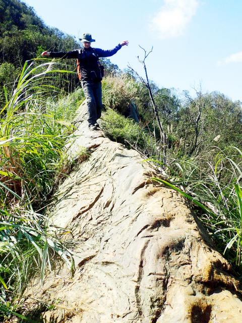
Photo: Richard Saunders
The trail is rough but relatively gentle at first, but it soon turns into a steep climb to an electricity pylon. Look out for trail ribbons here, as the way on upwards to the spine of the ridge is unclear. Once on the top, the route is pretty obvious — just follow the very narrow ridge all the way to the next peak, with a cliff of bare rock dropping sheer (or even overhanging) to the left, and a precipitous, wooded hillside falling away on the right. It’s extremely steep in parts, with fixed ropes, and in many places the arms and legs have an equal workout.
Just after rounding the next peak there’s a good but very brief view of the steep little pyramid of Fengtou Peak between the trees. Descend to the saddle below the summit, and a final exhausting, precipitous climb leads to the top. There’s not much view from the top, but there are some dramatic panoramas to come later in the hike.
Less than 10 minutes after the summit of Fengtou Peak, a path on the left descends to Jingtong Station (at the end of the Pingsi Branch Railway Line) for those who have already had enough. If you can hack it though, stick to the trail ahead, still following the top of the ridge. The tree cover immediately opens out to one of the best views so far on the hike.
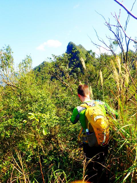
Photo: Richard Saunders
Next climb over the highest point of the ridge, an unnamed peak 609 meters high. Although steep in places, this stretch of the trail is easier. A second trail dropping away to the left is another escape route, passing the needle of rock called the Stone Candle (石燭尖) on the way down. After the junction, the trail along the ridge becomes very rough once again, with a few awkward obstacles (such as knife-edge blades of rock) to negotiate. Soon, however, come the best views of the whole hike, including several sudden and impressive vistas of pointy Fengtou East Peak, with the much larger pyramid of Zhongyang Peak rising behind it.
The final stretch to the summit of Fengtou East Peak is exhilaratingly placed right on the edge of a sheer cliff, and the view from the rocky summit is a 360-degree panorama, dominated by the dramatic bulk of Zhongyang Peak, now quite close.
Finally, the way is down, and super steep at first, with a couple of tricky rock faces to negotiate (with fixed ropes, naturally). Later the trail is gentler, following a dry watercourse. At last it emerges at a wooden finger sign post, connecting to a lovely section of the short but scenic Dongshige Old Trail (東勢格古道), beside a crystal-clear stream tinkling over moss-covered rocks.
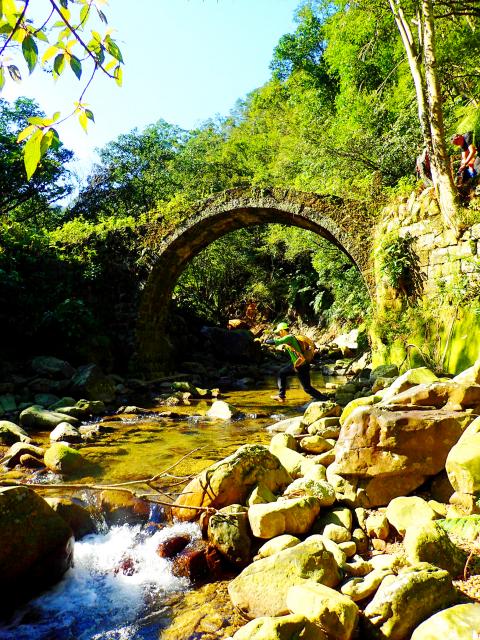
Photo: Richard Saunders
Turn left, pass an attractive small waterfall, an abandoned mine shaft and some ruined miners’ houses, and the path emerges back onto Route 106 on the edge of Pingsi village, about seven tiring (but exhilarating) hours after leaving it.
Richard Saunders is a classical pianist and writer who has lived in Taiwan since 1993. He’s the founder of a local hiking group, Taipei Hikers, and is the author of six books about Taiwan, including Taiwan 101 and Taipei Escapes. Visit his Web site at www.taiwanoffthebeatentrack.com.
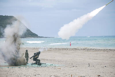
In late October of 1873 the government of Japan decided against sending a military expedition to Korea to force that nation to open trade relations. Across the government supporters of the expedition resigned immediately. The spectacle of revolt by disaffected samurai began to loom over Japanese politics. In January of 1874 disaffected samurai attacked a senior minister in Tokyo. A month later, a group of pro-Korea expedition and anti-foreign elements from Saga prefecture in Kyushu revolted, driven in part by high food prices stemming from poor harvests. Their leader, according to Edward Drea’s classic Japan’s Imperial Army, was a samurai

The following three paragraphs are just some of what the local Chinese-language press is reporting on breathlessly and following every twist and turn with the eagerness of a soap opera fan. For many English-language readers, it probably comes across as incomprehensibly opaque, so bear with me briefly dear reader: To the surprise of many, former pop singer and Democratic Progressive Party (DPP) ex-lawmaker Yu Tien (余天) of the Taiwan Normal Country Promotion Association (TNCPA) at the last minute dropped out of the running for committee chair of the DPP’s New Taipei City chapter, paving the way for DPP legislator Su

Located down a sideroad in old Wanhua District (萬華區), Waley Art (水谷藝術) has an established reputation for curating some of the more provocative indie art exhibitions in Taipei. And this month is no exception. Beyond the innocuous facade of a shophouse, the full three stories of the gallery space (including the basement) have been taken over by photographs, installation videos and abstract images courtesy of two creatives who hail from the opposite ends of the earth, Taiwan’s Hsu Yi-ting (許懿婷) and Germany’s Benjamin Janzen. “In 2019, I had an art residency in Europe,” Hsu says. “I met Benjamin in the lobby
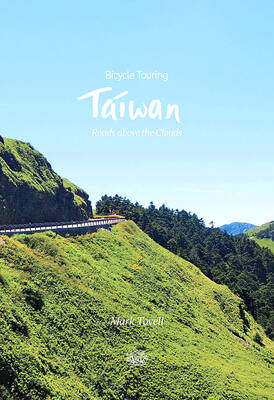
It’s hard to know where to begin with Mark Tovell’s Taiwan: Roads Above the Clouds. Having published a travelogue myself, as well as having contributed to several guidebooks, at first glance Tovell’s book appears to inhabit a middle ground — the kind of hard-to-sell nowheresville publishers detest. Leaf through the pages and you’ll find them suffuse with the purple prose best associated with travel literature: “When the sun is low on a warm, clear morning, and with the heat already rising, we stand at the riverside bike path leading south from Sanxia’s old cobble streets.” Hardly the stuff of your